
Block Management in Redruth
Mine workings make infiltration drainage unsuitable, and a World Heritage mining district takes in the centre.
Residents' management companies, RTM companies and freeholders in Redruth can hand us the full running of a block: budgets, accounts, compliance and leases. The Camborne and Redruth Mining District World Heritage Site covers about a fifth of the parish, including the town centre conservation area, and the council warns infiltration drainage is unsuitable here because of mine workings and contaminated land. Flats make up 21.1 per cent of households.
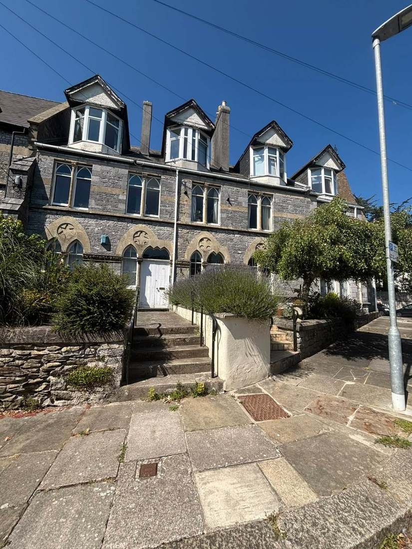
What We Would Put First for a Block in Redruth
Specify Drainage Works Without Infiltration
The critical drainage area for Camborne, Pool, Illogan and Redruth warns that infiltration drainage is unsuitable because of mine workings and contaminated land. Where a block needs drainage repairs we would brief surveyors and contractors on that before specifying.
Maintenance and repairsSecure Consents in the Town Centre Conservation Area
The town centre conservation area holds 48 listed structures and buildings, with Murdoch House at grade II star, inside the World Heritage Site. We would confirm consent requirements before tendering any external works.
ConsentsSeparate Costs in Flats over Commercial Premises
Redruth North holds 96 of the town's 103 flats over commercial premises. For a mixed-use building we would set service charge apportionments and budgets that keep residential and commercial costs clearly separate.
Service chargesManaging a Block in Redruth at a Glance
- Local authority
- Cornwall Council
- Authority type
- Unitary
- Building control
- Cornwall Council Building Control
- County
- Cornwall
- Fire and rescue service
- Cornwall Fire and Rescue Service
- Water and sewerage
- South West Water
- From our Plymouth office
- About 49 miles in a straight line
- Setting
- Inland
What It Costs to Move a Block in Redruth to Us
Management is a fixed annual fee, quoted for the building and agreed before we start. We take no commission and no third-party incentives, so the fee is the whole of what we earn from the building. Taking a block on carries a one-off start-up fee, set by size:
| Block size | Fee |
|---|---|
| Start-up fee, up to 10 units | £420.00 |
| Start-up fee, up to 25 units | £540.00 |
| Start-up fee, 50 units and above | £660.00 |
Taken from our published Additional Services price list, PBM Form #01-27 rev.6, effective 23 June 2025. All fees quoted are inclusive of VAT. See the full price list and how a handover works.
A World Heritage Mining District Takes in the Centre
Redruth has three conservation areas: the town centre at 28.2 hectares, Plain-an-Gwarry at 11.1 hectares from June 1993, and 8.7 hectares of the Carn Brea area from 1974. The council's own appraisal records that the town centre area was designated in 1983 and extended twice, in 1988 and 1991, with revised boundaries taking effect on 24 April 2010. It records 48 statutory listed structures and buildings inside the town centre boundary, all grade II except Murdoch House at grade II star. Across the whole parish Historic England holds 97 entries with no grade I at all. For a block in the town centre, consent requirements should be confirmed before external works are tendered.
Four separate World Heritage Site areas fall inside Redruth parish. The largest is the Camborne and Redruth Mining District at 283.5 hectares, about a fifth of the parish, which contains both the town centre and Plain-an-Gwarry conservation areas. Wheal Peevor lies wholly inside the parish, and two parts of the Gwennap Mining District reach in. The council's appraisal describes the town's mining role as recognised in that designation, which it records as of outstanding universal value. For a block inside the World Heritage Site, consents should be confirmed before external works are specified.
Most Flats over Shops Are in Redruth North
At the 2021 Census 1,205 of the 5,723 households across Redruth North and South were flats, 21.1 per cent. Of these, 791 were purpose-built, 197 in a converted or shared house, 114 in another converted building and 103 over commercial premises. Redruth North carries most of the commercial-building flats, at 96 of the 103. Flats over shops need service charge apportionments that keep residential and commercial costs clearly separate.
Drainage, Not Rivers, Defines Redruth's Flood Position
No Environment Agency flood warning area or flood alert area names Redruth: none of the agency's 4,208 areas does, including the 84 in Cornwall. Instead, the council's critical drainage area for Camborne, Pool, Illogan and Redruth identifies Redruth as a priority community in the local flood risk management strategy. It warns that infiltration drainage is unsuitable here because of mine workings and contaminated land. For a block, drainage repairs and replacements should be specified with those ground conditions in mind, without relying on soakaways.
Redruth's Neighbourhood Plan Was Made in December 2025
Applications are decided under the Cornwall Local Plan and the Redruth Parish Neighbourhood Plan, made on 3 December 2025. At the referendum on 16 October 2025, 881 voted yes and 146 no, 85.53 per cent in favour, from 1,030 ballot papers issued against an electorate of 11,879, a turnout of 8.67 per cent. No Article 4 direction covers Redruth. Schemes for external works to a block are judged against both plans, and in the town centre conservation area against its appraisal as well.
Service charge or accounts query? Email accounts@
Redruth Questions
Is Redruth in an Environment Agency Flood Warning Area?
No. None of the Environment Agency's 4,208 flood warning and alert areas names Redruth. The position sits instead with the council's critical drainage area for Camborne, Pool, Illogan and Redruth, which identifies Redruth as a priority community and warns that infiltration drainage is unsuitable because of mine workings and contaminated land.
Does the World Heritage Site Cover Blocks in Redruth Town Centre?
Four World Heritage Site areas fall inside Redruth parish. The largest, the Camborne and Redruth Mining District at 283.5 hectares, about a fifth of the parish, contains both the town centre and Plain-an-Gwarry conservation areas. Wheal Peevor lies wholly inside the parish and two parts of the Gwennap Mining District reach in.
Is There an Article 4 Direction or Neighbourhood Plan in Redruth?
No Article 4 direction covers Redruth. The Redruth Parish Neighbourhood Plan was made on 3 December 2025 after a referendum on 16 October 2025 in which 881 voted yes and 146 no, 85.53 per cent in favour, on a turnout of 8.67 per cent. Applications are otherwise decided under the Cornwall Local Plan.
Nearby Areas
Talk to Us About Your Building in Redruth.
A free, no-obligation proposal, written so it can be circulated to a board.