Block Management in Bournemouth
Block, estate and leasehold management for Bournemouth. Compliance is tracked against Bournemouth, Christchurch and Poole Council. Marine-exposed stock is surveyed on a shorter interval and funded from what the surveys find. Roughly 126 miles from our office.

Managing a Block in Bournemouth at a Glance
- Local authority
- Bournemouth, Christchurch and Poole Council
- Authority type
- Unitary
- Building control
- BCP Council Building Control
- County
- Dorset
- Fire and rescue service
- Dorset and Wiltshire Fire and Rescue Service
- Water and sewerage
- Bournemouth Water for supply and Wessex Water for sewerage
- From our Plymouth office
- Approx. 126 miles by road, a planned journey rather than a casual one
- Setting
- Coastal
Who You Deal with in Bournemouth
A block in Bournemouth deals with Bournemouth, Christchurch and Poole Council, a unitary authority, so building control, planning and housing enforcement sit with one body. Fire safety in the common parts is enforced by Dorset and Wiltshire Fire and Rescue Service. Communal water and sewerage is Bournemouth Water for supply and Wessex Water for sewerage.
The Residential Stock in Bournemouth
The most flat-dominated place in the county. At the 2021 Census 46,695 households in the Bournemouth built-up area, 50.7 per cent, were in a flat, maisonette or apartment, against 22.2 per cent across England. Across BCP as a whole 7.6 per cent of households are in flats formed from converted or shared houses, more than double the England figure, which means a large stock of subdivided Victorian and Edwardian villas rather than purpose-built blocks.
Coastal Exposure in Bournemouth
BCP Council operates the Bournemouth seafront, including both piers, the cliff lifts and the cliff-top beaches.
The measurable part of marine exposure is corrosion. A high-salinity coastal atmosphere is category C5-M in the standards, where unprotected steel can lose 200 micrometres in a year. In practice that means the metalwork on a Bournemouth block sets the inspection interval, and the reserve fund follows the inspections rather than a standard cycle.
Flood Risk in Bournemouth
Bournemouth's exposure is surface water, not tide. BCP Council states plainly that no Level 2 flood risk assessment is needed for Bournemouth because it does not have the same level of tidal and fluvial risk as Christchurch and Poole. What it does have is a drainage record: on 18 August 2011, 40.6mm of rain in an hour produced 270 reported flooding incidents with at least 157 properties flooded internally, and residents unable to return for at least six months. Named hotspots include Winton High Street, Castlepoint, Cooper Dean Roundabout and St Catherine's Hill. The council's assessment also records that it holds limited information on sewer flood risk because no data was provided by the water company.
For a block that reaches leaseholders through the insurance premium and excess, and through the management pack when someone sells.
Conservation Areas and Listed Buildings in Bournemouth
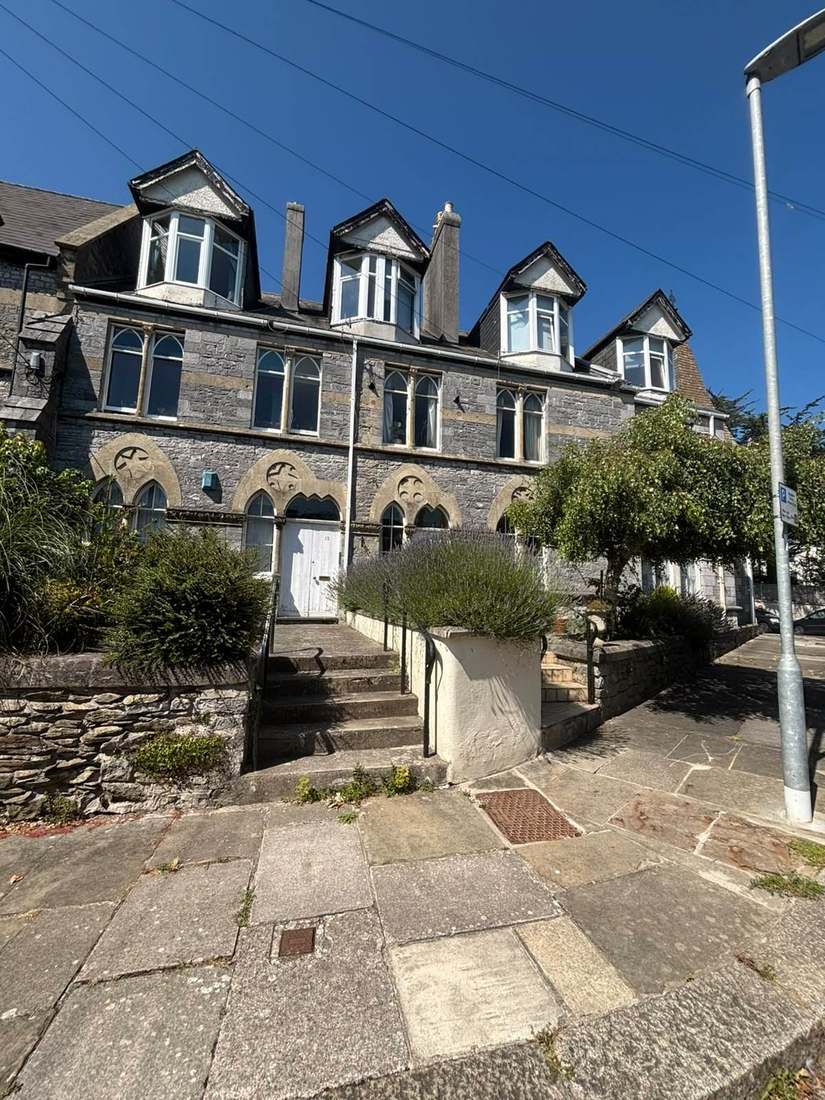
Part of BCP's 48. Bournemouth designations include East Cliff, West Cliff and Poole Hill, Westbourne, Dean Park, Boscombe Spa, Boscombe Manor, Meyrick Park and Talbot Woods, Southbourne Grove and Churchill Gardens, several of which are dense flatted or converted-villa areas.
Low density by Dorset standards: 757 listed building entries across the whole BCP area, of which 18 are Grade I and 39 Grade II*. Two Bournemouth conservation areas, West Cliff and Poole Hill and Churchill Gardens in Boscombe, are on Historic England's Heritage at Risk Register for 2025.
It also narrows the contractor list and lengthens the programme, both of which belong in the Section 20 specification rather than in a surprise later.
Higher-Risk Buildings in Bournemouth
Government remediation data for July 2026 records BCP with 11 to 50 buildings monitored across the national programmes, 43 per cent of remediation complete, and 10 enforcement actions taken against buildings of 11 metres and over under the Housing Act 2004. Of ten inspections, six were rated a Category 1 hazard, producing four improvement notices and four hazard awareness notices.
Above 18 metres or seven storeys the Building Safety Act regime applies in full. Below it, the Fire Safety Order and the 2022 Regulations still do, and that gap is what our building safety consultancy exists for.
Radon in Bournemouth
Most of the built-up area is below the Affected Area threshold, but not all of it. The live national radon map returns the lowest band, under one per cent, at the town centre, Boscombe and Sandbanks, and 197 of 215 squares over the conurbation sit in that band. The exceptions matter: 16 squares in the 3 to 5 per cent band lie along the northern fringe in the Kinson and Bearwood and Merley wards, and two in the 1 to 3 per cent band in East Southbourne and Tuckton. A block in those wards is in an Affected Area where measurement is advised; one in the town centre is not.
In a block the part worth attention is the enclosed communal space at or below ground level: plant rooms, undercrofts, basements and bin stores. Measuring is inexpensive, takes three months, and the result belongs with the compliance record.
Licensing and Permitted Development in Bournemouth
An Article 4 direction covering the whole of the former Borough of Bournemouth has removed the permitted development right to change a dwellinghouse to a small house in multiple occupation since 16 December 2011. Policy CS24 of the Bournemouth Core Strategy then permits such a change only where no more than 10 per cent of dwellings within 100 metres are already in that use. Mandatory licensing applies; there is no additional or selective scheme.
This sits outside the lease entirely, but it still reaches us: satisfying the council is not the same as obtaining consent under the lease, and a leaseholder generally needs each.
Changing Managing Agent in Bournemouth
Changing agent is the company's decision, taken the way its articles require. The only part with a deadline is the notice the outgoing agent is contractually owed. On a higher-risk building the safety case, the registration position and the golden thread information all have to transfer intact.
See the handover sequence in full, and our fees, which are a fixed annual amount with no commission on contractor work.
Going Deeper in Bournemouth
Towns and Villages We Cover from Bournemouth
Boscombe, Westbourne, Southbourne, Charminster, Winton, Moordown, Kinson, Ensbury Park, Pokesdown, Springbourne, Talbot Woods.
Service charge or accounts query? Email accounts@
Bournemouth Questions
Which Council Does a Block in Bournemouth Deal With?
BCP Council Building Control. One body, so building control, planning and licensing sit together.
Who Enforces Fire Safety in the Common Parts in Bournemouth?
Dorset and Wiltshire Fire and Rescue Service, as the enforcing authority for the Fire Safety Order.
Who Supplies Water to a Development in Bournemouth?
Bournemouth Water for supply and Wessex Water for sewerage. A communal supply is the building's contract, not a leaseholder's, so report a loss to common parts through us.
Is Bournemouth Too Far from Your Plymouth Office?
It is about 126 miles, a planned journey rather than a casual one. Distance changes how site visits are scheduled, not whether they happen.
Is My Building in Bournemouth a Higher-Risk Building?
It is if it is 18 metres or seven storeys with two or more residential units, in which case it must be registered with the Building Safety Regulator.
Do We Need Consent for External Works in Bournemouth?
On a listed building or in a conservation area, yes, for much that would be permitted elsewhere. Get it before the Section 20 specification, not after.
Nearby Areas
Talk to Us About Your Building in Bournemouth.
A free, no-obligation proposal, written so it can be circulated to a board.