
Block Management in Ivybridge
Ten squares over the town reach radon class 6, on Dartmoor fringe granite.
We take on blocks, estates and leases in Ivybridge on behalf of residents' management companies, RTM companies and freeholders. Ten kilometre squares over the town are radon class 6, where the maximum radon potential exceeds 30 per cent of homes above the action level. The River Erme is the main flood source, with Pinehurst Way, Cornwood Road and Woodland Road named at risk and no formal defences.
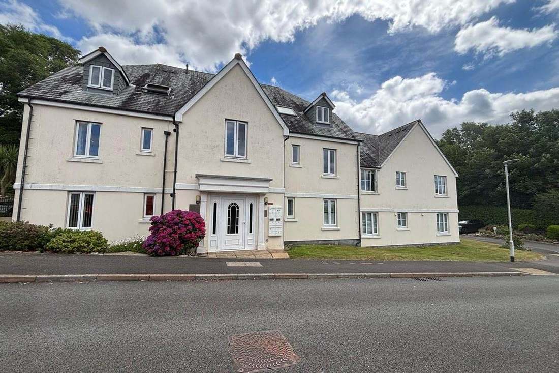
What We Would Put First for a Block in Ivybridge
Measure Radon in Communal Areas
Ten squares over the town are class 6 and ten class 5, on the granite of the Dartmoor fringe, and both ward centroids are class 6. We would recommend radon measurement in ground-floor communal areas and keep results on the compliance record.
CompliancePlan for Hillside Surface Water
The steep hillsides are known to generate high surface water runoff, and there are no formal defences, only informal masonry walls at Glanvilles Mill. We would schedule drainage inspections and budget for gutter and gully maintenance.
Maintenance and repairsDisclose Named Flood Streets to Insurers
The strategic flood risk assessment names Pinehurst Way, Cornwood Road and Woodland Road at risk from the Erme, with a thin strip of zones 2 and 3 along the river. For a block there we would set out that exposure when placing insurance.
InsuranceManaging a Block in Ivybridge at a Glance
- Local authority
- South Hams District Council
- Authority type
- District, under the county council
- Building control
- South Hams District Council Building Control
- County
- Devon
- Fire and rescue service
- Devon and Somerset Fire and Rescue Service
- Water and sewerage
- South West Water
- From our Plymouth office
- About 9 miles in a straight line
- Setting
- Inland
What It Costs to Move a Block in Ivybridge to Us
Management is a fixed annual fee, quoted for the building and agreed before we start. We take no commission and no third-party incentives, so the fee is the whole of what we earn from the building. Taking a block on carries a one-off start-up fee, set by size:
| Block size | Fee |
|---|---|
| Start-up fee, up to 10 units | £420.00 |
| Start-up fee, up to 25 units | £540.00 |
| Start-up fee, 50 units and above | £660.00 |
Taken from our published Additional Services price list, PBM Form #01-27 rev.6, effective 23 June 2025. All fees quoted are inclusive of VAT. See the full price list and how a handover works.
Radon Is a First-Order Management Question Here
Radon is a first-order management question in Ivybridge. Ten of the kilometre squares over the town are class 5 at 10 to 30 per cent and ten are class 6, where the maximum radon potential is greater than 30 per cent of homes above the action level. Both ward centroids are class 6. The cause is the granite of the Dartmoor fringe. Radon measurement in ground-floor communal areas should be a standing compliance item for blocks here.
Only 6.4 Per Cent of Households Live in Flats
At the 2021 Census 335 of the 5,205 households across the two Ivybridge wards were flats, 6.4 per cent. Of those, 216 were purpose-built, 46 in a converted or shared house, 35 in another converted building and 38 over commercial premises. Ivybridge East is lower still at 3.5 per cent. Blocks are a small part of the town's housing, and most are purpose-built.

Developments We Manage in Ivybridge
These are real buildings in our care, not a coverage list. Each one is set out in more detail, with photographs, on our property experience page.
- Woodland Court, 10 apartments converted from the farm buildings of Woodland Manor
The Erme, Not the Tide, Drives Flood Risk
Fluvial only: the council states that Ivybridge is not at significant risk of tidal flooding. Its strategic flood risk assessment records fluvial risk from the River Erme as the predominant source. The river runs off steep hills to the north and through the centre of the town, with the town centre mostly in flood zone 1 and a thin strip of zones 2 and 3 along the river. Pinehurst Way, Cornwood Road and Woodland Road are named at risk, and the steep hillsides are known to generate high surface water runoff. There are no formal defences, only informal masonry walls at Glanvilles Mill. A 300,000 pound flood alleviation scheme at Claymans Pathway and Slipperstone Drive, benefiting 30 residential properties, is a tributary scheme rather than an Erme one. For a block on the named streets, flood exposure belongs in insurance disclosures, and hillside blocks need regular gutter and gully maintenance.

Eighteen Listed Entries, Every One of Them Grade II
One area, designated on 3 October 1985, one of 43 in the district. The council publishes no character appraisal for it, only a designation date and a map. Historic England's list holds just 18 entries in the parish, all grade II, with no grade I, no grade II star, no scheduled monuments and no registered parks. Kingsbridge, a smaller town, has 123. Heritage consent is rarely a constraint on block works here, though a block inside the conservation area should be checked against its boundary first.
A Main Town in the Thriving Towns and Villages Area
Decided under the Plymouth and South West Devon Joint Local Plan 2014 to 2034, adopted by South Hams on 21 March 2019. The adopted plan places Ivybridge in the Thriving Towns and Villages policy area as one of six main towns, not in the Plymouth policy area, which covers Plymouth and its urban fringe. The plan allocates 1,078 homes across four sites. The Ivybridge Neighbourhood Plan was made on 17 December 2017 following a referendum on 30 November 2017. There is no Article 4 direction anywhere in South Hams, so permitted development for a block is not restricted by one. There is an air quality management area at Western Road.
Service charge or accounts query? Email accounts@
Ivybridge Questions
Is Ivybridge at Risk of Tidal Flooding?
No. The council states plainly that Ivybridge is not at significant risk of tidal flooding. Fluvial risk from the River Erme is the predominant source, with the town centre mostly in flood zone 1. A 300,000 pound scheme at Claymans Pathway and Slipperstone Drive, benefiting 30 residential properties, addresses a tributary rather than the Erme itself.
Is Ivybridge Treated as Part of Plymouth for Planning?
No. The Plymouth and South West Devon Joint Local Plan, adopted by South Hams on 21 March 2019, places Ivybridge in the Thriving Towns and Villages policy area as one of six main towns, not in the Plymouth policy area. The plan allocates 1,078 homes across four sites, and the Ivybridge Neighbourhood Plan was made on 17 December 2017.
How Heavily Designated Is Ivybridge's Historic Fabric?
Lightly. There is one conservation area, designated on 3 October 1985, with no published character appraisal. Historic England's list holds 18 entries in the parish, all grade II, with no grade I, no grade II star, no scheduled monuments and no registered parks. There is no Article 4 direction anywhere in South Hams, though an air quality management area applies at Western Road.
Nearby Areas
Talk to Us About Your Building in Ivybridge.
A free, no-obligation proposal, written so it can be circulated to a board.