
Block Management in Painswick
Painswick holds one listed entry per 3.6 households, all within the Cotswolds National Landscape.
Painswick blocks can be placed with us for block, estate and leasehold management, whether the client is an RMC, an RTM company or a freeholder. There are 242 listed entries in a built-up area of 877 households, and two conservation areas cover 24.7 per cent of the town with no adopted statement for either. The whole town also lies inside the Cotswolds National Landscape.

What We Would Put First for a Block in Painswick
Confirm Listing Before Any Works
With 242 listed entries, three Grade I and twelve Grade II*, in a built-up area under one square kilometre, we would confirm each block's listing and obtain listed building consent before specifying repairs or redecoration.
ConsentsSpecify Without a Character Statement
Neither conservation area has an adopted statement, so for a quarter of the town there is no character assessment to argue a scheme against. For Section 20 works we would allow time for consent and specify materials with that gap in mind.
Major works and Section 20Recommend Radon Measurement
The published advice across all of Painswick is that radon measurement is advised, and 26.8 per cent of the town sits at 10 to 30 per cent. We would recommend measurement in communal areas and keep results on the compliance record.
ComplianceInspect Drainage in Place of Warnings
Only the Rivers Frome and Cam alert covers the town, at 3.81 per cent, and no area names Painswick or the Painswick Stream. With no property-level warning available, we would include drainage checks in each scheduled inspection.
InspectionsManaging a Block in Painswick at a Glance
- Local authority
- Stroud District Council
- Authority type
- District, under the county council
- Building control
- Stroud District Council Building Control
- County
- Gloucestershire
- Fire and rescue service
- Gloucestershire Fire and Rescue Service
- Water and sewerage
- Severn Trent Water
- From our Plymouth office
- About 129 miles in a straight line
- Setting
- Inland
What It Costs to Move a Block in Painswick to Us
Management is a fixed annual fee, quoted for the building and agreed before we start. We take no commission and no third-party incentives, so the fee is the whole of what we earn from the building. Taking a block on carries a one-off start-up fee, set by size:
| Block size | Fee |
|---|---|
| Start-up fee, up to 10 units | £420.00 |
| Start-up fee, up to 25 units | £540.00 |
| Start-up fee, 50 units and above | £660.00 |
Taken from our published Additional Services price list, PBM Form #01-27 rev.6, effective 23 June 2025. All fees quoted are inclusive of VAT. See the full price list and how a handover works.
One Listed Entry for Every 3.6 Households
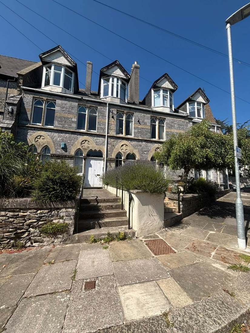
Painswick has two conservation areas in a town of less than a square kilometre. Painswick itself was designated in December 1977. It was extended to the south west in June 1990 to take in land south of Edge Lane and the grounds of Lullingworth House, with no changes since. Gyde House was designated separately in June 1990 and has not changed either. Between them they cover 24.7 per cent of the built-up area, so roughly a quarter of Painswick is designated. Neither has an adopted conservation area statement, and the council states that plainly for both. For a block in that quarter there is a designation but no character assessment to argue a scheme against, so external works need time for consent and carefully matched materials.
242 entries on the National Heritage List fall inside a built-up area of under one square kilometre containing 877 households. That is roughly one listed entry for every 3.6 households, against about one in 25 at Cirencester and one in 29 at Stroud. Three are Grade I and twelve Grade II*. Many of the entries are churchyard monuments at St Mary's. No scheduled monument lies inside the built-up area. Before repairs or redecoration, a block's listing should be confirmed and listed building consent obtained where it is needed.
Most Painswick Flats Are in Purpose-Built Blocks
The Painswick and Upton ward wholly contains the town, but only 1.8 per cent of the ward's area lies inside the built-up area. The ward records 3,238 households against the town's 877, roughly three and a half times the town, so its flats figure of 245, 7.6 per cent, does not describe Painswick. Across the seven output areas covering the town there are 877 households with 101 in flats, 11.5 per cent. Of these, 63 are in purpose-built blocks, 9 in a converted or shared house, 19 in another converted building and 10 over commercial premises. Flats in conversions and over commercial premises need clear lease boundaries for repairs and insurance.
A Catchment Alert, but No Warning Area of Its Own
Painswick sits on the Painswick Stream, a tributary of the Frome. One Environment Agency area covers the town, the Rivers Frome and Cam alert, at 3.81 per cent of the built-up area. That alert names only the Frome and the Cam, and none of the 4,208 Environment Agency areas in England names Painswick or the Painswick Stream. A block here would therefore receive a general catchment alert and no property-level warning. No defence scheme and no count of properties flooded are published, so gutters, gullies and drains are best checked at each inspection.
Radon Measurement Is Advised Across Painswick
Painswick spans three radon classes across only five one-kilometre squares. Class 3 covers 64.4 per cent of the built-up area at 3 to 5 per cent of homes at or above the action level. Class 5 covers 26.8 per cent at 10 to 30 per cent, and class 4 the remaining 8.8 per cent. The published advice across the whole town is that radon measurement is advised. For a block, that means measuring in ground-floor flats and communal areas and keeping the results on the compliance record.

Every Address Lies in the Cotswolds National Landscape
Applications are decided under the Stroud District Local Plan, adopted 19 November 2015. There is no neighbourhood plan at any stage. There is no Article 4 direction: Painswick is not among the five conservation areas in the district that have one, even though a quarter of the town is designated. The whole town is inside the Cotswolds National Landscape, which covers 100 per cent of the built-up area. Consents for external works to any block here are considered with that designation in view.
Service charge or accounts query? Email accounts@
Painswick Questions
Would a Block in Painswick Receive a Flood Warning?
Not a property-level one. The only Environment Agency area covering the town is the Rivers Frome and Cam alert, at 3.81 per cent of the built-up area, and it names only the Frome and the Cam. None of the 4,208 areas in England names Painswick or the Painswick Stream, so a block would receive a general catchment alert at most.
Does Painswick Have a Neighbourhood Plan or an Article 4 Direction?
Neither. Applications are decided under the Stroud District Local Plan, adopted on 19 November 2015, and there is no neighbourhood plan at any stage. Painswick is not among the five conservation areas in the district with an Article 4 direction, despite a quarter of the town being designated. The whole town is inside the Cotswolds National Landscape.
Why Not Use the Ward Figures for Flats in Painswick?
The Painswick and Upton ward records 3,238 households against the town's 877, roughly three and a half times the town, so its 245 flats are not a Painswick figure. Across the seven output areas covering the town there are 877 households with 101 in flats, 11.5 per cent: 63 purpose-built, 9 in a converted or shared house, 19 in another converted building and 10 over commercial premises.
Nearby Areas
Talk to Us About Your Building in Painswick.
A free, no-obligation proposal, written so it can be circulated to a board.