
Block Management in Stroud
Three quarters of the town sits at 10 per cent radon or above.
Our service for Stroud covers block, estate and leasehold management on behalf of residents' management companies, RTM companies and freeholders. Roughly three quarters of the built-up area is radon class 5 or 6, and 274 flats sit in other converted buildings such as former mills. The Frome, Slad Brook and Nailsworth Stream converge in the town, with six Environment Agency areas covering parts of it.

What We Would Put First for a Block in Stroud
Recommend Radon Measurement at Every Address
Class 5 covers 58.3 per cent of Stroud's built-up area and class 6, the top band above 30 per cent, a further 15.4 per cent. We would check the block's address and recommend radon measurement in ground floor communal areas, recording results on the compliance file.
ComplianceSurvey Converted Buildings Before Major Works
274 of Stroud's flats sit in other converted buildings, more than in converted houses. For a converted mill we would schedule a building survey before preparing any Section 20 specification, and check the Industrial Heritage conservation area guidance where it applies.
Major works and Section 20Confirm Which Flood Area Applies
Six Environment Agency areas cover parts of Stroud, including the Slad Brook warning area running down to Rowcroft. We would identify the block's area and place buildings insurance with that exposure disclosed.
InsuranceCheck Article 4 on Converted Houses
Stroud's 2008 direction names individual addresses in Top of the Town and on London Road, and the council states it does not apply to flats. For a converted house on one of the scheduled addresses we would check the position before external alterations.
ConsentsManaging a Block in Stroud at a Glance
- Local authority
- Stroud District Council
- Authority type
- District, under the county council
- Building control
- Stroud District Council Building Control
- County
- Gloucestershire
- Fire and rescue service
- Gloucestershire Fire and Rescue Service
- Water and sewerage
- Severn Trent Water
- From our Plymouth office
- About 127 miles in a straight line
- Setting
- Inland
What It Costs to Move a Block in Stroud to Us
Management is a fixed annual fee, quoted for the building and agreed before we start. We take no commission and no third-party incentives, so the fee is the whole of what we earn from the building. Taking a block on carries a one-off start-up fee, set by size:
| Block size | Fee |
|---|---|
| Start-up fee, up to 10 units | £420.00 |
| Start-up fee, up to 25 units | £540.00 |
| Start-up fee, 50 units and above | £660.00 |
Taken from our published Additional Services price list, PBM Form #01-27 rev.6, effective 23 June 2025. All fees quoted are inclusive of VAT. See the full price list and how a handover works.
Three Quarters of Stroud Sits at 10 Per Cent Plus
Radon spans classes 2 to 6 across twenty-two one-kilometre squares, because the town runs from valley-floor Lias up onto limestone slopes. Class 5 covers 58.3 per cent of the built-up area, at 10 to 30 per cent of homes at or above the action level. Class 6, the top band at greater than 30 per cent, covers a further 15.4 per cent. The remainder is split between classes 2, 3 and 4. So roughly three quarters of Stroud sits at 10 per cent or above, while other parts of the same town read low. Each block should be checked at its own address and measured where advised, with results kept on the compliance record.
More Flats in Former Mills Than in Converted Houses
The town holds 11,782 households across the 82 output areas covering the built-up area. Of these, 2,136 are in flats, 18.1 per cent: 1,505 in purpose-built blocks, 243 in a converted or shared house, 274 in another converted building and 114 over commercial premises. The 274 flats in former schools, churches and warehouses outnumber those in converted or shared houses, which is the mills appearing in the census. Stroud Central is the flats ward, at 44.2 per cent of its households. Converted mills and other non-residential buildings need a full building survey before any major works are specified, as their structure and services rarely follow a standard block pattern.

Frome, Slad Brook and Nailsworth Stream Converge Here
Three watercourses converge here, the River Frome, the Slad Brook and the Nailsworth Stream, and six Environment Agency areas cover part of the town. The Frome and Cam alert covers 4.87 per cent of the built-up area, and the River Frome at Stroud and Ryeford warning area 3.37 per cent. The Nailsworth Stream warning area covers 1.21 per cent. The Slad Brook warning area covers 0.74 per cent; it runs from Upper Steanbridge Mill down to Rowcroft and names that street. The Slad Brook alert covers 0.69 per cent, and the Frome at Brimscombe and Thrupp 0.25 per cent. Two of the warning areas name Stroud in their own labels. No named flood alleviation scheme for the town with a date and a cost is published, and no count of properties flooded at Stroud town is published either. For a block, the first step is to identify which area, if any, it sits in and disclose that exposure when buildings insurance is placed.
Conservation Areas Trace One Industrial Landscape
Stroud's conservation areas are best understood as one industrial landscape cut into pieces. The town centre area began as The Shambles in February 1978 and was joined by Stroud Central in September 1982, extended in March 1991. The two merged in April 2008 when a joint conservation area statement was adopted. Top of the Town dates from February 1978 and was substantially extended in April 2008 to take in Bisley Road and Horns Road. The Industrial Heritage area dates from September 1987 and was comprehensively reviewed between 2006 and 2008. A conservation area statement and design guide were then adopted. They apply not only to it but to seven other areas as well, at Dunkirk and Watledge, Ebley Mills, Lodgemore and Fromehall, Longfords Mills, Stanley Mills, St Mary's and Belvedere and Stroud Station. Its management proposals were adopted as a supplementary planning document in November 2008 and form part of the development plan, which gives them real weight rather than advisory status. Stroud Station dates from November 1986, Lodgemore and Fromehall Mills from November 1986 with no changes since, and St Mary's and Belvedere Mills from November 1986. Stratford Park dates from November 1990, and Randwick from June 1990, with a character appraisal and management plan adopted in June 2025. There are 41 conservation areas across the district as a whole. The national register holds boundaries for only some of these, so a block's status should be confirmed with the council. For a converted mill, the Industrial Heritage guidance should be checked before any major works specification is prepared.
402 entries on the National Heritage List fall inside the built-up area: two Grade I, seventeen Grade II* and 376 Grade II. That is the profile of a large industrial town rather than a dense historic core. No scheduled monument lies inside the built-up area. A block in a listed building needs listed building consent for works that affect its character, and that consent should be in place before the works are specified.
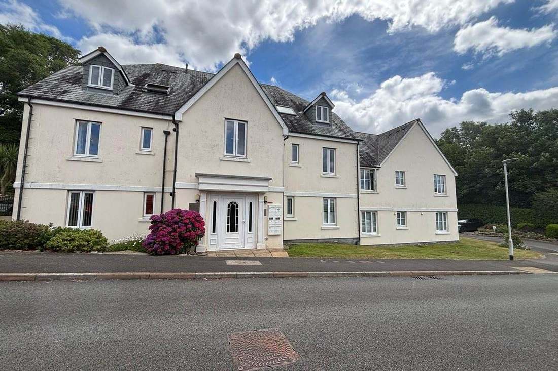
The Article 4 Direction Does Not Apply to Flats
An Article 4(2) direction made on 17 April 2008 covers two of the town's conservation areas, Stroud Central and Top of the Town. It applies only where the work would front a relevant location. It removes the enlargement, improvement or other alteration of a dwellinghouse, any other alteration to a roof slope, and the erection of a porch outside an external door. It also removes the provision of a building, enclosure or pool incidental to the dwellinghouse, and the installation, alteration or replacement of a satellite antenna. The council adds two points. First, the controls apply only where the works are on elevations fronting a public highway or public open space. Second, it states that Article 4 directions do not apply to flats or commercial properties, because those do not have the same permitted development rights in the first place. So for a block of flats in Stroud this direction changes little, while for a converted house it may change a great deal. The direction is property-specific. The schedule names individual addresses on London Road in the central area. In Top of the Town it names addresses on Mount Pleasant, Bisley Old Road, Belmont Road, Bisley Road, Spider Hill, Churchfield Road, Lower Churchfield Road, Horns Road, Middle Street, Acre Street, Lower Street and Trinity Road.
The 2015 Local Plan Remains the Adopted One
Decided under the Stroud District Local Plan, adopted 19 November 2015 and running to 2031. The position on its replacement is unclear. A Local Plan Review was submitted for examination on 25 October 2021 and held hearings between March and June 2023. It was paused from August 2023 after the inspectors raised three specific concerns about soundness, with a technical evidence consultation in late 2024. Separately, a new Local Plan process began with a scoping consultation published on 29 June 2026, whose indicative timetable runs to adoption in December 2029 or January 2030. The council nowhere states that the review was withdrawn. On either reading the 2015 plan remains the adopted one. A neighbourhood plan was made on 26 October 2016, but it covers the town centre only rather than the whole town, and its referendum date and figures are not published. Only 12.54 per cent of the built-up area lies inside the Cotswolds National Landscape, and the town centre falls outside it. Consents for alterations to a block are tested against the 2015 plan, and in the centre against the neighbourhood plan too.
Service charge or accounts query? Email accounts@
Stroud Questions
Does Stroud's Article 4 Direction Apply to a Block of Flats?
The council states that Article 4 directions do not apply to flats or commercial properties, because they do not have the same permitted development rights. The 2008 direction covering Stroud Central and Top of the Town therefore changes little for a block of flats, but may change a great deal for a converted house. Controls apply only to elevations fronting a public highway or open space.
Why Does Radon Vary So Much Across Stroud?
The town runs from valley-floor Lias up onto limestone slopes, so its twenty-two kilometre squares span classes 2 to 6. Class 5 covers 58.3 per cent of the built-up area. Class 6, above 30 per cent of homes at or above the action level, covers a further 15.4 per cent, while other parts read low. Address-level checking matters here.
Which Local Plan Decides Applications in Stroud?
The Stroud District Local Plan, adopted 19 November 2015 and running to 2031, remains the adopted plan. A Local Plan Review submitted in October 2021 was paused from August 2023, and a separate new Local Plan process began with a scoping consultation on 29 June 2026. A neighbourhood plan made on 26 October 2016 covers the town centre only.
Nearby Areas
Talk to Us About Your Building in Stroud.
A free, no-obligation proposal, written so it can be circulated to a board.