
Block Management in Wells
Window consent depends on the street, under three separate Article 4 directions
Residents' management companies, RTM companies and freeholders in Wells can hand us their block, estate and leasehold management. Three Article 4 directions apply, and under the 1999 direction a window replacement programme on streets such as St Thomas Street or Tor Street needs express consent. Wells also has 337 listed entries, 25 of them Grade I, and the East Somerset Rivers alert covers 15.8 per cent of the city.
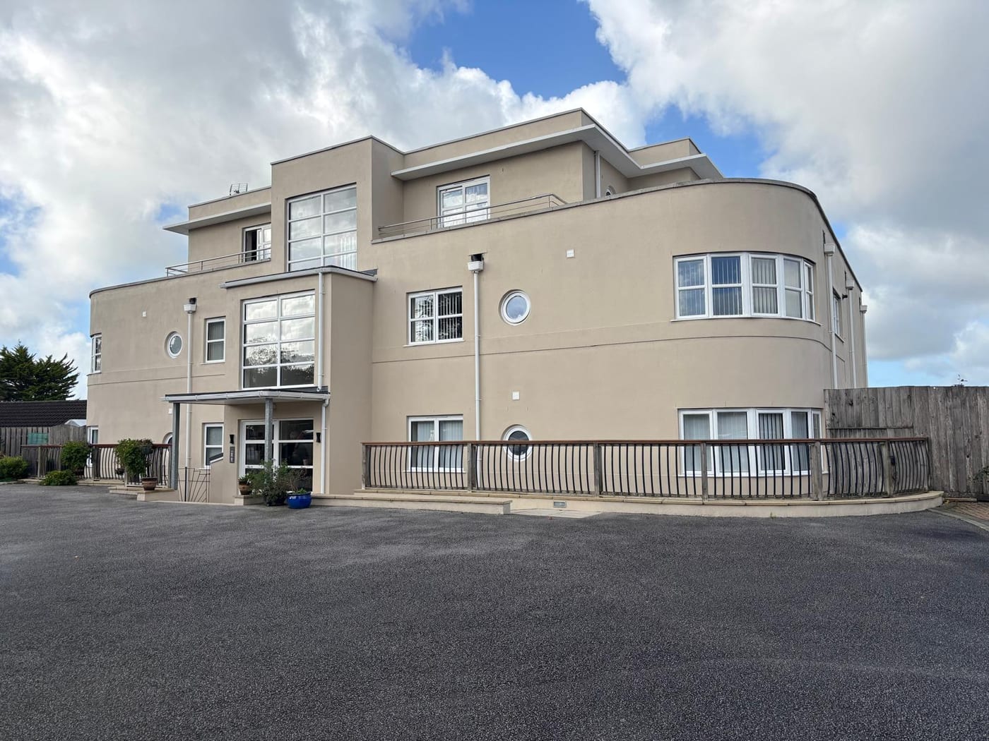
What We Would Put First for a Block in Wells
Check the Street Against All Three Directions
The 1999 direction controls windows, doors and roofs fronting a highway on streets including St Thomas Street, Tor Street and Priory Place, and the 2011 direction covers roofs and chimneys on Portway and North Road. We would obtain consent before any Section 20 specification.
Major works and Section 20Plan for Flood Without a Warning Service
The East Somerset Rivers alert covers 15.8 per cent of Wells, but the River Sheppey warning area stops 454 metres short of the city. We would write an emergency plan for the block that does not depend on receiving a flood warning.
Block managementMeasure Radon on the Mendip Side
The city centre is lowest band, but class 4 and class 5 squares cover 54 per cent of Wells by area. We would check the block's own square and arrange radon measurement in communal areas wherever it is advised.
ComplianceAssess Converted Historic Buildings Early
138 ward households live in a converted or shared house, and 323 listed entries sit inside the conservation area. For a converted listed block we would commission a fire risk assessment and survey before setting the reserve fund.
Fire risk assessmentsManaging a Block in Wells at a Glance
- Local authority
- Somerset Council
- Authority type
- Unitary
- Building control
- Somerset Building Control, the council's own service covering the four former district areas
- County
- Somerset
- Fire and rescue service
- Devon and Somerset Fire and Rescue Service
- Water and sewerage
- Wessex Water
- From our Plymouth office
- About 87 miles in a straight line
- Setting
- Inland
What It Costs to Move a Block in Wells to Us
Management is a fixed annual fee, quoted for the building and agreed before we start. We take no commission and no third-party incentives, so the fee is the whole of what we earn from the building. Taking a block on carries a one-off start-up fee, set by size:
| Block size | Fee |
|---|---|
| Start-up fee, up to 10 units | £420.00 |
| Start-up fee, up to 25 units | £540.00 |
| Start-up fee, 50 units and above | £660.00 |
Taken from our published Additional Services price list, PBM Form #01-27 rev.6, effective 23 June 2025. All fees quoted are inclusive of VAT. See the full price list and how a handover works.
Three Article 4 Directions, Decided Street by Street
Three Article 4 directions apply in Wells, and they remove different rights on different streets, so the street a block stands on decides which controls apply. The first, made 9 August 2000, covers Market Street, St Cuthbert Street and the High Street. It restricts the demolition of all or part of a gate, fence, wall or other means of enclosure within the curtilage of a dwelling. The second, remade 6 July 1999, covers a long list of streets: parts of St Thomas Street, St Andrew Street and St Cuthbert Street, St John Street, Tor Street, part of Silver Street, Southover, part of South Street, Market Street, parts of Tucker Street and Priory Road, Lorne Place, Priory Place, St John's Court, Beckett Place, Foster Court and part of Chamberlain Street. It restricts the installation, replacement or alteration of any window, door or other opening fronting a highway, waterway or open space, and any other alteration to the roof fronting the same. That one bites hardest on block management, because a window replacement programme on those streets needs express consent. The third, made 1 September 2011 alongside the conservation area extension, covers parts of Tucker Street, West Street, Ethel Street, Portway and Portway Avenue, Priory Road, Silver Street, Bath Road, North Road and North Grove. It removes six classes of right, including roof alterations, chimneys, flues and soil and vent pipes, and gates, fences and walls. Any window, roof or boundary works specification should start by checking the block's street against all three.
Many Flats Sit in Buildings Never Designed as Flats
The Wells ward held 5,362 households at the 2021 Census with 828 in flats, 15.4 per cent. Of those, 561 were in purpose-built blocks, 138 in a converted or shared house, 71 in another converted building and 58 over commercial premises. All of the ward's output areas are in the city, and three more of the city's sit in Mendip West ward. Taking the whole built-up area gives 5,742 households and 834 flats, 14.5 per cent. With 337 listed buildings and a large historic core, a meaningful part of the flat stock is in buildings never designed as flats. Those conversions need early attention to fire separation, shared structure and the reserve fund.

A Large Flood Alert Area, but No Warning Service
The centre of Wells sits inside an Environment Agency flood area, the East Somerset Rivers alert, which covers 15.8 per cent of the built-up area. Yet no flood warning area covers Wells at all. The River Sheppey warning area stops 454 metres short of the built-up area and names Croscombe, Dulcote and Coxley on the city's edge rather than any street inside it. An emergency plan for a block here therefore cannot rely on receiving a flood warning. The council's evidence base maps flood defence structures within Wells but lists them by anonymous reference only, so no Wells defence can be named, dated or costed from the published record. District-wide, defences are described as mostly offering a 100 to 150 year standard of protection.
25 Grade I Entries, So Check Consents Before Works
One conservation area, designated in 1970 by Somerset County Council. The boundary was revised in 1989 to add 7 to 15 Priory Road, the sports field east of New Street and the Vicarage in St Thomas Street. It was extended again in October 2011 to take in North Road, Bath Road, Priory Road, Ethel Street, West Street, Tucker Street, Portway and Portway Avenue. The appraisal was approved on 19 October 2011 and divides the area into eight character areas. The Mendip Hospital and Dinder conservation areas both fall outside the Wells parish boundary. For a block inside the area, external works need checking against conservation controls, and on many streets against a direction removing permitted development rights as well.
The appraisal records over 330 listed building entries in Wells and notes the very high proportion at the upper grades: 25 Grade I, 8 per cent of the total, and 36 Grade II*, 11 per cent. Historic England's current data gives 337 entries in the parish with the same 25 and 36, of which 323 are inside the conservation area. The cathedral alone accounts for four separate Grade I entries, the Bishop's Palace group four more, and Vicars' Close six across its two terraces, chapel and hall. Three scheduled monuments and two registered parks and gardens sit inside the parish. The Bishop's Palace grounds are registered at Grade II* and cover 32.79 hectares, and Milton Lodge is registered at Grade II. The council describes Vicars' Close as said to be one of the oldest continuously inhabited streets in Europe. There is no adopted local list of non-designated heritage assets, only one described as being developed in 2011. A block in a listed building can need listed building consent for works, and that should be confirmed before any specification is tendered.

The Centre Reads Low, the Mendip Side Does Not
Wells is sharply split between low and high radon areas. The city centre is in the lowest class. There all parts of the square have under 1 per cent of homes at or above the action level, and radon measurement is not advised. But of the thirteen one-kilometre squares covering the built-up area, four are class 4 at 5 to 10 per cent and two are class 5 at 10 to 30 per cent. Between them those cover 54 per cent of the city by area, against 39 per cent in the lowest band. A block on the Mendip side of Wells and a block in the centre are in genuinely different positions. Radon measurement in the communal areas should follow the block's own square, not the city-centre reading.
That is national advice about the ground, not about the building. The same map excludes basements, cellars and underground spaces at every band, so an enclosed plant room, undercroft or lower-ground flat is still worth a look even here, and whatever is found belongs with the compliance record.
A Neighbourhood Plan Made in February 2024
Applications are decided under the Mendip Local Plan: Part I adopted 15 December 2014, Part II adopted 20 December 2021, and the Part II limited update adopted 25 September 2025. The update includes a Wells allocation for 47 dwellings at the Glastonbury Road police station site. The Wells Neighbourhood Plan was made on 14 February 2024 following a referendum on 25 January 2024. In that referendum 1,372 votes were cast, 1,114 in favour and 255 against with 3 rejected papers, 81 per cent of the vote. The neighbourhood area is the whole parish, designated by Mendip District Council's cabinet on 8 September 2014, and the examination was carried out by Deborah McCann. The council's own Wells page still describes the plan as in production, but the register of made plans and the decision statement confirm it is made. Both the local plan and the neighbourhood plan carry weight when a block applies for planning consent for alterations.
Service charge or accounts query? Email accounts@
Wells Questions
Do We Need Consent to Replace Windows in a Wells Block?
It depends on the street. The Article 4 direction remade on 6 July 1999 restricts installing, replacing or altering any window, door or other opening fronting a highway, waterway or open space on streets including St John Street, Tor Street, Southover and Lorne Place. A window replacement programme on those streets needs express consent. The other two directions control enclosures, roofs and chimneys.
Will a Block in Wells Receive Environment Agency Flood Warnings?
Not from a warning area inside the city. The East Somerset Rivers alert covers 15.8 per cent of the built-up area, but no flood warning area covers Wells. The River Sheppey warning area stops 454 metres short and names Croscombe, Dulcote and Coxley, so an emergency plan here cannot rely on receiving a warning.
Is Radon a Concern for Blocks in Wells?
It depends on location. The city centre is in the lowest class, where measurement is not advised. But of the thirteen squares over the built-up area, four are class 4 and two class 5, covering 54 per cent of the city by area. A block on the Mendip side and one in the centre are in genuinely different positions.
Nearby Areas
Talk to Us About Your Building in Wells.
A free, no-obligation proposal, written so it can be circulated to a board.