
Block Management in Wilton
Volunteer flood wardens deploy the town's barriers, with warning areas on both the Wylye and Nadder.
In Wilton we provide block and estate management, leasehold administration and service charge accounting for RMCs, RTM companies and freeholders. Ten Environment Agency areas overlap the built-up area, the Nadder gauge reached a record 1.19 metres on 27 January 2026, and the demountable defences depend on volunteer flood wardens. Flats make up 24.4 per cent of Wilton's households.

What We Would Put First for a Block in Wilton
Plan Around the Volunteer Flood Wardens
Wilton's barriers are demountable and are deployed on Environment Agency advice by volunteer flood wardens, under a flood plan dated February 2023. For a block in a warning area we would record those arrangements and the block's own response in the compliance file.
ComplianceInsure on the Street-Level Warning Areas
The Lower Wylye at Wilton Town area names Ditchampton, North Street, Castle Lane and Minster Street, and the Nadder area names South Street. We would identify the block's exposure precisely when placing insurance and handling any claim.
InsuranceReserve on Confirmed Defences Only
The Environment Agency proposed an embankment and a Crow Lane flood wall in March 2017, but no source confirms they were built. For a riverside block we would plan reserves on the defences actually confirmed, not the proposal.
Reserve fundsClarify Demises in Converted Buildings
Forty of Wilton's flats are in former schools, churches and warehouses, 2.0 per cent of households. For such a building we would establish the demise and repairing obligations from the leases at handover.
Leasehold managementManaging a Block in Wilton at a Glance
- Local authority
- Wiltshire Council
- Authority type
- Unitary
- Building control
- Wiltshire Council Building Control
- County
- Wiltshire
- Fire and rescue service
- Dorset and Wiltshire Fire and Rescue Service
- Water and sewerage
- Wessex Water
- From our Plymouth office
- About 111 miles in a straight line
- Setting
- Inland
What It Costs to Move a Block in Wilton to Us
Management is a fixed annual fee, quoted for the building and agreed before we start. We take no commission and no third-party incentives, so the fee is the whole of what we earn from the building. Taking a block on carries a one-off start-up fee, set by size:
| Block size | Fee |
|---|---|
| Start-up fee, up to 10 units | £420.00 |
| Start-up fee, up to 25 units | £540.00 |
| Start-up fee, 50 units and above | £660.00 |
Taken from our published Additional Services price list, PBM Form #01-27 rev.6, effective 23 June 2025. All fees quoted are inclusive of VAT. See the full price list and how a handover works.
Ten Flood Areas, and Defences That Need Volunteers
Ten Environment Agency areas overlap the built-up area, and both rivers and groundwater produce warning areas that name Wilton's streets. On groundwater, the Salisbury Plain alert covers 78.0 per cent of the town and the Cranborne Chase alert a further 21.9 per cent. Above those sits a warning area whose published description is simply groundwater flooding for Wilton, covering 10.7 per cent. On rivers, the Lower Wylye at Wilton Town warning area covers 8.3 per cent and names Grovely Riding School, Ditchampton, North Street, Castle Lane and Minster Street. A separate warning area for the River Nadder at South Street covers 1.2 per cent. It names South Street between Bull Bridge and the Library, including the surgery, the Michael Herbert Hall and its car park and the allotment gardens. The Environment Agency runs separate catchment alerts and separate in-town warning areas for the Wylye and the Nadder. Roughly a ninth of the built-up area is in Flood Zone 3 and a sixth in Flood Zone 2. The gauge in the town, on the Nadder, has a normal range of 0.09 to 0.57 metres. It publishes 0.76 metres as the level above which property flooding is possible, and recorded its highest ever level of 1.19 metres on 27 January 2026. The Environment Agency proposed a defence scheme in March 2017 to protect the 30 properties then at high risk. It comprised a raised embankment about half a metre high around the recreation ground, joining the existing defences beside Wiley Terrace, plus a flood wall to protect properties in Crow Lane. Construction was intended to start in early 2018 and finish that summer. No cost was published and no source confirms it was built. What is confirmed is that the town's defences are demountable and depend on people. The town council records that the barriers are deployed when flooding is imminent, on Environment Agency advice, by volunteer flood wardens who manage installation and removal, under a flood plan dated February 2023. For a block, insurance, the reserve fund and the emergency plan should rest on those confirmed defences only.
A Real Stock of Flats in Converted Buildings
The Wilton ward fits the town almost exactly, with sixteen of its seventeen output areas inside the built-up area. The published ward figure is 502 flats among 2,210 households, 22.7 per cent. The town itself has 2,028 households and 494 flats, 24.4 per cent. That is 394 in purpose-built blocks, 31 in a converted or shared house, 40 in another converted building and 29 over commercial premises. The 40 flats in former schools, churches and warehouses are 2.0 per cent of households, against 1.4 per cent at Westbury and 0.2 per cent at Amesbury. In a town with a carpet factory, an abbey site and a large estate, that is a real conversion stock. For such a building, the demise and repairing obligations need establishing from the leases at handover.
About 80 Per Cent of the Conservation Area Is Parkland
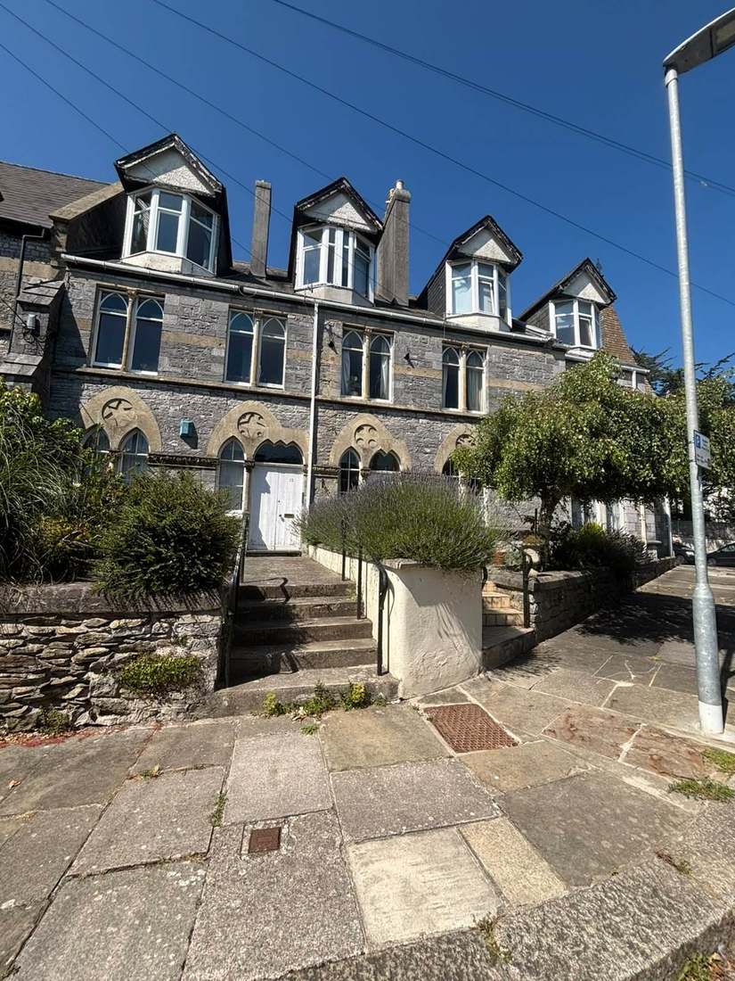
One conservation area, designated in 1973. It covers 191.3 hectares, but about 80 per cent of that lies inside the Wilton House registered park rather than in the town. Only about 38.5 hectares is actual townscape, and only a quarter of the built-up area falls inside the designation. The council publishes a conservation area statement rather than a full appraisal. For a block, the first question is whether it sits in the town part of the designation, because only then do conservation controls apply to its external works.
155 entries on the National Heritage List fall inside the parish, twelve of them Grade I, but eleven of those twelve are inside the Wilton House park. The town proper has one Grade I building, the Italianate Church of St Mary and St Nicholas on West Street, and five Grade II* entries. The built-up area outside the park holds 115 entries, one Grade I and five Grade II*. The park itself is a Grade I registered park and garden of 358.7 hectares, registered on 1 September 1987, so its northern half carries both that designation and conservation area status. The ruined church of St Mary in the Market Place is both listed at Grade II* and separately scheduled as a monument, so it engages two consent regimes at once. Only two buildings of the Royal Wilton carpet factory are listed, both at Grade II. For a listed block, listed building consent should be settled before works are specified.
Class 2 over 64.6 Per Cent of the Town
Low. Of the nine one-kilometre squares over the built-up area, five are class 2 and cover 64.6 per cent of the town. There the maximum radon potential is 1 to 3 per cent of homes at or above the action level, and the published advice is that measurement is advised. The other four are in the lowest band, covering the remaining 35.4 per cent. A block in a class 2 square should have radon measured in its ground-floor communal areas.

New Development Here Must Be Phosphate Neutral
Applications are decided under the Wiltshire Core Strategy, adopted 20 January 2015. Its Core Policy 33 makes Wilton a local service centre and provides for approximately 255 new homes across the community area to 2026. The largest single allocation affecting the town sits in a different policy. The former army headquarters site is allocated under the Salisbury community area policy as UKLF, Wilton, for 450 dwellings, of which 40 per cent are to be affordable. It also includes three hectares of employment land intended to provide at least 1,200 jobs to replace those lost when the military site closed. The term Erskine Barracks appears nowhere in the adopted plan. The development template for that site identifies the setting of Wilton Park and the conservation area, the risk of coalescence with Salisbury and proximity to the River Nadder among its constraints. The emerging Wiltshire Local Plan reached examination in November 2024 but was withdrawn on 22 May 2026 under section 22 of the Planning and Compulsory Purchase Act 2004. Its replacement is not expected before 30 April 2029. The council states that the 2015 Core Strategy's policies are not automatically out of date and will continue to guide development. There is no neighbourhood plan and no Article 4 direction. About 13.5 per cent of the parish lies inside the Cranborne Chase National Landscape. Only half a per cent of the built-up area does, in a sliver at the extreme western tip more than a kilometre from the market hall, and none of the conservation area. The constraint that applies everywhere here is nutrient neutrality. The whole town sits inside the River Avon Special Area of Conservation catchment, where the applicable nutrient is phosphorus. The adopted housing site allocations plan records that new development within the catchment must be phosphate neutral. The river itself runs through the town, covering about one per cent of the built-up area. For a block, phosphate neutrality matters if a project would add dwellings, such as a conversion or an extra flat.
Service charge or accounts query? Email accounts@
Wilton Questions
Is Most of the Wilton Conservation Area Actually Town?
No. The conservation area covers 191.3 hectares, but about 80 per cent lies inside the Wilton House registered park. Only about 38.5 hectares is townscape, and only a quarter of the built-up area falls inside the designation. Eleven of the parish's twelve Grade I entries are in the park, leaving the Church of St Mary and St Nicholas as the town's one Grade I.
At What River Level Is Property Flooding Possible?
The gauge on the Nadder in Wilton has a normal range of 0.09 to 0.57 metres and publishes 0.76 metres as the level above which property flooding is possible. Its highest recorded level was 1.19 metres on 27 January 2026. Roughly a ninth of the built-up area is in Flood Zone 3 and a sixth in Flood Zone 2.
Does Nutrient Neutrality Affect Development at Our Block?
It applies to new development. The whole town sits inside the River Avon Special Area of Conservation catchment, where the applicable nutrient is phosphorus, and the adopted housing site allocations plan records that new development within the catchment must be phosphate neutral. Wilton has no neighbourhood plan and no Article 4 direction.
Nearby Areas
Talk to Us About Your Building in Wilton.
A free, no-obligation proposal, written so it can be circulated to a board.