
Block Management in Cricklade
Upper Thames flood warnings, a conservation area over a quarter of town, lowest-band radon
In Cricklade, Plymouth Block Management would act as managing agent for residents' management companies, RTM companies and freeholders. The Thames warning area from Somerford Keynes to Cricklade covers 12.90 per cent of the built-up area, and the conservation area takes in 27.4 per cent of the town. Radon tells the opposite story: all seven squares over the town sit in the lowest band.

What We Would Put First for a Block in Cricklade
Plan Around Area-Based Flood Warnings
No Cricklade warning area names a street, so warnings here are area-based rather than address-based. With the Thames warning covering 12.90 per cent of the built-up area, we would establish whether a block falls inside it and place insurance accordingly.
InsuranceAssume Central Blocks Are in the Conservation Area
The conservation area covers 27.4 per cent of the town and 106 of its 113 listed entries. For a central block we would confirm the designation before any external specification and obtain consents first.
ConsentsRecord the Radon Position, Then Move On
All seven squares return the lowest radon class, where measurement is not advised. We would note that position in the compliance record and direct the budget toward risks the facts do show here, such as upper Thames flooding.
ComplianceManaging a Block in Cricklade at a Glance
- Local authority
- Wiltshire Council
- Authority type
- Unitary
- Building control
- Wiltshire Council Building Control
- County
- Wiltshire
- Fire and rescue service
- Dorset and Wiltshire Fire and Rescue Service
- Water and sewerage
- Thames Water
- From our Plymouth office
- About 133 miles in a straight line
- Setting
- Inland
What It Costs to Move a Block in Cricklade to Us
Management is a fixed annual fee, quoted for the building and agreed before we start. We take no commission and no third-party incentives, so the fee is the whole of what we earn from the building. Taking a block on carries a one-off start-up fee, set by size:
| Block size | Fee |
|---|---|
| Start-up fee, up to 10 units | £420.00 |
| Start-up fee, up to 25 units | £540.00 |
| Start-up fee, 50 units and above | £660.00 |
Taken from our published Additional Services price list, PBM Form #01-27 rev.6, effective 23 June 2025. All fees quoted are inclusive of VAT. See the full price list and how a handover works.
The Upper Thames, Not the Avon, Sets Cricklade's Flood Risk
Cricklade's flood risk comes from the upper Thames rather than anything in the Bristol Avon system. The warning area for the Thames from Somerford Keynes to Cricklade covers 12.90 per cent of the built-up area. The alert area from Ewen down to and including Cricklade covers 12.76 per cent. A further alert for the tributaries above Cricklade covers 4.53 per cent, listing the Flagham, Swill, Hankerton and Derry Brooks, the Hykemeres Stream and the River Key. The River Key warning area clips a further third of a per cent. None of them names a Cricklade street, so the warning here is area-based rather than address-based. Groundwater is not a designated issue, the nearest such area being about 20 kilometres off, and no defence scheme is published. Each block needs checking against the mapped warning area before insurance is placed.
Few Cricklade Households Live in Flats
The town itself holds 1,786 households, of which 150 are flats, 8.4 per cent. They are made up of 117 in purpose-built blocks, 15 in a converted or shared house, 4 in another converted building and 14 over commercial premises. The published figure for the Cricklade and Latton ward, 169 flats among 2,195 households, covers an area about a quarter larger than the town, so it overstates the household base by 409. Where a block sits over commercial premises, the lease should settle how insurance and repairs are shared with the shop.
More Than a Quarter of Cricklade Is Conservation Area
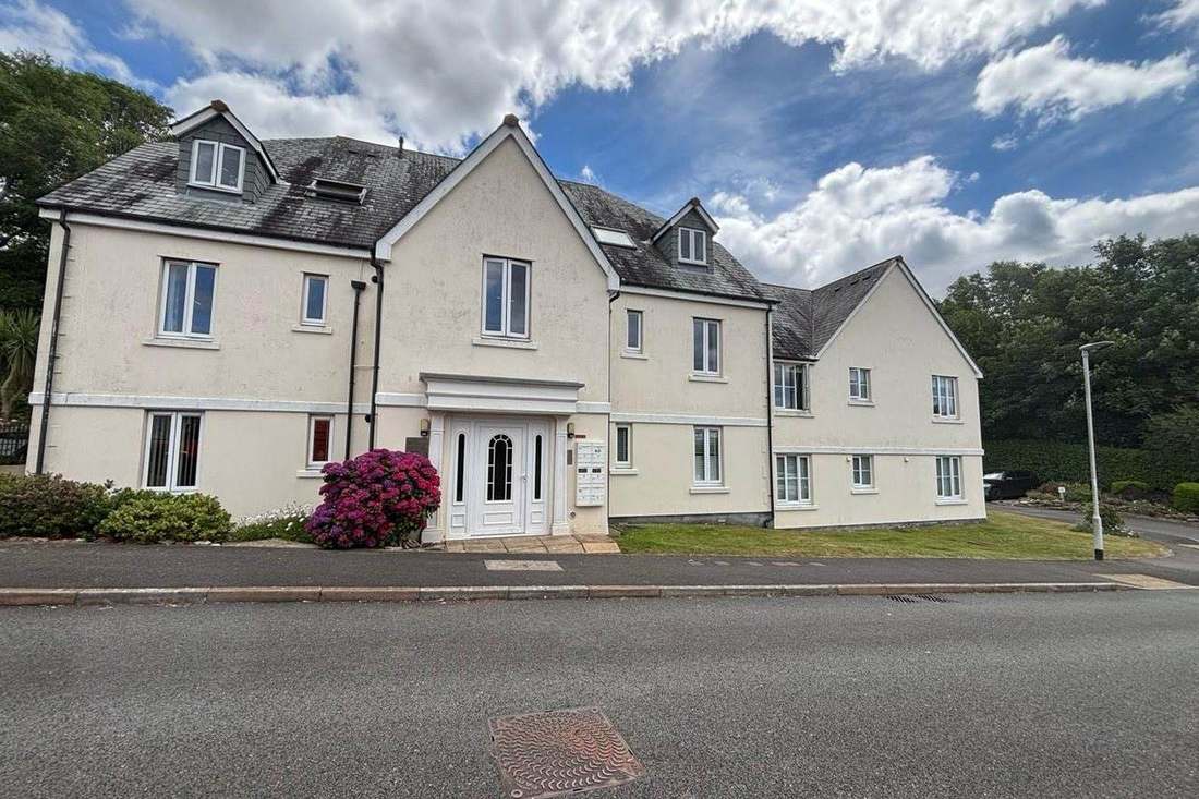
One conservation area, with no published designation date. An appraisal is registered as existing, also without a published adoption date. The designation covers 34.1 hectares, of which 29.8 fall inside the built-up area, covering 27.4 per cent of the town. More than a quarter of Cricklade sits inside it, so a central address should be assumed to be within it until checked, before any external works are specified.
113 entries on the National Heritage List fall inside the built-up area, two Grade I, five Grade II* and 106 Grade II, of which 106 sit inside the conservation area. The two Grade I entries are the Church of St Sampson and the churchyard cross at the Church of St Mary, both listed in January 1955. The Grade II* entries include the Old Town Cross, the Church of St Mary itself, 23 High Street, a group of four Rice Vaughan monuments and Jenner's School. Because most listed entries sit inside the conservation area, a block there may need listed building consent as well as conservation area checks.
Every Cricklade Square Sits in the Lowest Radon Band
The lowest band, with no variation at all. All seven one-kilometre squares over the built-up area are in the lowest class, with under 1 per cent of homes at or above the action level, and the published advice is that radon measurement is not advised. There is no elevated ground anywhere in the town, so a block's compliance record can note radon as low without arranging measurement.
That is national advice about the ground, not about the building. The same map excludes basements, cellars and underground spaces at every band, so an enclosed plant room, undercroft or lower-ground flat is still worth a look even here, and whatever is found belongs with the compliance record.
The 2015 Core Strategy Still Guides Cricklade Schemes
Decided under the Wiltshire Core Strategy, adopted 20 January 2015. The emerging Wiltshire Local Plan reached examination in November 2024 but was withdrawn on 22 May 2026 under section 22 of the Planning and Compulsory Purchase Act 2004. Its replacement is not expected to be adopted before 30 April 2029. The council states that the 2015 Core Strategy's policies are not automatically out of date despite its plan period having run to 2026, and will continue to guide development. There is no Article 4 direction: Cricklade does not appear in the council's register of 48 Article 4 areas. The town lies outside the Cotswolds National Landscape, whose nearest boundary is about 9.5 kilometres away. External works on a block therefore turn on the conservation area and listing.
Service charge or accounts query? Email accounts@
Cricklade Questions
Which Local Plan Decides Applications in Cricklade?
The 2015 Wiltshire Core Strategy still does, because the emerging Local Plan was withdrawn in May 2026. There is no Article 4 direction in Cricklade.
Is Radon a Concern for a Block in Cricklade?
On the national mapping, no. All seven one-kilometre squares over the built-up area return the lowest class, where under 1 per cent of homes are at or above the action level and the advice is that radon measurement is not advised. There is no elevated ground anywhere in the town.
Which Watercourses Could Flood a Cricklade Block?
The upper Thames is the main one, with a warning area covering 12.90 per cent of the built-up area. A further alert for the tributaries above Cricklade, including the Flagham, Swill, Hankerton and Derry Brooks, the Hykemeres Stream and the River Key, covers 4.53 per cent. Groundwater is not a designated issue and no defence scheme is published.
Nearby Areas
Talk to Us About Your Building in Cricklade.
A free, no-obligation proposal, written so it can be circulated to a board.