
Block Management in Chippenham
Fourteen accepted flood outlines since 1894 and Article 4 control over exterior painting.
We take on blocks and estates in Chippenham on behalf of RMCs, RTM companies and freeholders, covering service charges, compliance, major works and lease administration. The Bristol Avon and its brooks give the town fourteen accepted flood outlines from 1894 to 2012, with warning areas naming streets from Monkton Park to Bath Road. Inside the town-centre conservation area, an Article 4 direction removes rights including roof alterations and exterior painting.

What We Would Put First for a Block in Chippenham
Check Blocks Against Named Warning Streets
Chippenham's warning areas name Monkton Park, Riverside Drive, St Mary Street, the High Street, River Parade and Bath Road, among others. For a block on those streets we would confirm which area applies, keep it in the compliance record and give insurers an accurate flood history.
InsuranceConfirm Article 4 Before Repainting
The 3.66 hectare direction removes rights covering exterior painting, roof alterations, porches and hard surfaces, with listed buildings on Park Lane, The Causeway and The Butts. We would confirm the boundary with Wiltshire Council and obtain consent before specifying cyclical decoration.
ConsentsRecommend Radon Measurement
Fourteen of the 21 squares over the town, 78.0 per cent of it, are class 2, where measurement is advised. For a Chippenham block we would recommend radon measurement in ground-floor communal areas and record the result.
ComplianceManaging a Block in Chippenham at a Glance
- Local authority
- Wiltshire Council
- Authority type
- Unitary
- Building control
- Wiltshire Council Building Control
- County
- Wiltshire
- Fire and rescue service
- Dorset and Wiltshire Fire and Rescue Service
- Water and sewerage
- Wessex Water
- From our Plymouth office
- About 116 miles in a straight line
- Setting
- Inland
What It Costs to Move a Block in Chippenham to Us
Management is a fixed annual fee, quoted for the building and agreed before we start. We take no commission and no third-party incentives, so the fee is the whole of what we earn from the building. Taking a block on carries a one-off start-up fee, set by size:
| Block size | Fee |
|---|---|
| Start-up fee, up to 10 units | £420.00 |
| Start-up fee, up to 25 units | £540.00 |
| Start-up fee, 50 units and above | £660.00 |
Taken from our published Additional Services price list, PBM Form #01-27 rev.6, effective 23 June 2025. All fees quoted are inclusive of VAT. See the full price list and how a handover works.
Fourteen Flood Outlines, the Largest on Ladyfield Brook
The Bristol Avon runs through Chippenham, joined by the Ladyfield, Hardenhuish and Pudding Brooks, and the town has a long recorded flood history. Fourteen accepted flood outlines intersect the built-up area, running from 15 November 1894 through to November 2012. Thirteen of them are attributed to channel capacity being exceeded and one to overtopping of defences. The largest is not on the Avon at all but on the Ladyfield Brook at Rowden in July 1968, covering 28.3 hectares inside the town. Four Environment Agency areas cover part of the town. The upper Bristol Avon alert covers 3.00 per cent of the built-up area. A warning area for properties set back from the river covers 1.32 per cent, naming Avon Reach, The Bridge, Foghamshire, Providence Terrace, Ivy Road, St Mary Street, Emery Gate, Borough Parade, Westmead Lane, Monkton Park, Riverside Drive and Eastern Avenue. A riverside warning area covers 0.93 per cent, naming the High Street, River Parade, Rowden Hill and Bath Road. The fourth is a marginal clip of the southern edge. Despite its name, the warning area titled Bristol Avon from Malmesbury to Chippenham does not reach into the town, stopping at its edge. The defences reflect where the risk has actually fallen: 2,356 metres of engineered high ground on the Ladyfield Brook to a 50 year standard, 964 metres more on the Pudding Brook, and a single 367 metre embankment on the Avon to a 100 year standard. No named alleviation scheme with a date and a cost is published. For a block on a named street, the warning area belongs on the compliance record and the flood history in the insurance disclosure.
Flats Concentrate in Hardens, Central and Rowden
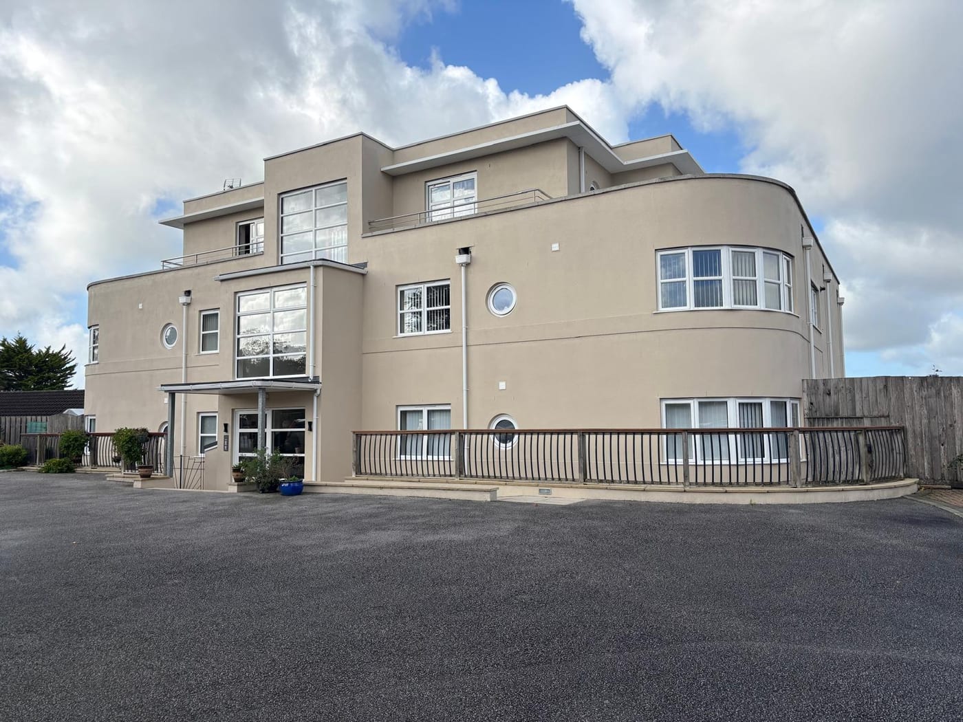
The census output areas inside the built-up area hold 15,566 households with 2,262 in flats, 14.5 per cent. Of these, 1,817 were in purpose-built blocks, 240 in a converted or shared house, 113 in another converted building and 92 over commercial premises. Eight Chippenham-named wards sit between 91 and 100 per cent inside the town and are a fair guide. The ninth, Kington, is only 6 per cent inside and does not describe Chippenham. The flats concentrate in Hardens and Central, Sheldon and Lowden and Rowden. Most are in purpose-built blocks, where communal plant and major works planning drive the budget.
277 Listed Entries, 230 in the Town Centre
Two conservation areas touch the town. The Chippenham area is the town-centre one, designated on 10 January 1973, and it covers 8.33 per cent of the built-up area. The Rowden area is much larger at 139 hectares but overwhelmingly rural, with only 7 per cent of it inside the town. The town-centre area has two separate appraisal documents recorded against it, though no adoption date is published for either. External works to a block inside the town-centre area need both the conservation area and the town-centre direction on painting and roof work taken into account.
277 entries on the National Heritage List fall inside the built-up area, two Grade I, eighteen Grade II* and 257 Grade II. 230 of them are inside the town-centre conservation area, including both Grade I buildings. Counted against the council's own dataset, the figure is 279. A block in the town centre should have its listing status checked before works are specified.
Most of Chippenham Sits in Radon Class 2
Predominantly the middle of the low range. Of the 21 one-kilometre squares over the built-up area, fourteen are class 2, covering 78.0 per cent of the town at 1 to 3 per cent of homes at or above the action level. There the published advice is that radon measurement is advised. Four squares are in the lowest band covering 12.3 per cent, where the advice is that measurement is not needed, and three are class 3 covering 9.7 per cent. So most of Chippenham sits just above the threshold at which the national advice changes, and measurement in ground-floor communal areas is the sensible default for a block.

Town-Centre Article 4 Covers Painting and Roof Work
An Article 4 direction applies, covering 3.66 hectares entirely inside the town-centre conservation area. The permitted development rights it removes cover the enlargement, improvement or alteration of a dwellinghouse, roof alterations, porches, hard surfaces and the painting of the exterior. Between them, these account for most routine external work. Neither an in-force date nor a street schedule is published. The listed buildings inside its boundary are on Park Lane, The Causeway and The Butts, which shows roughly where it applies. Before cyclical redecoration of a town centre block, the boundary should be confirmed with Wiltshire Council and consent obtained.
A Neighbourhood Plan Backed by 86.2 Per Cent
Decided under the Wiltshire Core Strategy, adopted 20 January 2015. The emerging Wiltshire Local Plan reached examination in November 2024 but was withdrawn on 22 May 2026, and its replacement is not expected to be adopted before 30 April 2029. The council states that the 2015 Core Strategy's policies are not automatically out of date, despite its plan period having run to 2026, and will continue to guide development. The Chippenham Neighbourhood Plan went to referendum on 23 May 2024. The town council reported that 86.2 per cent of those voting were in favour and 13.5 per cent against. The vote counts, the turnout and the date the council formally made the plan are not published. The plan had been submitted on 28 June 2023, found legally compliant on 14 July 2023 and recommended to referendum in March 2024. Applications for works to a block are decided against the Core Strategy and the neighbourhood plan.
Service charge or accounts query? Email accounts@
Chippenham Questions
Does the Malmesbury to Chippenham Flood Warning Cover Our Block?
Not if the block is in the town. Despite its name, the Bristol Avon from Malmesbury to Chippenham warning area stops at the town's edge. The areas that do reach the town are the upper Bristol Avon alert, a warning area for properties set back from the river, a riverside warning area naming the High Street, River Parade, Rowden Hill and Bath Road, and a marginal clip of the southern edge.
Which Plan Decides Applications in Chippenham Now?
The Wiltshire Core Strategy, adopted 20 January 2015. The emerging Wiltshire Local Plan was withdrawn on 22 May 2026, with a replacement not expected before 30 April 2029, and the council says the Core Strategy policies are not automatically out of date. The Chippenham Neighbourhood Plan went to referendum on 23 May 2024, with 86.2 per cent of those voting in favour.
How Well Defended Is Chippenham Against Flooding?
The defences follow where floods have fallen: 2,356 metres of engineered high ground on the Ladyfield Brook to a 50 year standard, 964 metres more on the Pudding Brook, and a single 367 metre embankment on the Avon to a 100 year standard. No named alleviation scheme with a date and a cost is published for the town.
Nearby Areas
Talk to Us About Your Building in Chippenham.
A free, no-obligation proposal, written so it can be circulated to a board.