
Block Management in Pewsey
Every Pewsey address lies in a groundwater flood alert, most of them in class 5 radon.
A Pewsey residents' management company, RTM company or freeholder can appoint us for block, estate and leasehold management. The Salisbury Plain groundwater flooding alert covers 100 per cent of the built-up area, a risk that rises through floors and persists for weeks. Class 5 radon covers about 90.7 per cent of the village, so for a ground-floor flat or basement plant room the advice is to measure rather than assume.

What We Would Put First for a Block in Pewsey
Measure Radon at Ground Level
Four of the six squares over Pewsey are class 5, covering about 90.7 per cent of it at 10 to 30 per cent of homes at or above the action level. We would arrange radon measurement in ground-floor communal areas and any basement plant room.
CompliancePlan for Groundwater, Not a River Bank
The Salisbury Plain groundwater alert covers the whole village, and groundwater rises through floors and persists for weeks. We would inspect ground-floor and basement areas, check flood cover at insurance placement and handle any claim through to settlement.
InsuranceObtain Consents in the Conservation Area
The main Pewsey conservation area covers 24.67 per cent of the built-up area, with a full character appraisal dated March 2007. For a block inside it we would obtain the necessary consents before specifying external works or starting Section 20 consultation.
ConsentsManaging a Block in Pewsey at a Glance
- Local authority
- Wiltshire Council
- Authority type
- Unitary
- Building control
- Wiltshire Council Building Control
- County
- Wiltshire
- Fire and rescue service
- Dorset and Wiltshire Fire and Rescue Service
- Water and sewerage
- Wessex Water
- From our Plymouth office
- About 123 miles in a straight line
- Setting
- Inland
What It Costs to Move a Block in Pewsey to Us
Management is a fixed annual fee, quoted for the building and agreed before we start. We take no commission and no third-party incentives, so the fee is the whole of what we earn from the building. Taking a block on carries a one-off start-up fee, set by size:
| Block size | Fee |
|---|---|
| Start-up fee, up to 10 units | £420.00 |
| Start-up fee, up to 25 units | £540.00 |
| Start-up fee, 50 units and above | £660.00 |
Taken from our published Additional Services price list, PBM Form #01-27 rev.6, effective 23 June 2025. All fees quoted are inclusive of VAT. See the full price list and how a handover works.
Class 5 Radon Covers About 90.7 Per Cent
Of the six one-kilometre squares over the built-up area, four are class 5 and they cover about 90.7 per cent of it. The published wording is that some parts of these squares are in bands of elevated radon potential. The maximum radon potential is 10 to 30 per cent of homes at or above the action level. The advice is that radon measurement is advised. Taken with the groundwater position, the conclusion for a ground-floor flat or any basement accommodation in this village is straightforward: measure rather than assume, and keep the results on the block's compliance record.
Most Pewsey Flats Are in Purpose-Built Blocks
The published Pewsey ward figure is 215 flats among 2,259 households, 9.5 per cent. The ward has 16 output areas, of which only 12 are inside the village, so it overstates the household count by about a quarter. The village itself has 1,795 households with 204 in flats, 11.4 per cent. Of these, 146 are in purpose-built blocks, 24 in a converted or shared house, 14 in another converted building and 20 over commercial premises. The ward also understates the flat share, because the rural fringe it adds is almost entirely houses. Of the ward's 148 purpose-built flats, 146 are inside the settlement, so essentially all of Pewsey's flats are in the village. Most are in purpose-built blocks, where ground-floor flats are the most exposed to the village's groundwater and radon risks.
A Groundwater Flood Alert Covers All of the Built-Up Area
The groundwater flooding alert for the Salisbury Plain area covers 100 per cent of Pewsey's built-up area. Its published text lists twenty settlements and Pewsey is not among them, but the coverage is complete. The Upper Hampshire Avon warning area from Upavon to Amesbury contains 9.53 per cent of the town and the Hampshire Avon alert 9.07 per cent. The warning area's description names Upavon, Haxton, Netheravon, Milston, Durrington and Bulford rather than Pewsey, so no Pewsey street list should be read into it. The main risk here is groundwater on a chalk valley floor. It rises through floors and into basements rather than arriving over a bank, and it persists for weeks rather than hours. That matters most for any ground-floor flat or basement plant room, both at inspections and when flood cover is placed.
A Quarter of the Village Is Conservation Area
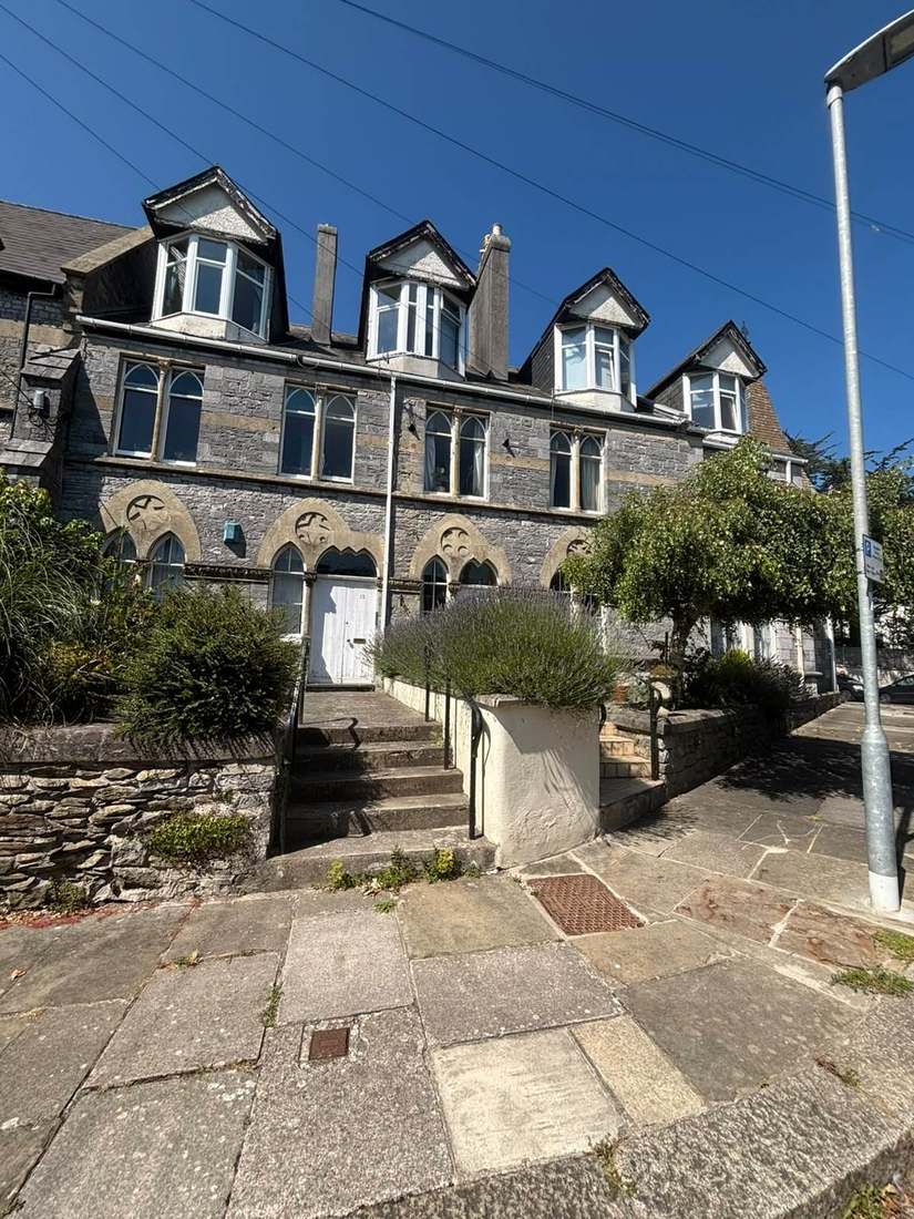
Pewsey has two conservation areas. The main Pewsey area accounts for 24.67 per cent of the built-up area, with the Wilcot Road area adding a further 0.63 per cent. The council's appraisal, dated March 2007, is a full character appraisal with management proposals rather than a bare statement. It records that Pewsey was first designated in 1985 in recognition of its architectural and historic character. The boundary was amended in 1995 and reviewed again in 2007. For a block inside either area, external works need the relevant consents, and the appraisal gives a clear basis for specifying materials.
52 entries on the National Heritage List fall inside the built-up area, one Grade I and 51 Grade II, and there is no Grade II* building at all. The council's own neighbourhood plan describes a number of Grade II listed buildings scattered throughout the area, with the church the only Grade I. The Grade I is the Church of St John the Baptist. No scheduled monument falls inside the built-up area, though the parish contains five out on the downs. The Pewsey White Horse is neither a scheduled monument nor a listed building. With listed buildings scattered through the village, a block's status should be checked before works are specified.

Modest Growth Only, Inside the North Wessex Downs
Applications are decided under the Wiltshire Core Strategy, adopted 20 January 2015. It classifies Pewsey as a Local Service Centre rather than a Large Village and states that it will only receive modest amounts of growth appropriate to its needs. Saved Kennet District Local Plan policies continue to apply. They cover Marlborough Road, new development in service centres, the riverside walks at Marlborough and Pewsey, the Broomcroft Road and Avonside area and the north east quadrant. The emerging Wiltshire Local Plan reached examination in November 2024 but was withdrawn on 22 May 2026 under section 22 of the Planning and Compulsory Purchase Act 2004. Its replacement is not expected before 30 April 2029. The council states that the 2015 Core Strategy's policies are not automatically out of date and will continue to guide development. The Pewsey Neighbourhood Development Plan was made on 22 October 2015 after a referendum on 21 September carried by 693 votes to 47 on a turnout of 25 per cent. A review is under way. Neither the council's own layer nor the national register records an Article 4 direction. The whole of the built-up area lies inside the North Wessex Downs National Landscape, as the made neighbourhood plan states. That designation applies to every address here and to consents for external works on any block.
Service charge or accounts query? Email accounts@
Pewsey Questions
Is Pewsey Named in Its Flood Warning Areas?
No. The Salisbury Plain groundwater alert covers 100 per cent of the built-up area, but its published text lists twenty settlements and Pewsey is not among them. The Upper Hampshire Avon warning area contains 9.53 per cent of the town, yet its description names Upavon, Haxton, Netheravon, Milston, Durrington and Bulford, so no street list should be inferred.
Is There an Article 4 Direction in Pewsey?
No. Neither Wiltshire Council's own layer nor the national register records an Article 4 direction. Applications are decided under the Wiltshire Core Strategy of 2015, where Pewsey is a Local Service Centre expected to take modest growth, and the Pewsey Neighbourhood Development Plan, made on 22 October 2015, which is now under review.
How Many Flats Are There in Pewsey?
The village itself has 1,795 households with 204 in flats, 11.4 per cent, of which 146 are in purpose-built blocks. The published ward figure of 215 flats in 2,259 households overstates households by about a quarter and understates the flat share, because the rural fringe it adds is almost entirely houses.
Nearby Areas
Talk to Us About Your Building in Pewsey.
A free, no-obligation proposal, written so it can be circulated to a board.