
Block Management in Tidworth
A garrison town with no conservation area and a groundwater warning area of its own.
Tidworth blocks can be run by Plymouth Block Management on behalf of residents' management companies, RTM companies and freeholders, with block, estate and leasehold management in one service. The town has no conservation area, so external works are ordinary permitted development questions. Groundwater is the dominant flood mechanism: the whole town sits in the Salisbury Plain alert, and a dedicated warning area covers nearly a quarter of it.
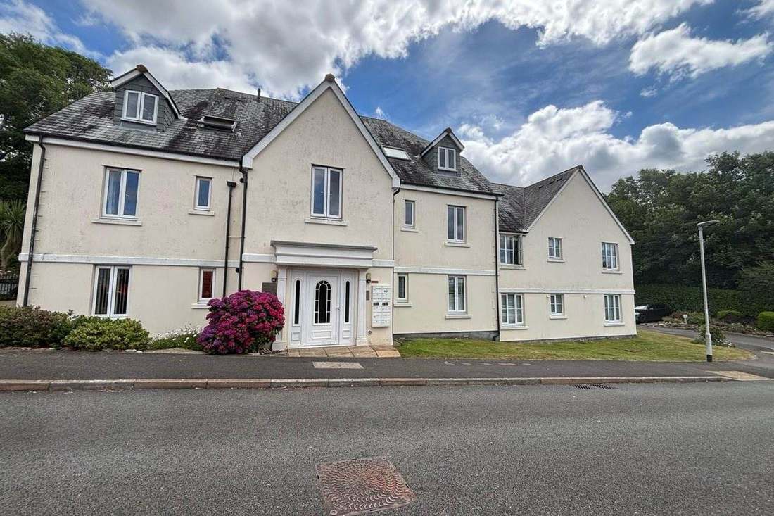
What We Would Put First for a Block in Tidworth
Inspect Ground Floors for Rising Groundwater
A groundwater warning area naming North Tidworth and Tidworth covers nearly a quarter of the town, roughly ten times either river warning area on the Bourne. We would include ground-floor and basement areas in the inspection schedule and register the block for that warning.
InspectionsReview Flood Terms at Insurance Placement
The whole built-up area sits in the Salisbury Plain groundwater alert, and no flood alleviation scheme with a date and cost is published for the town. We would disclose that exposure at placement and check the policy responds to water rising through the ground.
InsuranceHandle Subletting Consents in a Rented Town
Private renting approaches half of Tidworth's households, and owner occupation runs at 31 to 33 per cent across its two wards. We would handle lease consents for subletting promptly and keep the block's record of leaseholders and occupiers current.
Leasehold managementMeasure Radon Where the Advice Applies
Five of the eleven squares over Tidworth are class 2, covering 64.7 per cent of the town, where measurement is advised. We would confirm the block's square and arrange measurement in ground-floor communal areas where it falls in that band.
ComplianceManaging a Block in Tidworth at a Glance
- Local authority
- Wiltshire Council
- Authority type
- Unitary
- Building control
- Wiltshire Council Building Control
- County
- Wiltshire
- Fire and rescue service
- Dorset and Wiltshire Fire and Rescue Service
- Water and sewerage
- Wessex Water
- From our Plymouth office
- About 124 miles in a straight line
- Setting
- Inland
What It Costs to Move a Block in Tidworth to Us
Management is a fixed annual fee, quoted for the building and agreed before we start. We take no commission and no third-party incentives, so the fee is the whole of what we earn from the building. Taking a block on carries a one-off start-up fee, set by size:
| Block size | Fee |
|---|---|
| Start-up fee, up to 10 units | £420.00 |
| Start-up fee, up to 25 units | £540.00 |
| Start-up fee, 50 units and above | £660.00 |
Taken from our published Additional Services price list, PBM Form #01-27 rev.6, effective 23 June 2025. All fees quoted are inclusive of VAT. See the full price list and how a handover works.
The Groundwater Warning Area Is Ten Times the Bourne's
Groundwater is the dominant mechanism at Tidworth, and the Environment Agency operates a warning area specifically for it. The whole built-up area sits inside the Salisbury Plain groundwater alert. On top of that, a groundwater warning area naming North Tidworth and Tidworth covers nearly a quarter of the town. That is roughly ten times the footprint of either of the two river warning areas. Those river areas, on the Bourne, name Rectory Close and Trinity View Road in Tidworth and the High Street at Shipton Bellinger. Each covers around a fifth of one per cent of the town. Across the parish, Flood Zone 2 accounts for about 2.6 per cent and Flood Zone 3 about 1.5 per cent. On the Bourne valley floor, the risk with a dedicated warning service is water rising through the ground rather than the winterbourne overtopping. That behaves differently, persists longer and reaches basements and ground floors first. No flood alleviation scheme with a date and a cost is published for the town. A block here should have ground floors and basements in its inspection schedule and a policy that responds to groundwater.
Purpose-Built Flats and Private Renting Shaped by the Garrison
Both the stock and the tenure profile here follow from the garrison. On stock, Tidworth North and West returns 508 purpose-built flats among 2,247 households, 22.6 per cent. Taking the census output areas inside the built-up area gives 3,290 households with 674 in flats, 20.5 per cent, of which 617 are purpose-built. On tenure, owner occupation runs at 31 to 33 per cent across the two Tidworth wards. Private renting approaches half of all households, overwhelmingly in the census category of other private rented, which is where service family accommodation is recorded. Tidworth East and Ludgershall South ward has only ten of its nineteen output areas inside the town, the rest being Ludgershall, which has a separate built-up area of its own. With so many households renting, directors should keep an up-to-date record of which flats are let and who to contact for each.

No Conservation Area, and Only 23 Listed Entries
There is no conservation area in Tidworth. That reflects what Tidworth is: a garrison town largely built and rebuilt for military purposes rather than a market town with a historic core. For a managing agent it means external works here are ordinary permitted development questions rather than heritage consent questions.
23 entries on the National Heritage List fall inside the built-up area, one Grade I, two Grade II* and twenty Grade II. The council publishes no count, so the figure comes from Historic England's open data. It is a small listed stock for a town of this size, again reflecting its origins. Few blocks here will need listed building consent for repairs.
Measurement Advised over 64.7 Per Cent of Tidworth
Low but mostly in the band where measurement is advised. Eleven one-kilometre squares cover the built-up area. Five are class 2 and cover 64.7 per cent of the town, where the maximum radon potential is 1 to 3 per cent of homes at or above the action level. Six are in the lowest band covering the remaining 35.3 per cent, where the published advice is that measurement is not needed. A block should have its own square confirmed, and ground floor areas measured where it falls in class 2.
A Crown Land Article 4 with No Bearing on Flats
One Article 4 direction applies. It covers a single site of well under a hectare in North Tidworth beside Holy Trinity Church, amounting to two hundredths of one per cent of the town. The right it removes is the erection or alteration of gates, fences, walls or other means of enclosure by or on behalf of the Crown on Crown land for national security purposes. That is a Crown development right rather than a householder one. Neither a date nor a street list is published for it, and the reference number should not be read as a date. It has no bearing on flats, leaseholders or ordinary householder alterations. The wider military context matters for the town. The Army Basing Programme delivered 322 new service family homes at the Ashdown Estate in a 73 million pound project completed in March 2018. Construction began in July 2026 on about 13 million pounds of new facilities at Assaye Barracks, expected to complete by early 2028. The Royal Lancers are relocating to Tidworth from 2027.
Phosphorus Neutrality Binds New Homes Across the Whole Town
Decided under the Wiltshire Core Strategy, adopted 20 January 2015, together with saved policies from the Kennet District Local Plan. The council's own appendix records that plan as adopted in April 2004 rather than 2011 as its website suggests, 2011 being the plan period. Two saved Kennet policies are Tidworth-specific, both covering the north east quadrant allocation of 150 dwellings. The emerging Wiltshire Local Plan reached examination in November 2024. It was withdrawn on 22 May 2026 under section 22 of the Planning and Compulsory Purchase Act 2004, with its replacement not expected before 30 April 2029. The council states that the 2015 Core Strategy's policies are not automatically out of date and will continue to guide development. There is no neighbourhood plan for Tidworth and none for Ludgershall either, so no referendum figures exist. Tidworth is not in a National Landscape. The parish does not intersect the North Wessex Downs designation at all, and the built-up area is about 2.3 kilometres from it, just outside its southern edge. Two constraints are unusual and both matter. The Salisbury Plain Special Protection Area and Special Area of Conservation cover 13.1 per cent of the parish, and their boundary directly abuts the built-up area. The whole town also sits inside the River Avon Special Area of Conservation nutrient neutrality catchment, where the applicable nutrient is phosphorus, because the Bourne is a headwater of the Hampshire Avon. That constrains new residential development through the catchment rather than through proximity to the river channel, which is nearly six kilometres away. For an existing block, it matters mainly when a freeholder plans extra flats on the site.
Service charge or accounts query? Email accounts@
Tidworth Questions
Does the Article 4 Direction in Tidworth Affect Our Flats?
No. The single direction covers a site of under a hectare in North Tidworth beside Holy Trinity Church. It removes a Crown right to erect or alter gates, fences, walls or other enclosures on Crown land for national security purposes. It has no bearing on flats, leaseholders or ordinary householder alterations, and neither a date nor a street list is published.
Is Tidworth Inside the North Wessex Downs?
No. The parish does not intersect the North Wessex Downs National Landscape, and the built-up area is about 2.3 kilometres from it, just outside its southern edge. The Salisbury Plain Special Protection Area and Special Area of Conservation do directly abut the built-up area, covering 13.1 per cent of the parish.
What Is Changing at the Garrison?
Construction began in July 2026 on about 13 million pounds of new facilities at Assaye Barracks, expected to complete by early 2028, with the Royal Lancers relocating to Tidworth from 2027. Earlier, the Army Basing Programme delivered 322 new service family homes at the Ashdown Estate in a 73 million pound project completed in March 2018.
Nearby Areas
Talk to Us About Your Building in Tidworth.
A free, no-obligation proposal, written so it can be circulated to a board.