
Block Management in Fowey
Top radon band over most of the town, and quay streets that flooded in 2014.
Plymouth Block Management can take on block, estate and leasehold management for an RMC, RTM company or freeholder in Fowey. Four of the five kilometre squares over the town sit in radon class 6, and in February 2014 overtopped defences flooded 26 properties along South Street, Webb Street and Fore Street. The conservation area alone holds 103 listed designations, two of them Grade I.

What We Would Put First for a Block in Fowey
Measure Radon in Communal Areas
Four of the five squares over Fowey are class 6 and the fifth class 5, with measurement advised in both bands. We would recommend radon measurement in ground-floor communal areas and record the result and any follow-up in the compliance file.
ComplianceReview Flood Cover for Quay Streets
Section 19 investigations record four properties flooding in December 2012 and 26 in February 2014 along South Street, Webb Street and Fore Street. For a block on those streets we would review flood cover and claims history at each renewal.
InsuranceConfirm Listing Directly with the Council
The conservation area holds 103 listed designations, including Grade I Place House. Its 2010 appraisal link returns an error, so we would confirm a block's status directly with Cornwall Council before specifying works and obtain consent where needed.
ConsentsInspect Metalwork at the Harbour Mouth
Fowey is a tidal harbour at an open-coast mouth on the Heritage Coast. For an exposed block we would include railings, balconies and fixings in scheduled inspections to catch metalwork corrosion and plan replacement through the reserve fund.
InspectionsManaging a Block in Fowey at a Glance
- Local authority
- Cornwall Council
- Authority type
- Unitary
- Building control
- Cornwall Council Building Control
- County
- Cornwall
- Fire and rescue service
- Cornwall Fire and Rescue Service
- Water and sewerage
- South West Water
- From our Plymouth office
- About 22 miles in a straight line
- Setting
- Coastal
What It Costs to Move a Block in Fowey to Us
Management is a fixed annual fee, quoted for the building and agreed before we start. We take no commission and no third-party incentives, so the fee is the whole of what we earn from the building. Taking a block on carries a one-off start-up fee, set by size:
| Block size | Fee |
|---|---|
| Start-up fee, up to 10 units | £420.00 |
| Start-up fee, up to 25 units | £540.00 |
| Start-up fee, 50 units and above | £660.00 |
Taken from our published Additional Services price list, PBM Form #01-27 rev.6, effective 23 June 2025. All fees quoted are inclusive of VAT. See the full price list and how a handover works.
Class 6 Radon over Two Thirds of Mapped Land
Four of the five kilometre squares over the town are class 6 of 6, the top band, and the fifth is class 5. Of the land actually covered by the mapping, 68 per cent is class 6 and 32 per cent class 5. In class 6 the maximum radon potential is greater than 30 per cent of homes at or above the action level, and in class 5 it is 10 to 30 per cent. About a third of the built-up area has no radon mapping at all, being estuary. The published advice in both bands is that radon measurement is advised, so it should be arranged in ground-floor communal areas and kept on the compliance record.
Purpose-Built Blocks Hold 7.2 Per Cent of Town Households
Within the town itself there are 963 households. Of these, 69 are in purpose-built blocks, 7.2 per cent, 36 in a converted or shared house, 14 in another converted building and 16 over commercial premises, with no caravans at all. The electoral division covering the town, Fowey, Tywardreath and Par, held 2,603 households at the 2021 Census. It had 85 flats in purpose-built blocks, 64 in a converted or shared house, 22 in other converted buildings and 26 over commercial premises. That division is 2.7 times the size of the town, so its figures overstate detached housing by nearly eight percentage points and understate flats by more than half. Converted houses and flats over shops make up a large part of Fowey's flats, so lease apportionment and fire safety in shared buildings are recurring questions.

Town and Harbour Held to 2105, Cliffs Left Undefended
A tidal harbour at an open-coast mouth, which the conservation area appraisal places on the Heritage Coast. The shoreline management plan gives Fowey a policy unit named for the town, running 3.62 kilometres, held in all three epochs to 2105. The town sits in the policy development zone running from Pencarrow Head to Gribbin Head. On either side of it the undefended cliffs and intertidal units are no active intervention throughout, and Polruan across the harbour has its own hold the line unit. The defended frontage is the town and the harbour, and the coast beyond it is not. Exposed blocks need railings, balconies and fixings in scheduled inspections for corrosion.
Standards classify a high-salinity coastal atmosphere as C5-M, very high marine, in which unprotected steel loses more than 80 micrometres of thickness in its first year against as little as 1.3 inland. Balustrades, railings, fixings and walkway structures are what that costs a Fowey block, so we survey them on a shorter interval and fund the reserve fund from what the surveys find.
Overtopped Defences Flooded 26 Properties in February 2014
Tidal and coastal, and the council's own section 19 flood investigations record what that means in practice. In December 2012 the Town Quay was overtopped. As the tide rose, drains began to surcharge on Town Quay, Webb Street and Fore Street, flooding four properties. In February 2014 defences were overtopped along South Street, Webb Street and Fore Street and at Caffamill car park, and 26 properties flooded. Flood zone 3 covers 4.9 per cent of the built-up area. Fowey is not a priority community in the council's strategy and no defence scheme is published. Three Environment Agency areas contain part of the town. The River Fowey alert covers 2.01 per cent of the built-up area, but its published description names Lostwithiel, the Glynn Valley, Trago Mills and St Neot, and does not name Fowey. The two south Cornwall coast areas from Gribbin Head to Rame Head, one an alert and one a warning, each cover about 1.9 per cent and do name Fowey. No Environment Agency area names a single street in the town. For a block on the quay streets, flood cover and claims history need reviewing at every renewal.
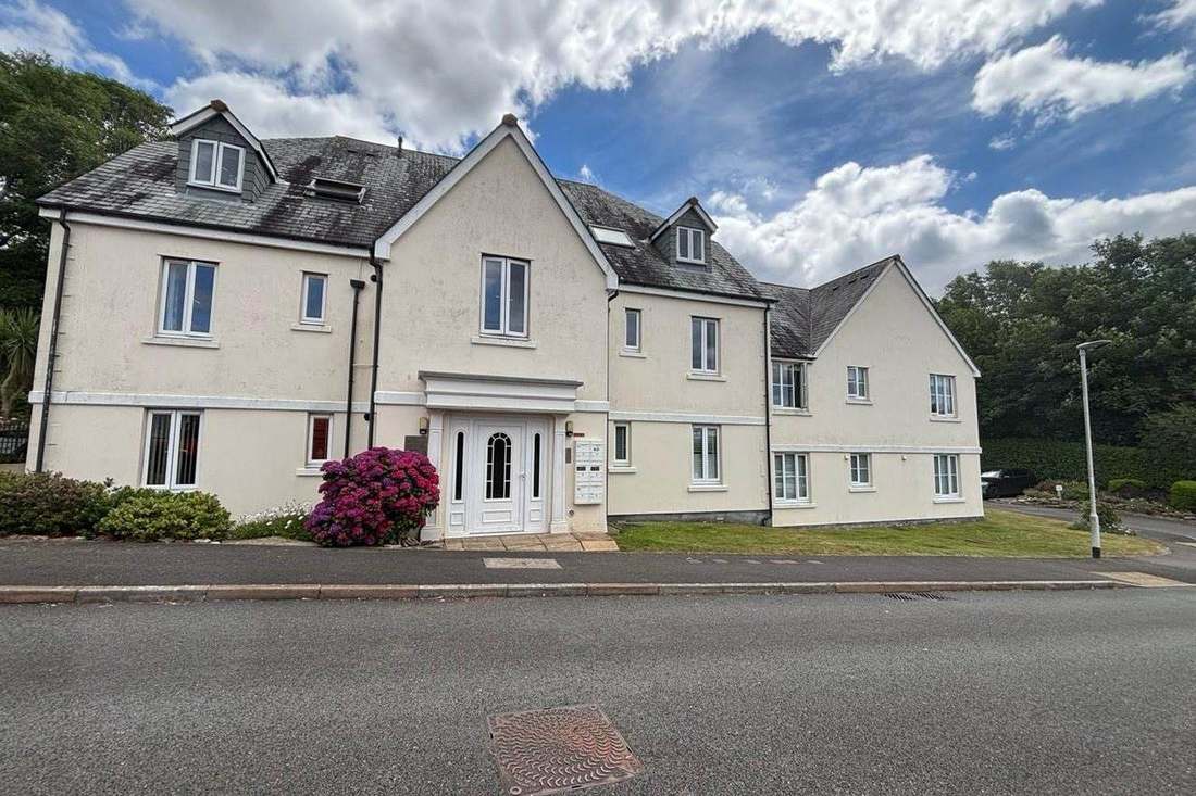
103 Listed Designations, with Place and St Fimbarrus Grade I
One area. The council's dataset gives a designation date of 31 May 1969, amended on 24 April 2010, while its own appraisal says the area was first designated in 1967 and extended in 1981. The appraisal is dated March 2010, with boundary changes in effect from 24 April 2010. At 72.7 hectares the area is nearly three quarters the size of the entire built-up area, but only about 38 per cent of it lies inside the town, the rest being the Place and Readymoney headland. Of the town itself, 27.4 per cent sits inside the designation. The appraisal's published online link returns an error, so a block's position is best confirmed directly with Cornwall Council before external works are specified.
The council publishes its own figure for the conservation area: 103 listed building designations. Two are grade I, Place House and St Fimbarrus church, and seven are grade II star, including the walls at Place House, St Catherine's Castle, the fifteenth century Blockhouse and The Ship Inn. There are also two scheduled monuments and four tree preservation orders inside the area. Historic England's list puts 105 entries inside the conservation area and 103 inside the built-up area. Two Grade II* entries, St Catherine's Castle and the castle remains at the harbour mouth, fall outside the built-up area while remaining inside the conservation area. Other Grade II* entries include 27 and 29 Fore Street, Frenchman's Creek and the museum. For a block in the conservation area, listed status and any tree preservation order should be checked before works.
Neighbourhood Plan Made 2020, Article 4 Only Recommended
Decided under the Cornwall Local Plan, with the Fowey Neighbourhood Development Plan made on 11 March 2020. The referendum result is not published, the plan pre-dating the council's published results. There is no Article 4 direction; the 2010 appraisal recommends the council consider one. Lanteglos-by-Fowey across the harbour has its own made plan, from January 2022, so the two sides of the water are covered by different documents. A block across the harbour is therefore judged against a different neighbourhood plan from one in Fowey itself.
Service charge or accounts query? Email accounts@
Fowey Questions
Does the River Fowey Flood Alert Cover Fowey Town?
Not by name. The River Fowey alert covers 2.01 per cent of the built-up area, but its description names Lostwithiel, the Glynn Valley, Trago Mills and St Neot rather than Fowey. The two south Cornwall coast areas from Gribbin Head to Rame Head, one alert and one warning, each cover about 1.9 per cent and do name Fowey. No Environment Agency area names a single street in the town.
Is Radon Measurement Advised for a Block in Fowey?
Yes. Of the land covered by the mapping, 68 per cent is class 6 and 32 per cent is class 5. In class 6 the maximum radon potential is greater than 30 per cent of homes at or above the action level, and in class 5 it is 10 to 30 per cent. The published advice in both bands is that measurement is advised. About a third of the built-up area is estuary with no radon mapping.
Which Planning Documents Apply in Fowey?
The Cornwall Local Plan and the Fowey Neighbourhood Development Plan, made on 11 March 2020. There is no Article 4 direction; the 2010 appraisal recommends the council consider one. Lanteglos-by-Fowey across the harbour has its own made plan from January 2022, so the two sides of the water are covered by different documents.
Nearby Areas
Talk to Us About Your Building in Fowey.
A free, no-obligation proposal, written so it can be circulated to a board.