
Block Management in West Moors
A village free of conservation areas, defended on the Uddens Water to a two year standard.
Acting for residents' management companies, RTM companies and freeholders, we take on block, estate and leasehold management in West Moors. The village has no conservation area and no Article 4 direction, so heritage consent is not a factor for a block. Its flood exposure is real, with the Lower Stour tributaries alert in sixteen fragments and an unnamed defence on the Uddens Water designed to a two year standard.

What We Would Put First for a Block in West Moors
Check Drainage Near Riverside Road
Flood zones encroach on residential areas along Riverside Road and Mannington Way, with flooding also recorded on Burt's Lane and Holt Road. For a block there we would add external drainage to the inspection schedule and review flood terms at insurance renewal.
InspectionsTreat the Uddens Water Defence as Low Standard
The embankment, high ground and wall on the Uddens Water is designed to a two year standard, with no scheme name or properties-protected figure published. We would not treat it as protection when placing insurance or setting the reserve fund.
InsuranceSpecify Works Without a Heritage Stage
With no conservation area and no Article 4 direction over the village, external works for a block are ordinary planning questions. We would confirm that position, specify the work and move to Section 20 consultation without a separate heritage consent stage.
Major works and Section 20Managing a Block in West Moors at a Glance
- Local authority
- Dorset Council
- Authority type
- Unitary
- Building control
- Dorset Council Building Control
- County
- Dorset
- Fire and rescue service
- Dorset and Wiltshire Fire and Rescue Service
- Water and sewerage
- Bournemouth Water or Wessex Water for supply depending on the address, with Wessex Water for sewerage
- From our Plymouth office
- About 103 miles in a straight line
- Setting
- Inland
What It Costs to Move a Block in West Moors to Us
Management is a fixed annual fee, quoted for the building and agreed before we start. We take no commission and no third-party incentives, so the fee is the whole of what we earn from the building. Taking a block on carries a one-off start-up fee, set by size:
| Block size | Fee |
|---|---|
| Start-up fee, up to 10 units | £420.00 |
| Start-up fee, up to 25 units | £540.00 |
| Start-up fee, 50 units and above | £660.00 |
Taken from our published Additional Services price list, PBM Form #01-27 rev.6, effective 23 June 2025. All fees quoted are inclusive of VAT. See the full price list and how a handover works.
A Two Year Defence Standard on the Uddens Water
The Lower Stour tributaries alert covers 6.69 per cent of the built-up area in sixteen separate fragments spread across the whole settlement. No property-level flood warning area reaches the village: the nearest stops 2,670 metres away. An Environment Agency gauging station sits inside the built-up area on the Uddens Water, a headwater of the Moors River and ultimately a Stour tributary. The county's assessment lists an unnamed defence on the Uddens Water at West Moors: an embankment, high ground and wall designed to a two year standard and rated in condition two to three. No scheme name, build date, cost or properties-protected figure is published for it. A two year standard is low, so the presence of a defence should not be read as strong protection. The county strategy records nine property flooding reports in the 2013 and 2014 winter, four of them internal. The council's assessment notes that the flood zones encroach on residential areas along Riverside Road and Mannington Way, with flooding also recorded on Burt's Lane and Holt Road. For a block on those streets, external drainage belongs on the inspection schedule and flood terms need reviewing at each insurance renewal.
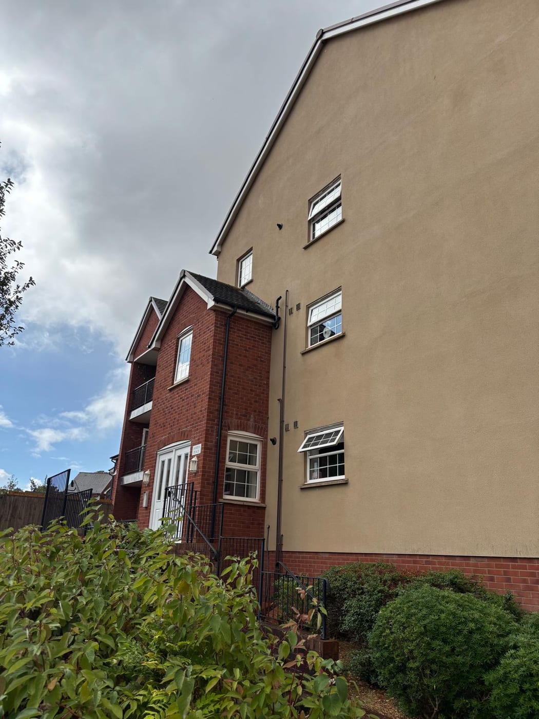
Purpose-Built Flats and an Older Population
The West Moors and Three Legged Cross ward held 4,114 households with 507 in flats, 12.32 per cent. The village's own built-up area is larger, holding 4,843 households across 37 output areas, because ten output areas from the neighbouring Ferndown South ward belong to it. On that basis the village holds 640 flats, 13.21 per cent: 583 in purpose-built blocks, 19 in a converted or shared house, 4 in another converted building and 34 over commercial premises. Conversions are almost non-existent here. Many residents are older: 40.8 per cent are aged 65 or over and 7.5 per cent aged 85 or over. For a block, that age profile makes accessible communal areas and evacuation arrangements a central part of the fire risk assessment.
No Conservation Area, One Listed War Memorial
There is no conservation area in West Moors. None lies within 450 metres of the built-up area, and the nearest designation, at Hampreston, does not overlap it. Heritage consent is therefore not a factor for a block here, and external works are ordinary planning questions.
One listed building stands in the built-up area, the West Moors war memorial, listed on 8 February 2018 and graded II. There is no Grade I and no Grade II* building, and no registered park or garden. One scheduled monument sits within the village, a bowl barrow south west of Palmers Ford Farm. Listed building consent is therefore unlikely to arise for a block in West Moors.
Lowest Radon Band in All Eleven Squares
The lowest band throughout. All eleven one-kilometre squares covering the built-up area are in the lowest class. There all parts of the square have under 1 per cent of homes at or above the action level, and radon measurement is not advised. Radon is not a factor in a block's health and safety review here.
That is national advice about the ground, not about the building. The same map excludes basements, cellars and underground spaces at every band, so an enclosed plant room, undercroft or lower-ground flat is still worth a look even here, and whatever is found belongs with the compliance record.

No Article 4, Despite One Named for the Village
There is no Article 4 direction in West Moors. Four Dorset Council directions lie within about 450 metres of the built-up area and none of them overlaps it. That includes one named for the village, at Dolman's Farm, made on 20 December 1983. It restricts the use of land for motor car or motor cycle racing on more than fourteen days in a calendar year. Dorset Council has published 78 Article 4 directions in all, and none covers the village. For a block, no direction removes permitted development rights for external works.
Service charge or accounts query? Email accounts@
West Moors Questions
Does the Dolman's Farm Article 4 Direction Affect West Moors?
No. The direction at Dolman's Farm, made on 20 December 1983, restricts using land for motor car or motor cycle racing on more than fourteen days in a calendar year, and it does not overlap the built-up area. None of the four Dorset Council directions within about 450 metres of the village overlaps it.
Do We Need to Measure Radon in West Moors?
No measurement is advised. All eleven one-kilometre squares over the built-up area are in the lowest band, where all parts of the square have under 1 per cent of homes at or above the action level, and there is no variation across the village. Radon is not a factor for a block here.
Has West Moors Flooded Recently?
The county strategy records nine property flooding reports in the winter of 2013 and 2014, four of them internal. The council's assessment notes flood zones encroaching on Riverside Road and Mannington Way, and flooding on Burt's Lane and Holt Road. West Moors also has an Environment Agency gauging station inside the village, on the Uddens Water.
Nearby Areas
Talk to Us About Your Building in West Moors.
A free, no-obligation proposal, written so it can be circulated to a board.