
Block Management in Wimborne Minster
Demountable flood defences on the Allen, and a once outstanding conservation area
Wimborne Minster residents' management companies, RTM companies and freeholders can appoint Plymouth Block Management for block, estate and leasehold management. The River Allen warning area names the High Street, East Street and Poole Road, and the defences include demountable sections that only work if someone deploys them. Flats make up 30.7 per cent of households in the civil parish, and most of the ward's flats are purpose-built.

What We Would Put First for a Block in Wimborne Minster
Find Out Who Deploys the Defences
The Allen defences include demountable sections, with design standards from 2 year to 100 year and condition ratings from 2 to 4. For a block behind them we would establish who deploys the demountables and record it in the block's compliance file.
ComplianceInsure for River and Groundwater
The Allen warning area names the High Street, East Street, Poole Road and Station Road, and the town centre is inside the Cranborne Chase groundwater alert area. We would place insurance that reflects both mechanisms and keep flood records for claims handling.
InsuranceMeasure Radon in the Class 3 Squares
Six of twelve squares, including the town centre, are class 3 at 3 to 5 per cent, where measurement is advised; the other six are the lowest band. We would recommend radon measurement in communal areas for blocks in the class 3 squares.
InspectionsObtain Consents in the Minster Area
Of the parish's 179 listed entries, 164 sit inside the Wimborne Minster conservation area, and the parish holds three Grade I entries, including Dean's Court and Julian's Bridge. We would confirm listing and designation before any external Section 20 specification.
ConsentsManaging a Block in Wimborne Minster at a Glance
- Local authority
- Dorset Council
- Authority type
- Unitary
- Building control
- Dorset Council Building Control
- County
- Dorset
- Fire and rescue service
- Dorset and Wiltshire Fire and Rescue Service
- Water and sewerage
- Wessex Water
- From our Plymouth office
- About 99 miles in a straight line
- Setting
- Inland
What It Costs to Move a Block in Wimborne Minster to Us
Management is a fixed annual fee, quoted for the building and agreed before we start. We take no commission and no third-party incentives, so the fee is the whole of what we earn from the building. Taking a block on carries a one-off start-up fee, set by size:
| Block size | Fee |
|---|---|
| Start-up fee, up to 10 units | £420.00 |
| Start-up fee, up to 25 units | £540.00 |
| Start-up fee, 50 units and above | £660.00 |
Taken from our published Additional Services price list, PBM Form #01-27 rev.6, effective 23 June 2025. All fees quoted are inclusive of VAT. See the full price list and how a handover works.
Demountable Defences on the Allen Need Someone to Deploy Them
Fluvial from two rivers, with a groundwater dimension on top. The River Allen warning area for the town centre names Wimborne Road, Allenview Road, Hanham Road, Mill Lane, Crown Mead, East Street, the High Street, Dean Court Lane, Millstream Close, Poole Road, Station Road and Newmans Close. A second Allen area names Knobcrook Road, Mill Lane and East Street. The Lower Stour area covering the stretch from Sturminster Marshall to Christchurch explicitly includes shops in Wimborne. The town centre also falls inside the Cranborne Chase groundwater flooding alert area, so groundwater is a distinct mechanism here. The council's assessment describes parts of the town along the Allen as protected by walls, embankments and high ground. It records that the Allen's flood zones run through the town, affecting Poole Road and Leigh Road up to Wimborne Road. Many residential areas in between are affected, along with education facilities and the tourist information centre. The Environment Agency's asset data lists the Allen defences from Brockington Farm to Wimborne Minster as embankment, high ground, wall and demountable defence. Their design standards range from 2 year to 100 year, and condition ratings span 2 to 4. Demountable defences are a particular consideration for a block, because they only work if someone deploys them. The county assessment lists Wimborne among known Dorset schemes but gives no description, date or cost for it. For a block, insurance should reflect both river and groundwater, and the emergency plan should record who deploys the demountables.
Most Flats Here Are Purpose-Built
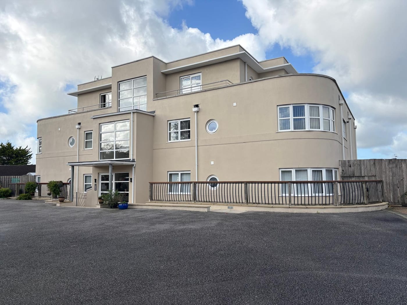
The Wimborne Minster ward held 3,899 households at the 2021 Census with 1,304 in flats, 33.4 per cent. The flats are overwhelmingly purpose-built, 1,075 of the 1,304, with only 121 in converted or shared houses. The ward boundaries do not match the town in either direction. The ward takes in part of Pamphill parish and excludes the Wimborne East parish ward, which sits in the neighbouring Colehill ward. Summing the census output areas to the civil parish itself gives 4,369 households and 1,343 flats, 30.7 per cent. Most flats here are in purpose-built blocks, with roofs, structure and communal areas shared through the service charge.
Once an Outstanding Conservation Area, with 164 Listed Entries
Two conservation areas lie in the parish, and two official sources give different dates for the main one. The council's own supplementary planning guidance states that Wimborne Minster was designated a conservation area in 1970. It was shortly afterwards elevated to outstanding conservation area status, reflecting its importance in the national context. It was extended in 1981 to take in The Leaze, land west of Poole Road, part of Lewens Lane and Rowlands Hill, the cricket ground and land bounded by Blind Lane, Knobcrook Road and West Borough. The national register instead records a start date of 25 February 1992. The second area, dating from April 1981, covers the Victorian Rowlands Hill and St Johns Hill area to the east. It extends down Avenue Road into the heart of the nineteenth century railway town. For a block in either area, external works need checking against conservation controls before they are specified.
179 entries on the National Heritage List fall inside the parish, three Grade I and eight Grade II*. Of those, 164 sit inside the Wimborne Minster conservation area and none inside the St Johns Rowlands Hill area, which is a Victorian suburb rather than a historic core. The three Grade I entries, all listed on the same day in June 1952, are the Minster Church of St Cuthburga, Dean's Court and Julian's Bridge. For a block in the Minster conservation area, listing should be confirmed before any external works are specified.
An Even Split Between Lowest Band and Class 3
An even split. Of the twelve one-kilometre squares intersecting the parish, six are in the lowest band and the other six are class 3 at 3 to 5 per cent, with no square in any other class. The town centre falls in a class 3 square, where the published advice is that radon measurement is advised. The exposure is moderate rather than severe. A block in a class 3 square should have radon measured in its communal areas.

A 2014 Core Strategy and Saved 2002 Policies Apply
Applications are decided under the Christchurch and East Dorset Local Plan Part 1 Core Strategy, running to 2028. It was adopted by East Dorset District Council on 28 April 2014 and by Christchurch Borough Council on 22 April 2014. Saved policies from the East Dorset Local Plan adopted on 11 January 2002 also apply, including a dedicated Wimborne and Colehill chapter. There is no made neighbourhood plan: Wimborne Minster is listed as in preparation and Colehill as paused, and no referendum has been held. The made plans at Wimborne St Giles, from April 2025, and Sturminster Marshall, from October 2024, cover different parishes. There is no Article 4 direction in the town, so no direction removes permitted development rights for a block's external works.
Service charge or accounts query? Email accounts@
Wimborne Minster Questions
Which Conservation Area Date Applies to Wimborne Minster?
Two official sources differ. The council's guidance states the town was designated in 1970, shortly afterwards elevated to outstanding conservation area status, and extended in 1981. The national register records a start date of 25 February 1992. The second area, covering Rowlands Hill and St Johns Hill, dates from April 1981 and holds no listed entries.
Is There a Neighbourhood Plan for Wimborne?
Not yet. Wimborne Minster's plan is listed as in preparation and Colehill's as paused, with no referendum held. Made plans at Wimborne St Giles and Sturminster Marshall cover different parishes. Applications are decided under the Christchurch and East Dorset Core Strategy of 2014 and saved 2002 East Dorset policies, and there is no Article 4 direction.
What Share of Wimborne Households Live in Flats?
Census output areas for the civil parish give 4,369 households and 1,343 flats, 30.7 per cent. The Wimborne Minster ward shows 33.4 per cent, with 1,075 of its 1,304 flats purpose-built, but its boundary takes in part of Pamphill parish and excludes the Wimborne East parish ward.
Nearby Areas
Talk to Us About Your Building in Wimborne Minster.
A free, no-obligation proposal, written so it can be circulated to a board.