
Block Management in Weston-super-Mare
A third of households in Weston Central and Hillside live in converted or shared houses.
Converted houses included, our block, estate and leasehold management serves Weston-super-Mare RMCs, RTM companies and freeholders. The town has 4,090 households in a converted or shared house. Behind the Weston Bay seawall, which has a one in 200 year standard, a block of flats cannot rely on its upper flats for refuge and needs a dedicated refuge area.
What We Would Put First for a Block in Weston-super-Mare
Untangle the Demise in Converted Houses
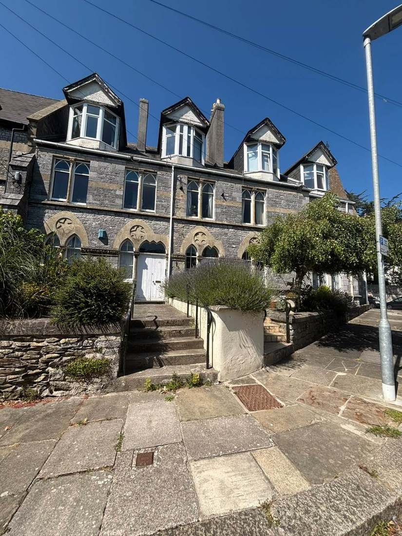
Weston Central is 33.6 per cent and Hillside 31.7 per cent converted or shared houses, which usually means shared roofs and risers and an unclear demise. We would establish the demise from leases and plans at handover before setting the service charge.
Leasehold managementFire Risk Assessments for Single-Stair Conversions
The council lists poor quality conversions and sub-divisions of former houses among the area's common problems. For a converted block we would commission a fire risk assessment that addresses single-stair layouts and shared risers.
Fire risk assessmentsRecord Refuge Arrangements for Tidal Flooding
The council's flood assessment says a block of flats cannot rely on its upper flats for refuge and requires a dedicated refuge area. For a block behind the Weston Bay seawall we would record the tidal flood position and refuge arrangements in the compliance file.
ComplianceGet Permission Before Taking Walls Down
Since 31 August 2022, demolishing a stone wall of one metre or less anywhere in the Great Weston Conservation Area needs planning permission. We would obtain it before any boundary wall repair that involves taking a section down.
ConsentsConfirm Cladding Status on Taller Blocks
North Somerset has 11 to 50 residential buildings of 11 metres and over with unsafe cladding under monitoring, and no Weston-specific count is published. For a block of that height we would confirm its remediation position and keep the record current.
Building safetyManaging a Block in Weston-super-Mare at a Glance
- Local authority
- North Somerset Council
- Authority type
- Unitary
- Building control
- North Somerset Building Control
- County
- North Somerset
- Fire and rescue service
- Avon Fire and Rescue Service
- Water and sewerage
- Bristol Water for supply and Wessex Water for sewerage
- From our Plymouth office
- Approx. 101 miles by road, an hour and a half or so
- Setting
- Coastal
What It Costs to Move a Block in Weston-super-Mare to Us
Management is a fixed annual fee, quoted for the building and agreed before we start. We take no commission and no third-party incentives, so the fee is the whole of what we earn from the building. Taking a block on carries a one-off start-up fee, set by size:
| Block size | Fee |
|---|---|
| Start-up fee, up to 10 units | £420.00 |
| Start-up fee, up to 25 units | £540.00 |
| Start-up fee, 50 units and above | £660.00 |
Taken from our published Additional Services price list, PBM Form #01-27 rev.6, effective 23 June 2025. All fees quoted are inclusive of VAT. See the full price list and how a handover works.
The Council Records Seafront Stonework in Decay
The council's conservation area appraisal records that there are few trees in the seafront character area because of coastal exposure. It notes deterioration of stonework at the rear of Claremont Crescent and the Birnbeck Road terrace, and describes a number of seafront buildings where decay and disrepair are visible in the streetscape. The estuary the seafront faces has a tidal range exceeding 12 metres at Avonmouth on spring tides. For a seafront block, stonework, pointing and exposed joinery need shorter inspection and redecoration cycles.
Metalwork is where coastal exposure shows up first and costs most. The standards put a high-salinity coastal atmosphere in category C5-M, losing over 80 micrometres of steel in year one against 1.3 to 25 inland, so railings, balustrades and fixings on a Weston-super-Mare block are surveyed more often and the reserve fund is modelled on the findings.
Many Households Live in Converted or Shared Houses
Across the ten wards named for the town, 6,445 of 37,800 households were in a purpose-built block at the 2021 Census. A further 4,090, 10.8 per cent, were part of a converted or shared house including bedsits, roughly three times the England rate of 3.5. Two wards stand out. Weston Central is 72.4 per cent flats with 33.6 per cent in converted or shared houses, and Hillside is 73.3 per cent flats with 31.7 per cent converted. The council's own conservation guidance lists poor quality conversions and sub-divisions of former houses among the area's common problems. For a converted block, the demise, shared roofs and risers, and fire separation need establishing at handover.
Tidal Risk Behind a One in 200 Year Seawall
Tidal, and dependent on defences. The council's strategic flood risk assessment states that without defences roughly a quarter of North Somerset would be at risk. It notes that a residual risk remains because of the age and condition of those defences, and that tidal flooding arrives fast enough to do more damage than river flooding. The Weston Bay seawall is rated at a one in 200 year standard, and the same document records that it was breached in 1962. Two rules in that assessment reach a block directly. Ground floor sleeping accommodation is not permitted where defended tidal flood depth exceeds 150 millimetres. A block of flats cannot rely on its upper flats for refuge, so a dedicated refuge area is essential.
Great Weston Spans Seafront, Centre, Hillside and Whitecross
The Great Weston Conservation Area, adopted in December 2018, amalgamated five earlier areas designated between 1971 and 1998 and added the town centre, Whitecross, Milton Road Cemetery and Bristol Road Lower. It has four character areas: seafront, town centre, hillside and Whitecross. Uphill, Uphill North and Worle Village are separately designated. For a block inside any of these areas, external works need checking against conservation controls before they are specified.
83 entries fall inside the built-up area, none of them Grade I and 7 Grade II*. The town is mainly unlisted Victorian and Edwardian terraces inside a conservation area rather than individually listed buildings. Birnbeck Pier, built 1867 and Grade II*, is on the Heritage at Risk Register and the council's own appraisal calls it derelict. For most blocks here, conservation area controls matter more than listed building consent.

11 to 50 North Somerset Buildings Under Cladding Monitoring
North Somerset appears in the government's July 2026 remediation tables with a banded figure of 11 to 50 residential buildings of 11 metres and over with unsafe cladding under monitoring. Of those, 64 per cent are in programme, 18 per cent have remediation underway and 18 per cent are complete. North Somerset also appears in the Building Safety Fund table with one to five eligible buildings, all remediated. No count specific to Weston-super-Mare is published. For a block of 11 metres or more, the remediation position should be confirmed and kept on the building safety record.
Radon Splits Between the Centre and Worle
Radon potential varies within a couple of kilometres. Of 15 sampled land squares within about three kilometres of the centre, 8 are in the band where maximum potential reaches 10 to 30 per cent and measurement is advised. The other 7 are in the lowest band. The town centre and Uphill both sampled in the higher band and Worle in the lowest. A block's own square decides whether radon measurement belongs in its health and safety review.
Eight Heritage Directions, One Covering Low Stone Walls
Eight Article 4 directions cover the town and its surroundings, all of them heritage controls rather than HMO controls. The newest came into force at 9am on 31 August 2022. It removes permitted development rights to demolish stone walls of one metre or less anywhere in the Great Weston Conservation Area. The direction rests on commissioned evidence that the incremental loss of boundary walls was harming the character of the Victorian stone town. No published direction removes small HMO permitted development rights, and licensing is mandatory only. For a block in the conservation area, taking down any part of a stone boundary wall of one metre or less during repairs needs planning permission first.
What Else Changes About Managing a Block in Weston-super-Mare
- Two different water companies serve the same flat: Bristol Water supplies the water and Wessex Water takes the sewage, so mains faults and drainage adoption go to different companies.

Tribunal Decisions on Blocks in Weston-super-Mare
Published First-tier Tribunal decisions on named developments here, each read in full. They show what the tribunal expects of whoever runs a block in this area.
| Development | Issue | Decided |
|---|---|---|
| 20 to 32 Russell Avenue, Locking Parklands | Section 20 consultation | 21 May 2024 |
| Beach Hotel, Regent Street and Salisbury Terrace | Insurance | 27 September 2022 |
| 91 Pennycress, Locking Castle | Appointment of a manager | 3 October 2019 |
| Flat 1, 10 South Parade | Service charge | 11 May 2015 |
Going Deeper in Weston-super-Mare
Towns and Villages We Cover Around Weston-super-Mare
Worle, Uphill, Hutton, Locking, Banwell, Congresbury, Clevedon, Nailsea, Portishead, Yatton.
Service charge or accounts query? Email accounts@
Weston-super-Mare Questions
Does Weston Have an HMO Article 4 Direction?
No. All eight Article 4 directions covering the town and its surroundings are heritage controls rather than HMO controls, and no published direction removes small HMO permitted development rights. Licensing is mandatory only. The newest direction, in force from 9am on 31 August 2022, controls demolition of stone walls of one metre or less in the Great Weston Conservation Area.
Can Ground Floor Flats Be Used as Bedrooms in a Flood Area?
Not where defended tidal flood depth exceeds 150 millimetres: the council's strategic flood risk assessment does not permit ground floor sleeping accommodation there. The same document records that the Weston Bay seawall, with a one in 200 year standard, was breached in 1962, and that tidal flooding arrives fast enough to do more damage than river flooding.
Does Radon Vary Across Weston?
Yes, within a couple of kilometres. Of 15 sampled land squares within about three kilometres of the centre, 8 are in the band where maximum potential reaches 10 to 30 per cent and measurement is advised. The other 7 are in the lowest band. The town centre and Uphill sampled in the higher band and Worle in the lowest, so no blanket statement holds.
Is My Building in Weston-super-Mare a Higher-Risk Building?
It is if it is 18 metres or seven storeys with two or more residential units, in which case it must be registered with the Building Safety Regulator.
Nearby Areas
Talk to Us About Your Building in Weston-super-Mare.
A free, no-obligation proposal, written so it can be circulated to a board.