
Block Management in Barnstaple
Three separate flood waters, radon advised across the whole town, and 234 listed buildings.
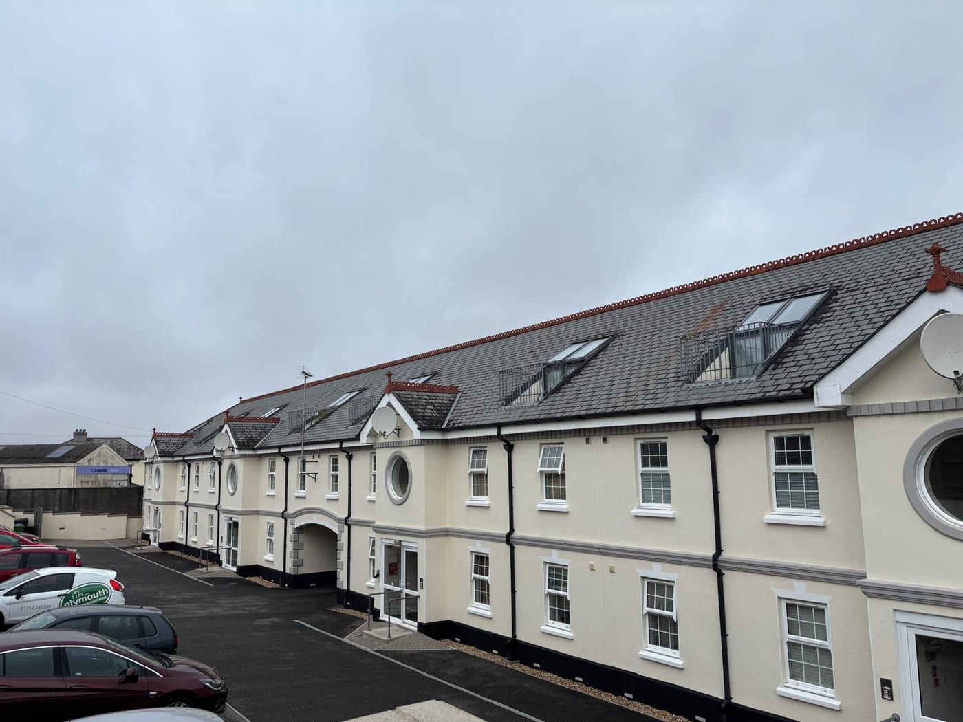
Plymouth Block Management provides block, estate and leasehold management for residents' management companies, RTM companies and freeholders with flats in Barnstaple. The tidal Taw, the River Yeo and Bradiford Water each carry their own Environment Agency warning area, naming streets from Castle Quay to Pilton Park. Radon measurement is advised across 100 per cent of the town, and the Town Centre conservation area holds 234 listed buildings in 30.9 hectares.

What We Would Put First for a Block in Barnstaple
Map Each Block Against the Warning Areas
Castle Quay, The Strand, Pottington, Pilton and Sticklepath sit in the tidal Taw warning area, and Raleigh Meadow and Pilton Park in the River Yeo one. We would record which applies to the block, register the committee for it and check the insurance schedule reflects it.
InsuranceMeasure Radon in Ground-Floor Communal Areas
Radon measurement is advised across the whole of Barnstaple, and 8.1 per cent of the built-up area reaches class 6, above 30 per cent of homes. We would arrange measurement in ground-floor communal areas and plant rooms and keep the results on the compliance record.
ComplianceClear Consents Before Specifying Works in Pilton
In Pilton and Bradiford the Article 4 direction turns ordinary external alterations into planning applications, and the town centre holds 234 listed buildings. We would obtain the consents first, then specify and run Section 20 consultation, so the programme is not stopped after tender.
Major works and Section 20Check Empty Flats Against Council Tax Premiums
North Devon charges a 100 per cent premium on second homes from 1 April 2025. Empty premiums rise to 300 per cent past ten years and are not reset by a change of ownership. We would flag long-empty flats to the directors when sales or lease consents come through.
Leasehold managementManaging a Block in Barnstaple at a Glance
- Local authority
- North Devon Council
- Authority type
- District, under the county council
- Building control
- NMD Building Control, a partnership between North Devon and Mid Devon District Councils
- County
- Devon
- Fire and rescue service
- Devon and Somerset Fire and Rescue Service
- Water and sewerage
- South West Water
- From our Plymouth office
- Approx. 63 miles by road, about an hour
- Setting
- Inland
What It Costs to Move a Block in Barnstaple to Us
Management is a fixed annual fee, quoted for the building and agreed before we start. We take no commission and no third-party incentives, so the fee is the whole of what we earn from the building. Taking a block on carries a one-off start-up fee, set by size:
| Block size | Fee |
|---|---|
| Start-up fee, up to 10 units | £420.00 |
| Start-up fee, up to 25 units | £540.00 |
| Start-up fee, 50 units and above | £660.00 |
Taken from our published Additional Services price list, PBM Form #01-27 rev.6, effective 23 June 2025. All fees quoted are inclusive of VAT. See the full price list and how a handover works.
Three Waters, Each with Its Own Environment Agency Warning Area
Barnstaple sits on the tidal Taw inside the Taw and Torridge estuary, so its exposure is estuarine rather than open coast. It is exposed on three waters at once, the tidal Taw, the River Yeo and Bradiford Water, and each has its own Environment Agency warning area naming streets. The River Yeo area has 94.5 per cent of its extent inside the town and names Raleigh Meadow, Green Meadow Drive and Pilton Park. The tidal Taw area is 67.3 per cent contained and names Castle Quay, The Strand and the Pottington, Pilton and Sticklepath areas. A third area, for Pilton, The Strand and Rock Park, is 58.9 per cent contained. It names Victoria Road, New Road, Taw Vale, Town Square and Chaddiford Lane. A fourth, on Bradiford Water, names Windsor Road, Meadow Road and the A361 Braunton Road. Eight further areas lie close to the town without covering it, including the broad Barnstaple, Braunton and Ilfracombe alert. For a block, the first step is to establish which named area covers the building, then register for its warnings and make sure the insurance schedule reflects it.
Purpose-Built Flats, Not Conversions, Set Barnstaple Apart
At the 2021 Census, 2,112 of 8,274 households across the three Barnstaple wards, 25.5 per cent, were in flats, against 14.1 per cent across North Devon. Barnstaple differs from its district on terraced housing and purpose-built flats rather than on conversions. Across 13,992 households, 13.7 per cent are in purpose-built blocks against 8.4 per cent across North Devon, and 28.4 per cent are terraced against 21.9 per cent. The converted or shared house share of 3.6 per cent is close to the district's 3.3 per cent. So the subdivided-villa pattern that fits Exmouth or Teignmouth does not fit Barnstaple. The variation inside the town is wide. Barnstaple Central is 37.6 per cent purpose-built flats and 12.3 per cent converted or shared house, against 1.6 per cent converted in Barnstaple with Pilton, a factor of nearly eight. Because Central is much the smallest of the three wards, the town average understates it by nearly nine percentage points. For a block, the major works specification should follow the building's own construction, purpose-built or converted, rather than a town average.
234 Listed Buildings Packed into 30.9 Hectares of Town Centre
North Devon publishes 41 conservation areas across the district. Five of them are inside Barnstaple's built-up area: Ebberly Lawn, Newport, Pilton, Rumsam and the town centre. Only the Town Centre is historic, designated in 1969. Ebberly Lawn, Pilton, Newport and Rumsam were all designated in a single thirteen-month period between December 2008 and December 2009. North Devon publishes an appraisal and a management plan for each of the five. The Town Centre appraisal records how the area grew. Devon County Council made the first designation in 1969, covering Taw Vale and part of Litchdon Street, as one of four conservation areas in the town. A fifth followed in 1971, taking in much of the High Street and most of Boutport Street. There were six separate conservation areas in the town until 1985. They were then consolidated by extending the central area outwards to include Castle Mound, Castle Green, The Square and the north side of Bear Street. For a block, the relevant appraisal and management plan should be read before any external works are specified.
The town centre conservation area is small but dense. The council counts 234 listed buildings in its 30.9 hectares: six Grade I, ten Grade II* and 218 Grade II. It also holds one scheduled ancient monument, the remains of the medieval motte and bailey castle at Castle Mound. Counting entries inside the built-up area instead gives 378, with six Grade I and thirteen Grade II*. Both counts include six Grade I entries, but not the same six. The council's count includes Long Bridge, Grade I and dating mainly from the thirteenth century. It sits in the Town Centre conservation area but outside the built-up area, because the boundary is cut by the tidal Taw. Three Grade II entries do the same. The built-up-area count instead includes two Grade I buildings in the Pilton conservation area. For a block, the building's own entry on the National Heritage List decides whether listed building consent is needed.
No Part of Barnstaple Sits in the Lowest Radon Band
All five elevated radon classes occur across the 42 one-kilometre squares over Barnstaple. The most common is class 4, at 5 to 10 per cent of homes at or above the action level, covering 56.0 per cent of the built-up area. A further 18.9 per cent is class 5. Another 8.1 per cent reaches class 6, where maximum radon potential is greater than 30 per cent of homes at or above the action level. No part of Barnstaple is in the lowest band, so radon measurement is advised across 100 per cent of the town. Braunton, eight kilometres away in the same district, peaks at class 4 and has no class 5 or 6 ground at all. For a block, that makes radon measurement in ground-floor flats and communal areas a standing compliance item.
Pilton and Bradiford Need Applications for Routine External Changes
An Article 4 direction made in July 1984 covers identified frontages at Pilton and Bradiford, on the north side of the town. On those frontages, enlarging, improving or altering a dwellinghouse, or adding a porch, needs a planning application where it would otherwise be permitted development. For a block on those frontages, external changes should be checked with the council before they are specified.
A Neighbourhood Area Since 2016 but Still No Made Plan
Planning decisions are made under the North Devon and Torridge Local Plan 2011 to 2031. The two councils adopted it jointly on 29 October 2018, following the inspector's report of 11 September 2018. A new joint plan with Torridge is in preparation. Barnstaple Town Council had the whole parish designated as a neighbourhood area on 14 April 2016, but more than ten years later no plan has been made. Two much smaller settlements in the district have completed theirs, Georgeham in January 2022 and Braunton in October 2023, and neither covers the town. No other neighbourhood plan in the district has been made. North Devon has published no Article 4 directions to the national register. For a block, a planning case is made against the joint plan alone, without the town-level policies that a Dartmouth or a Teignmouth scheme also has to satisfy.
A 100 Per Cent Second Home Premium from April 2025
North Devon Council resolved on 17 January 2024 to charge a 100 per cent premium on second homes, and it took effect on 1 April 2025. A second home here means furnished property that is nobody's sole or main residence. The long-term empty premium has run since 1 April 2024 at 100 per cent past one year, 200 per cent past five and 300 per cent past ten. The council states the empty period runs from the first day of vacancy and is not reset by a change of ownership. For a block, a long-empty flat can carry a large premium for its owner, which is worth knowing when a sale or lease consent comes through.

Four Unitary Councils to Replace Devon's Districts by April 2028
On 16 July 2026 the Secretary of State decided to reorganise local government across Devon, Plymouth and Torbay into four unitary councils, replacing Devon County Council and its eight districts. Elections to the new councils are due in May 2027 and they are to be implemented by April 2028, through a Structural Changes Order subject to Parliamentary approval. Until then the existing county and district structure stands.
The obligations in the lease and in statute do not change. What changes is the body an application goes to and the authority that enforces housing standards, so compliance records and planning history need to be in order before the transfer rather than after it.
What Else Changes About Managing a Block in Barnstaple
- Building control is a shared service with Mid Devon while planning stays with North Devon, so building regulations and planning go to differently constituted bodies.
Service charge or accounts query? Email accounts@
Barnstaple Questions
Which Barnstaple Streets Fall in a Flood Warning Area?
It depends on the street. The tidal Taw area names Castle Quay, The Strand, Pottington, Pilton and Sticklepath. The River Yeo area names Raleigh Meadow, Green Meadow Drive and Pilton Park, and a Bradiford Water area names Windsor Road, Meadow Road and the A361 Braunton Road. Victoria Road, New Road, Taw Vale and Town Square fall in a further area for Pilton, The Strand and Rock Park.
Does Barnstaple Have a Neighbourhood Plan We Need to Consider?
No. Barnstaple Town Council had the parish designated as a neighbourhood area on 14 April 2016, but no plan has been made. Proposals for a block are judged against the North Devon and Torridge Local Plan 2011 to 2031 alone, adopted jointly in 2018, with a new joint plan in preparation. Only Georgeham and Braunton have made plans in the district.
How High Is Radon Across Barnstaple?
No part of the town is in the lowest band, so measurement is advised everywhere. Class 4, at 5 to 10 per cent of homes at or above the action level, covers 56.0 per cent of the built-up area. A further 18.9 per cent is class 5 and 8.1 per cent class 6. Measurement is a recommendation rather than a requirement.
Is the Council for Barnstaple Changing?
Yes. Reorganisation was decided in July 2026 and takes effect by April 2028. The lease obligations do not change; the authority you file with does.
Nearby Areas
Talk to Us About Your Building in Barnstaple.
A free, no-obligation proposal, written so it can be circulated to a board.