
Block Management in Ilfracombe
Over a third of households in flats, many in subdivided Victorian guest houses.
In Ilfracombe, Plymouth Block Management offers block and leasehold management to resident-owned companies, RTM companies and freeholders on fixed fees. In Ilfracombe East 43.4 per cent of households are flats and more than half of those are not purpose-built, which brings shared demises and non-standard compartmentation. Radon is also high, with nine kilometre squares over the town at class 5.

What We Would Put First for a Block in Ilfracombe
Untangle Demises in Converted Terraces
In Ilfracombe East, 723 of 1,350 flats are not purpose-built, many in former Victorian guest houses. At handover we would review the leases and plans to settle who repairs what, and record shared services and structure clearly.
Leasehold managementCommission Fire Risk Assessments for Conversions
Subdivided guest houses bring non-standard compartmentation. For a converted block in Ilfracombe we would commission a fire risk assessment of the communal parts and track every action it raises on the compliance record.
Fire risk assessmentsRecommend Radon Measurement in Communal Areas
Nine kilometre squares over Ilfracombe return class 5 at 10 to 30 per cent, and both ward centroids sit in class 5. We would recommend radon measurement in ground-floor and lower communal spaces and keep the results on file.
ComplianceDisclose Seafront Flood Exposure to Insurers
The coastal warning area names Cheyne Beach, The Quay, The Strand and Broad Street. For a block on those streets we would set out the tidal exposure to insurers and keep the claims history ready at each renewal.
InsuranceManaging a Block in Ilfracombe at a Glance
- Local authority
- North Devon Council
- Authority type
- District, under the county council
- Building control
- North Devon Council Building Control
- County
- Devon
- Fire and rescue service
- Devon and Somerset Fire and Rescue Service
- Water and sewerage
- South West Water
- From our Plymouth office
- About 58 miles in a straight line
- Setting
- Coastal
What It Costs to Move a Block in Ilfracombe to Us
Management is a fixed annual fee, quoted for the building and agreed before we start. We take no commission and no third-party incentives, so the fee is the whole of what we earn from the building. Taking a block on carries a one-off start-up fee, set by size:
| Block size | Fee |
|---|---|
| Start-up fee, up to 10 units | £420.00 |
| Start-up fee, up to 25 units | £540.00 |
| Start-up fee, 50 units and above | £660.00 |
Taken from our published Additional Services price list, PBM Form #01-27 rev.6, effective 23 June 2025. All fees quoted are inclusive of VAT. See the full price list and how a handover works.
A Defended Pocket on an Undefended Bristol Channel Coast
Open coast on the Bristol Channel, and a defended pocket in an otherwise undefended frontage. The shoreline management plan holds the line at Ilfracombe in all three epochs. Its stated intent is to maintain the existing seawall and breakwater defences and eventually replace them with larger structures, while the units immediately either side are no active intervention. The town has two designated bathing waters. For a seafront block, external metalwork, fixings and coatings should be specified for open-coast exposure.
The measurable part of marine exposure is corrosion. A high-salinity coastal atmosphere is category C5-M in the standards, where unprotected steel can lose 200 micrometres in a year. In practice that means the metalwork on an Ilfracombe block sets the inspection interval, and the reserve fund follows the inspections rather than a standard cycle.
Ilfracombe East Is 43.4 Per Cent Flats
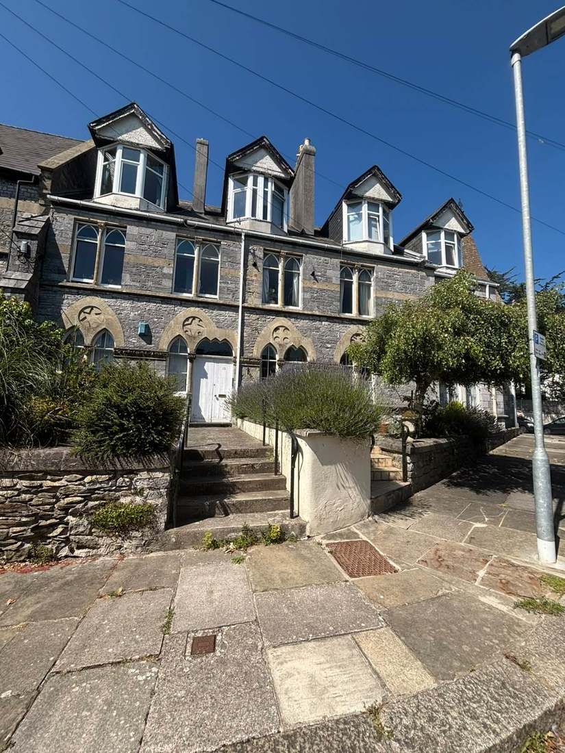
At the 2021 Census 1,707 of the 5,041 households across the two Ilfracombe wards were flats, 33.9 per cent. Ilfracombe East stands out: 1,350 of its 3,111 households are flats, 43.4 per cent. More than half of those, 723, are not purpose-built, being 434 in a converted or shared house, 150 in another converted building and 139 over commercial premises. Converted or shared house flats alone account for 13.95 per cent of households in that ward against 3.5 per cent for England, four times the national rate. The conservation area appraisal explains the cause: large Victorian terraces were used as guest houses and later as apartments and bedsits. It names that subdivision as the source of the town's parking pressure. For a managing agent that means shared demises, non-standard compartmentation and contested responsibility for structure.
The Sea, Not the Rivers, Drives Flood Warnings Here
Tidal rather than fluvial: no fluvial flood warning area exists for the town on the Environment Agency's register. The coastal warning area for the north Devon coast at Ilfracombe names low lying and exposed parts of the town, including Cheyne Beach, The Quay, The Strand and Broad Street. Surface water risk comes from culverting: the East and West Wilder Brooks run through culverts below ground before discharging at Wildersmouth Beach. For a block on the named seafront streets, tidal exposure belongs in every insurance disclosure.
The District's Largest Conservation Area, at 79 Hectares
One area of 79 hectares, the largest in the district, over two and a half times the second largest at Barnstaple town centre. It was first designated in 1973 and greatly extended in 1986. The boundary was last revised in September 2009, when 13.3 hectares were removed and only Tunnels Beaches added. The council's appraisal counts 123 listed entries inside it, two of them grade I and one grade II star, and there are three scheduled monuments including Hillsborough promontory fort. For a block inside the boundary, external works should be checked against conservation area controls before they are specified.

Nine Kilometre Squares over the Town Reach Class 5
Class 4 to 5 across the town. Six of the kilometre squares over the town are class 4 at 5 to 10 per cent and nine are class 5 at 10 to 30 per cent, and both ward centroids sit in class 5. The council publishes no figure, noting only that levels vary even from house to house in the same street. Radon measurement in ground-floor and lower communal areas should be a standing compliance item.
No Made Neighbourhood Plan, and a Caravan-Only Article 4
Decided under the joint North Devon and Torridge Local Plan 2011 to 2031, adopted on 29 October 2018. There is no made neighbourhood plan; the area was designated on 9 May 2019. The only Article 4 direction touching the town dates from 23 November 1966 and restricts caravans, not householder permitted development, so it does not restrict works to a block.
Service charge or accounts query? Email accounts@
Ilfracombe Questions
Does Ilfracombe Have River Flood Warnings?
No fluvial flood warning area exists for the town on the Environment Agency's register. The risk is tidal: the coastal warning area names Cheyne Beach, The Quay, The Strand and Broad Street. Surface water is linked to culverting, as the East and West Wilder Brooks run below ground before discharging at Wildersmouth Beach.
Will the Ilfracombe Seafront Stay Defended?
The shoreline management plan holds the line at Ilfracombe in all three epochs, with the stated intent to maintain the existing seawall and breakwater defences and eventually replace them with larger structures. The units immediately either side are no active intervention, so the town is a defended pocket in an otherwise undefended Bristol Channel frontage.
Is There a Neighbourhood Plan for Ilfracombe?
Not a made one. The neighbourhood area was designated on 9 May 2019, but decisions are taken under the joint North Devon and Torridge Local Plan 2011 to 2031, adopted on 29 October 2018. The only Article 4 direction touching the town dates from 23 November 1966 and restricts caravans, not householder permitted development.
Nearby Areas
Talk to Us About Your Building in Ilfracombe.
A free, no-obligation proposal, written so it can be circulated to a board.