
Block Management in Braunton
Where the River Caen meets the tidal estuary at Velator, two warning areas overlap.
Braunton's residents' management companies, RTM companies and freeholders can hand us the running of their blocks, estates and leases. The River Caen warning area covers 11.24 per cent of the built-up area, naming Caen Street, Chapel Street and South Street, and a separate tidal area takes in Velator and Wrafton. The conservation area grew from about six hectares to about 23 in 2011.

What We Would Put First for a Block in Braunton
Place Flood Cover Street by Street
The Caen warning names Stony Bridge, Deans Bridge, Chaloner's Road, Caen Street, Chapel Street, South Street and Station Road, and the tidal area names Braunton Marsh, Velator and Wrafton. We would disclose the block's exact warning area when placing insurance.
InsuranceCheck the Extended Conservation Boundary
The 2011 review adopted eight extensions, taking in North Street and Silver Street up to Maynes Orchard. For a block on those streets we would confirm the current boundary and obtain consents before specifying windows, roofs or other external works.
ConsentsTest Major Works Against the Neighbourhood Plan
The Braunton Parish Neighbourhood Plan, made on 4 October 2023, adds a town-level policy layer over the North Devon and Torridge Local Plan. We would check any Section 20 scheme needing permission against both before consultation begins.
Major works and Section 20Recommend Radon Measurement
Six of Braunton's nine squares are class 4, at 5 to 10 per cent of homes at or above the action level, and three are class 2. We would recommend measurement in ground-floor communal areas and keep the result on the compliance record.
ComplianceManaging a Block in Braunton at a Glance
- Local authority
- North Devon Council
- Authority type
- District, under the county council
- Building control
- North Devon Council Building Control
- County
- Devon
- Fire and rescue service
- Devon and Somerset Fire and Rescue Service
- Water and sewerage
- South West Water
- From our Plymouth office
- About 52 miles in a straight line
- Setting
- Inland
What It Costs to Move a Block in Braunton to Us
Management is a fixed annual fee, quoted for the building and agreed before we start. We take no commission and no third-party incentives, so the fee is the whole of what we earn from the building. Taking a block on carries a one-off start-up fee, set by size:
| Block size | Fee |
|---|---|
| Start-up fee, up to 10 units | £420.00 |
| Start-up fee, up to 25 units | £540.00 |
| Start-up fee, 50 units and above | £660.00 |
Taken from our published Additional Services price list, PBM Form #01-27 rev.6, effective 23 June 2025. All fees quoted are inclusive of VAT. See the full price list and how a handover works.
Fluvial and Tidal Warnings Overlap Only at Velator
Braunton is exposed both fluvially and tidally. The Environment Agency's warning area for the River Caen covers 11.24 per cent of the built-up area, and half of the flood area itself lies inside the town. It names Stony Bridge, Deans Bridge, Chaloner's Road, Caen Street, Chapel Street, South Street, Station Road and the Velator areas. The tidal Taw and Torridge estuary area covers 1.89 per cent and names Braunton Marsh, Velator, Wrafton and Chivenor. The Caen is treated as a fluvial source through the village and joins the estuary at Velator, which is why the two areas overlap there and nowhere else. Above both, the Barnstaple and Braunton alert covers 15.69 per cent, and the north Devon coast area adds 2.29 per cent. No named, dated or costed scheme is published. For a block, the exact warning area should be identified street by street and disclosed when insurance is placed.
Conversions Outnumber Purpose-Built Flats in Braunton East
Flats are few in Braunton. At the 2021 Census, 163 of the 2,077 households in Braunton East were flats, and only 42 of those were purpose-built, with 58 in a converted or shared house. Conversions there outnumber purpose-built flats. Braunton West and Georgeham runs the other way: 191 flats of 2,092 households, 147 of them purpose-built. The two wards reach out to the coast at Croyde and Georgeham and are far larger than the settlement. The 22 census output areas inside the built-up area hold 2,979 households, 71 per cent of the two-ward total. Of these, 177 are in purpose-built blocks, 5.94 per cent, and 61 in a converted or shared house. A further 19 are in another converted building, 47 over commercial premises and 68 in caravans or temporary structures. The two wards differ sharply on flats, at 2.02 and 7.03 per cent, so neither on its own describes the town. For a converted block in Braunton East, a fire risk assessment suited to a conversion is the first compliance step.
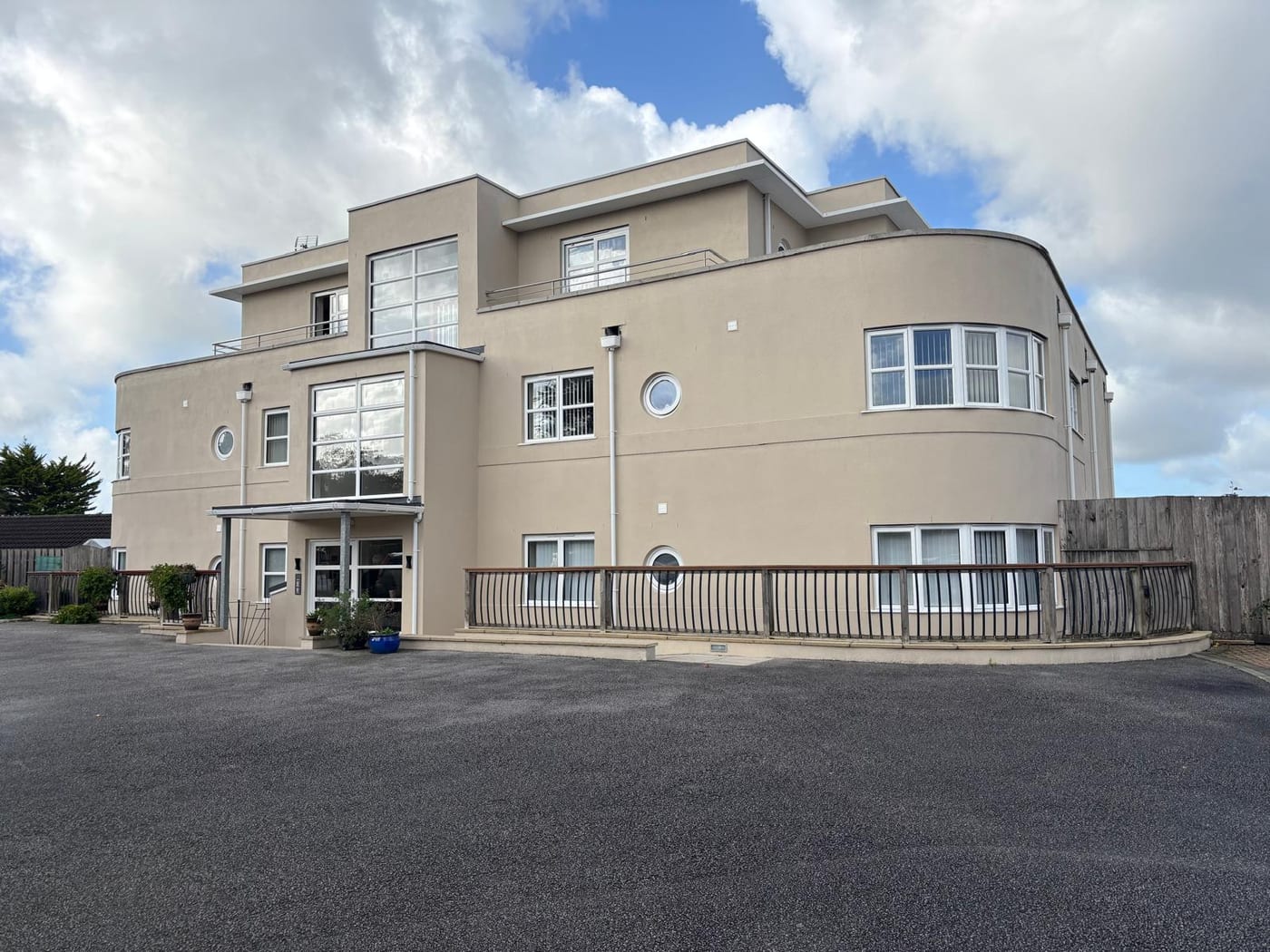
A 2011 Review Nearly Quadrupled the Conservation Area
One conservation area, first designated in 1973. Its first boundary change, in May 2011, took it from about six hectares to about 23, an increase of 380 per cent. It is now the third largest of North Devon's 41 conservation areas. Eight separate extensions were adopted in that review, including Silver Street north up to Maynes Orchard and a small extension for the Grade II listed Bowens. The council considered creating a separate conservation area for North Street but extended the existing one instead, because the character parallels were close. The council's appraisal counts 37 listed buildings inside the current boundary, one grade I and three grade II star, against 24 inside the pre-2011 boundary. Both a character appraisal and a management plan are published. For a block on the extended streets, the current boundary should be confirmed and consents obtained before windows, roofs or other external works are specified.
The council publishes a count for the conservation area, with a before and after table for the 2011 extensions. It records 37 listed buildings in the area: one Grade I, three Grade II* and 33 Grade II. The Grade II* count rose from two and the Grade II count from 21. Counting entries inside the built-up area gives 40, with the same grade profile. The Grade I is the Church of St Brannock, and the Grade II* entries are Broadgate, Church House and Town Farm. The council records no scheduled monuments inside the conservation area, the nearest being the Castle at Knowle 900 metres to the north. For a listed block, works to its fabric need listed building consent before they are specified.
No Square over Braunton Reaches Class 5 or 6
Of Braunton's nine one-kilometre squares, six are class 4, at 5 to 10 per cent of homes at or above the action level. The other three are class 2, at 1 to 3 per cent. No square reaches class 5 or 6. Braunton's highest square is below the lowest square in St Just, where every square exceeds 30 per cent. That reflects the Devonian sedimentary sequence here against the Penwith granite there. For a block in a class 4 square, radon measurement in ground-floor communal areas is still advisable.

A Made Neighbourhood Plan with 90.1 Per Cent Support
Planning decisions are made under the North Devon and Torridge Local Plan 2011 to 2031, jointly adopted by the two councils in 2018. The Braunton Parish Neighbourhood Plan was made on 4 October 2023, so there is a made town-level policy layer here. The referendum was held on 7 September 2023 with an electorate of 6,428. 1,156 ballot papers were issued, with no spoilt papers, giving a turnout of 17.9 per cent. The plan was carried by 1,042 votes to 114, which the council puts at 90.1 per cent in favour. The examiner was Andrew Ashcroft. There is no Article 4 direction at Braunton. North Devon publishes a full index of its 17 directions, covering places from Codden Hill and Combe Martin to Woolacombe and Yelland, and Braunton is not among them. For a block, any works needing permission are tested against both the local plan and the neighbourhood plan.
Service charge or accounts query? Email accounts@
Braunton Questions
What Does the Shoreline Management Plan Say About Braunton?
The two policy units naming Braunton are West Ashford to Braunton on the east bank of the Caen, and Braunton to Horsey Island on the west bank. Both are hold the line for the first epoch, managed realignment for the middle epoch, and hold the line again for the long term. Braunton Burrows and Saunton Down are no active intervention across all three epochs.
Is There an Article 4 Direction in Braunton?
No. North Devon publishes a full index of its Article 4 directions, covering places from Codden Hill and Combe Martin to Woolacombe and Yelland, and Braunton is not among them. Works are decided under the North Devon and Torridge Local Plan and the Braunton Parish Neighbourhood Plan made on 4 October 2023.
Is Radon as High in Braunton as Further West in Cornwall?
No. Of Braunton's nine one-kilometre squares, six are class 4, at 5 to 10 per cent of homes at or above the action level. The other three are class 2, at 1 to 3 per cent. None reaches class 5 or 6. Its highest square is below the lowest square in St Just, reflecting the Devonian sedimentary rock here rather than granite.
Nearby Areas
Talk to Us About Your Building in Braunton.
A free, no-obligation proposal, written so it can be circulated to a board.