
Block Management in Topsham
Exeter's oldest Article 4 direction sits on The Strand, outside the city's flood defence scheme.
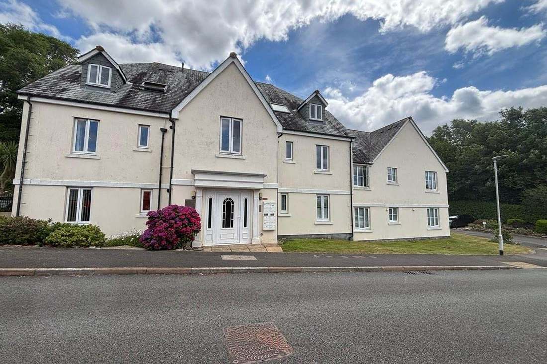
We would manage a Topsham block, estate or leasehold portfolio for its residents' management company, RTM company or freeholder. On The Strand, Article 4 direction A4D1 has removed permitted development rights since 23 April 1958, so alterations there need planning permission. The town is tidal, with a warning area naming Ferry Road and The Strand, and the Exeter flood defence scheme stops at Countess Wear without mentioning it.

What We Would Put First for a Block in Topsham
Seek Permission for Strand Alterations
Direction A4D1 has covered land at The Strand since 23 April 1958, removing rights to enlarge, improve or alter a dwellinghouse and to erect enclosures in its curtilage. For a block there we would secure planning permission before specifying works.
ConsentsPlan for Tidal Flooding Without a Scheme
The South Devon coast warning area at Topsham names Ferry Road and The Strand, and the Exeter flood defence scheme, from Cowley Bridge to Countess Wear, does not protect the town. We would register the block for warnings and review flood terms at each insurance renewal.
InsuranceWork from the 2009 Appraisal
Topsham's conservation area, Exeter reference CA20, was designated on 14 December 1967, with an appraisal and management plan of June 2009. We would check a block's position against it before specifying external repairs and running Section 20 consultation.
Major works and Section 20Managing a Block in Topsham at a Glance
- Local authority
- Exeter City Council
- Authority type
- District, under the county council
- Building control
- Exeter City Council Building Control
- County
- Devon
- Fire and rescue service
- Devon and Somerset Fire and Rescue Service
- Water and sewerage
- South West Water
- From our Plymouth office
- About 37 miles in a straight line
- Setting
- Tidal estuary (Exe)
What It Costs to Move a Block in Topsham to Us
Management is a fixed annual fee, quoted for the building and agreed before we start. We take no commission and no third-party incentives, so the fee is the whole of what we earn from the building. Taking a block on carries a one-off start-up fee, set by size:
| Block size | Fee |
|---|---|
| Start-up fee, up to 10 units | £420.00 |
| Start-up fee, up to 25 units | £540.00 |
| Start-up fee, 50 units and above | £660.00 |
Taken from our published Additional Services price list, PBM Form #01-27 rev.6, effective 23 June 2025. All fees quoted are inclusive of VAT. See the full price list and how a handover works.
The Strand Has Needed Permission Since 1958
Topsham has the oldest Article 4 direction in Exeter. Direction A4D1, covering land at The Strand, has been in force since 23 April 1958 with no end date. It removes permitted development rights for the enlargement, improvement or other alteration of a dwellinghouse. It also removes them for the erection or alteration of buildings or enclosures within its curtilage. A scheme on The Strand that would be permitted development anywhere else in Topsham needs planning permission. Exeter's separate 2023 direction on houses in multiple occupation, in force from 23 December 2024, does not reach Topsham: its boundary stops several kilometres short.
546 Households in Purpose-Built Flats Across the Ward
At the 2021 Census 546 of the 4,397 households in the Topsham ward were in purpose-built blocks of flats. A further 56 were in a converted or shared house, 37 in another converted building and 43 over commercial premises. Topsham is unparished, so these figures are for the ward. The ward also records 127 caravans or other mobile or temporary structures. Most flats here are in purpose-built blocks, and those over shops need cover that reflects the commercial unit below.

Tidal Risk, and the Exeter Scheme Stops at Countess Wear
Tidal. The Environment Agency's warning area for the South Devon coast at Topsham names low-lying parts of the town including Ferry Road and The Strand. The town also sits inside the South Devon estuaries alert area. The Exeter flood defence scheme does not protect it. That scheme runs from Cowley Bridge down to Bridge Road at Countess Wear and reduces risk to more than 3,000 homes and businesses. It was funded by 6 million pounds of government growth funding, with the city and county councils each contributing 3 million. Topsham is not mentioned in it. The city council also confirms there are no critical drainage areas anywhere in its administrative area. A block near the waterfront should be registered for warnings and have its flood terms reviewed at each renewal.
An Exeter Conservation Area Dating from 1967
One area, and it is one of Exeter's 20 rather than one of East Devon's 33. The city council's own published dataset gives the reference as CA20 and the designation date as 14 December 1967, with an appraisal and management plan of June 2009. The national planning register shows 2 March 1989 for the same area, but that is the council's data entry date rather than the designation. External repairs to a block inside the area should be specified against the 2009 appraisal before major works consultation.
Low Radon Readings Across the Topsham Ward
Low. UKHSA's 2016 data report records 410 homes measured in the Topsham ward with three at or above the action level, an arithmetic mean of 38 becquerels per cubic metre. Across the whole Exeter district only 36 of 5,300 results were at or above the action level. Radon is a minor compliance item for most blocks here.
Exeter's 2012 Core Strategy Applies, with No Neighbourhood Plan
Decided under the adopted Exeter Core Strategy of 2012 together with the Exeter Local Plan First Review of 2005, which run to 2026. The emerging Exeter Plan 2021 to 2041 is set to replace both. There is no neighbourhood plan for Topsham; the only one in the city is for St James. Consents for alterations to a block are judged against the city plans and, on The Strand, the direction there.
Service charge or accounts query? Email accounts@
Topsham Questions
Does Exeter's HMO Article 4 Direction Apply in Topsham?
No. Exeter's 2023 direction on houses in multiple occupation, in force from 23 December 2024, does not reach Topsham, as its boundary stops several kilometres short. The direction that does apply is A4D1 on The Strand, in force since 23 April 1958 with no end date, covering alterations to dwellinghouses and enclosures within their curtilage.
Is Radon a Concern for Blocks in Topsham?
It is low. UKHSA's 2016 data report records 410 homes measured in the Topsham ward, with three at or above the action level and an arithmetic mean of 38 becquerels per cubic metre. Across the whole Exeter district only 36 of 5,300 results were at or above the action level.
Is Topsham Protected by the Exeter Flood Defence Scheme?
No. The scheme runs from Cowley Bridge to Bridge Road at Countess Wear and reduces risk to more than 3,000 homes and businesses, but Topsham is not mentioned in it. The town's risk is tidal, covered by the South Devon coast warning area at Topsham and the South Devon estuaries alert.
Nearby Areas
Talk to Us About Your Building in Topsham.
A free, no-obligation proposal, written so it can be circulated to a board.