
Block Management in Perranporth
Perranporth has no conservation area, and most of its flood risk comes from its streams.
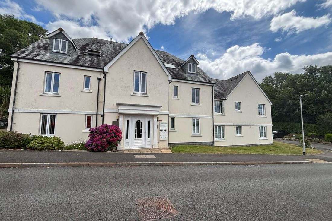
Perranporth is a flatted resort town, and we offer its residents' management companies, RTM companies and freeholders full block and leasehold management. One in four households here is in a flat or converted house, and all eight kilometre squares over the town are radon class 6. The open Atlantic area covers only 2.5 per cent of the town, so flood exposure comes mainly from the Perrancoombe and Bolingey streams.
What We Would Put First for a Block in Perranporth
Review Flood Cover on Named Streets
The Perrancoombe Stream warning area names Tywarnhayle Square, Beach Road, Beach Lane, Boscawen Road and Lower Perrancoombe, and the recorded floods of 2012 and 2014 in the town were sewage contaminated. For a block on those streets we would review flood cover at each placement and handle claims.
InsuranceRecommend Communal Radon Measurement
All eight kilometre squares over Perranporth are class 6, where measurement is advised. We would arrange radon measurement in ground floor communal areas and record the results in the compliance file for the board.
ComplianceCheck Listing Before Specifying Works
With no conservation area in the town and only six listed buildings, all Grade II, few blocks face a heritage consent layer. We would still check a block's status before specifying external works and running Section 20 consultation.
Major works and Section 20Managing a Block in Perranporth at a Glance
- Local authority
- Cornwall Council
- Authority type
- Unitary
- Building control
- Cornwall Council Building Control
- County
- Cornwall
- Fire and rescue service
- Cornwall Fire and Rescue Service
- Water and sewerage
- South West Water
- From our Plymouth office
- About 45 miles in a straight line
- Setting
- Coastal
What It Costs to Move a Block in Perranporth to Us
Management is a fixed annual fee, quoted for the building and agreed before we start. We take no commission and no third-party incentives, so the fee is the whole of what we earn from the building. Taking a block on carries a one-off start-up fee, set by size:
| Block size | Fee |
|---|---|
| Start-up fee, up to 10 units | £420.00 |
| Start-up fee, up to 25 units | £540.00 |
| Start-up fee, 50 units and above | £660.00 |
Taken from our published Additional Services price list, PBM Form #01-27 rev.6, effective 23 June 2025. All fees quoted are inclusive of VAT. See the full price list and how a handover works.
Stream Flooding Outweighs the Sea at Perranporth
Perranporth's flood risk is mainly fluvial. Three of the five Environment Agency areas containing the town are named for its own streams, and all three name streets. The Perrancoombe Stream area from Perrancoombe to Perranporth covers 4.8 per cent of the town and names Tywarnhayle Square, Beach Road, Beach Lane, Boscawen Road and Lower Perrancoombe. The Bolingey Stream area covers 6.3 per cent and names Nansmellyn Farm, the South West Water pumping station, the fire station and the electrical substation. A third covers the Perrancoombe from Rose In Vale, at 3.1 per cent. Above them the West Cornwall Rivers alert covers 15.2 per cent of the town. The coastal area from Chapel Porth to The Rumps names Perranporth directly but covers only 2.5 per cent. No defence scheme is published. On 24 November 2012 the Bolingey Stream overtopped its flood bank above the Station Road footbridge. Five properties flooded on St Piran's Road, gardens flooded on the Budnic Estate, and the flood water was sewage contaminated. On New Year's Day 2014 the Tywarnehayle Inn flooded through surcharging sewers beneath its floor, again sewage contaminated. The council recorded it as a repeat event that had happened twice in similar circumstances the previous year. For blocks on the named streets, flood cover should be reviewed at each insurance placement and drains kept on the inspection list.
A Flatted Resort Town Rather Than a Town of Terraces
At the 2021 Census 463 of the 2,713 households in the Perranporth division were flats, 17.1 per cent. Of these, 268 were purpose-built, 99 in a converted or shared house, 41 in another converted building and 55 over commercial premises. The census output areas inside the built-up area hold 1,246 households. Of these, 249 are in purpose-built blocks, 20.0 per cent, with a further 64 in a converted or shared house, 13 in another converted building and 46 over commercial premises. Taken together, one in four Perranporth households is in a flat or a converted or shared house, against about one in nine at Liskeard and Porthleven. The terraced share is 10.8 per cent. This is a flatted resort town rather than a town of terraces, and it carries the block management workload that implies.

Full Atlantic Exposure on the Open North Coast
Open coast, full Atlantic exposure. The Environment Agency places the town in its north Cornwall coast area running from Chapel Porth to The Rumps, an area defined in contrast to the tidal Camel estuary which it expressly excludes. That is materially different exposure from the creek at Penryn or the estuary at Padstow. Render, window frames, roof fixings and metalwork on exposed blocks weather faster, which should be reflected in inspection frequency and reserve fund planning.
The measurable part of marine exposure is corrosion. A high-salinity coastal atmosphere is category C5-M in the standards, where unprotected steel can lose 200 micrometres in a year. In practice that means the metalwork on a Perranporth block sets the inspection interval, and the reserve fund follows the inspections rather than a standard cycle.
No Conservation Area and Only Six Listed Buildings
Perranporth has no conservation area. None of the 145 conservation areas Cornwall Council holds is named for Perranporth or overlaps the town's boundary. The nearest are at Mithian about four kilometres away, Callestick and St Agnes. The only conservation area in the wider parish is at Callestick, a separate rural settlement. So there is no conservation area consent regime here, no appraisal, and none of the permitted development curtailment that conservation area status brings. For a block, that removes a whole layer of consent from external works, although listing should still be checked.
Six listed buildings stand in the whole of the built-up area and every one is Grade II. There is no Grade I and no Grade II* building of any kind. Padstow, with fewer households, has 132 entries, so Perranporth has roughly a twentieth of that listed stock. Few blocks here will be listed, but each block's status should still be checked before external works are specified.

Class 6 Radon, the Top Band, Across the Whole Town
All eight one-kilometre squares over the built-up area are class 6, the top band, covering 100 per cent of the town. The published wording is that maximum radon potential is greater than 30 per cent of homes at or above the action level, and the advice is that radon measurement is advised. Every block here should have radon measured in ground-floor flats and communal areas, with results kept on the compliance record.
Perranzabuloe Neighbourhood Plan Made in November 2024
Applications are decided under the Cornwall Local Plan and the Perranzabuloe Parish Neighbourhood Development Plan, made on 4 November 2024. The referendum on 3 October 2024 carried it by 596 votes to 83, 87.64 per cent in favour on a 13.3 per cent turnout. No Article 4 position is asserted, because Cornwall Council has published no Article 4 records to the national register. Before alterations to a block are specified, the council should be asked whether any direction applies.
Service charge or accounts query? Email accounts@
Perranporth Questions
Has Flooding in Perranporth Involved Sewage?
Yes. On 24 November 2012 the Bolingey Stream overtopped its flood bank above the Station Road footbridge, five properties flooded on St Piran's Road, and the water was sewage contaminated. On New Year's Day 2014 the Tywarnehayle Inn flooded through surcharging sewers beneath its floor, which the council recorded as a repeat event.
Is Any Part of Perranporth a Conservation Area?
No. None of Cornwall Council's 145 conservation areas overlaps the town or is named for Perranporth. The nearest are at Mithian, about four kilometres away, Callestick and St Agnes. So there is no conservation area consent regime, no appraisal and none of the permitted development curtailment that status brings.
Which Neighbourhood Plan Applies in Perranporth?
The Perranzabuloe Parish Neighbourhood Development Plan, made on 4 November 2024. It sits alongside the Cornwall Local Plan. Cornwall Council has published no Article 4 records to the national register, so no Article 4 position is asserted for the town.
Nearby Areas
Talk to Us About Your Building in Perranporth.
A free, no-obligation proposal, written so it can be circulated to a board.