
Block Management in Shaftesbury
No mapped river flood zone touches Shaftesbury, but surface water does.
Directors of residents' management companies and RTM companies in Shaftesbury, and freeholders there, can appoint us for block, estate and leasehold management. No mapped river flood zone touches the parish, yet overland flow paths form along Christy's Lane, St Georges Road, Fair Lane and Angel Lane in the 1 per cent event. Of 274 listed entries in the parish, 235 sit inside the conservation area.

What We Would Put First for a Block in Shaftesbury
Inspect Below-Ground Spaces Toward Enmore Green
The council's assessment flags potential groundwater flooding of property below ground level on the western edge toward Enmore Green. For a block with lower ground accommodation there we would schedule inspections and review the insurance cover.
InspectionsSurvey Ground Stability Before Major Works
The flood assessment flags potential for ground stability geohazards needing further investigation. Before specifying structural or drainage works on a block, we would commission the relevant survey as part of the Section 20 specification.
Major works and Section 20Record the Sewer Flooding History
Sewer flooding has been recorded on Bleke Street, Butts Knapp and Long Cross, all reported before 2014. For a block on those streets we would keep that history on file and use it when placing insurance and handling claims.
InsuranceCheck Radon by Individual Address
Squares under 1 per cent sit directly beside squares at 5 to 10 per cent, and the town centre is class 3, where measurement is advised. We would check the block's address and recommend communal measurement accordingly.
ComplianceManaging a Block in Shaftesbury at a Glance
- Local authority
- Dorset Council
- Authority type
- Unitary
- Building control
- Dorset Council Building Control
- County
- Dorset
- Fire and rescue service
- Dorset and Wiltshire Fire and Rescue Service
- Water and sewerage
- Wessex Water
- From our Plymouth office
- About 96 miles in a straight line
- Setting
- Inland
What It Costs to Move a Block in Shaftesbury to Us
Management is a fixed annual fee, quoted for the building and agreed before we start. We take no commission and no third-party incentives, so the fee is the whole of what we earn from the building. Taking a block on carries a one-off start-up fee, set by size:
| Block size | Fee |
|---|---|
| Start-up fee, up to 10 units | £420.00 |
| Start-up fee, up to 25 units | £540.00 |
| Start-up fee, 50 units and above | £660.00 |
Taken from our published Additional Services price list, PBM Form #01-27 rev.6, effective 23 June 2025. All fees quoted are inclusive of VAT. See the full price list and how a handover works.
No River Risk, but Surface Water and Groundwater Remain
No Environment Agency warning area or alert area names Shaftesbury. Of the eight areas within five kilometres, none names the town, and most belong to Gillingham. No Environment Agency flood risk zone intersects the parish, so there is no mapped Flood Zone 2 or Flood Zone 3 anywhere in it. The council's own assessment explains why. In Shaftesbury and Stalbridge the fluvial flood risk is low and is not expected to increase significantly due to climate change, as both are on high ground away from watercourses. Tidal risk is described as negligible. Surface water and groundwater remain, and those are real. In the 1 per cent event, overland flow paths develop along dry valleys and roads such as Christy's Lane, St Georges Road, Fair Lane and Angel Lane. Ponding occurs near Indus Road in the extreme event. There is potential for groundwater flooding of property situated below ground level and at the surface on the western edge toward Enmore Green. Several instances of sewer flooding have been recorded on Bleke Street, Butts Knapp and Long Cross, all reported before 2014. Four flood events are recorded between 1979 and 1994, one of them in 1990 caused by inadequate drainage. The assessment also flags potential for ground stability geohazards needing further investigation. It notes that development over a hectare in Flood Zone 1 still requires a site specific flood risk assessment. For a block here there is no river risk, but a postcode flood check will not show the surface water, groundwater and stability picture. Drainage, lower ground accommodation and insurance disclosures should be based on the council's assessment instead.
Purpose-Built Blocks Hold 540 of 698 Flats
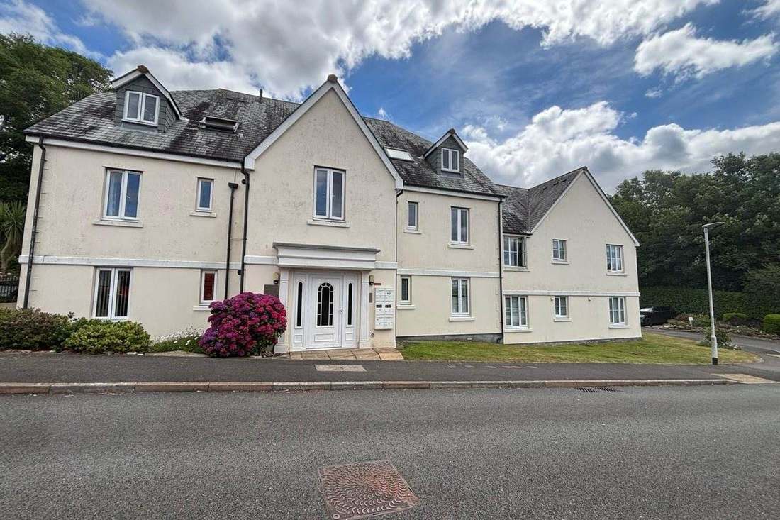
The Shaftesbury Town ward held 4,135 households at the 2021 Census with 698 in flats, 16.9 per cent. These were made up of 540 in purpose-built blocks, 65 in a converted or shared house, 41 in another converted building and 52 over commercial premises. Most flats are in purpose-built blocks, while those over shops need cover that reflects the commercial occupier below and clear cost apportionment.
235 Listed Entries Inside One Conservation Area
One conservation area, and both official sources agree on its date. The council's list gives the designation as 1 August 1970, and the national register records the same date for the principal part. The register maps two further parts, both dated 2 March 1979, which are extensions the council's own list does not date separately. There is no published conservation area appraisal. The council's appraisals for the former North Dorset area cover other places entirely, and it directs enquiries to the Dorset Historic Towns Survey. Without an appraisal, consent for external works on a block in the area is best discussed with the council before a major works specification is fixed.
274 entries on the National Heritage List fall inside the parish, two Grade I and four Grade II*, of which 235 sit inside the conservation area. The two Grade I are Park Wall and the remains of Shaftesbury Abbey. The four Grade II* are Ox House, the Grosvenor Arms Hotel, Pensbury House and the Church of St Peter. The council publishes no count, so these figures come from Historic England's open data. A block in a listed building needs listed building consent for works affecting its character, which should be built into any major works timetable.
Radon Jumps from the Lowest Band Straight to Class 4
A sharp step rather than a gradient. The town centre returns class 3, a maximum radon potential of 3 to 5 per cent of homes at or above the action level, and radon measurement is advised. Across the surrounding squares the classes that appear are the lowest band, class 3 and class 4 at 5 to 10 per cent, with class 2 skipped entirely. Squares at under 1 per cent therefore sit directly alongside squares at 5 to 10 per cent. A block's own address should be checked, with ground floor flats and basements measured where advised.
A Neighbourhood Plan Review Made in July 2026
Decided under the North Dorset Local Plan Part 1, adopted 15 January 2016, with saved policies from the 2003 district-wide plan. The original Shaftesbury Neighbourhood Plan for 2019 to 2031 was made on 22 June 2021, following a referendum on 6 May 2021. In that vote 1,556 voted yes and 216 no, with 56 rejected papers, on a turnout of 26.9 per cent from an electorate of 6,857. The first review was then made by Dorset Council's cabinet on 28 July 2026, after an examiner's report on 29 May 2026 concluded that a referendum was not required. There is no Article 4 direction anywhere in the town. Consents for alterations to a block are tested against the local plan and the reviewed neighbourhood plan together.
Service charge or accounts query? Email accounts@
Shaftesbury Questions
Will a Postcode Flood Check Show Our Shaftesbury Block's Real Risk?
Probably not. There is no Flood Zone 2 or 3 anywhere in the parish, so a postcode check will look clear. The council's assessment still records overland flow along Christy's Lane, St Georges Road, Fair Lane and Angel Lane in the 1 per cent event. It also records ponding near Indus Road in the extreme event, and groundwater potential toward Enmore Green.
Which Neighbourhood Plan Applies in Shaftesbury?
The Shaftesbury Neighbourhood Plan for 2019 to 2031, made on 22 June 2021 after a referendum in which 1,556 voted yes and 216 no. Its first review was made by Dorset Council's cabinet on 28 July 2026, after an examiner concluded on 29 May 2026 that a referendum was not required. There is no Article 4 direction in the town.
Is There a Conservation Area Appraisal for Shaftesbury?
No. The conservation area was designated on 1 August 1970, with two further parts dated 2 March 1979, but no appraisal is published. The council's appraisals for the former North Dorset area cover other places, and it directs enquiries to the Dorset Historic Towns Survey. Of the parish's 274 listed entries, 235 sit inside the conservation area.
Nearby Areas
Talk to Us About Your Building in Shaftesbury.
A free, no-obligation proposal, written so it can be circulated to a board.