
Block Management in Tewkesbury
Five Environment Agency flood areas meet where the Severn joins the Avon.
Fixed fees and no commission apply to the block and leasehold management we provide in Tewkesbury for RMCs, RTM companies and freeholders. The River Severn at Tewkesbury warning area alone covers 27.09 per cent of the built-up area, and the recorded Severn defences have a stated standard of one year in one. Of 367 listed entries, 42 are Grade II*.
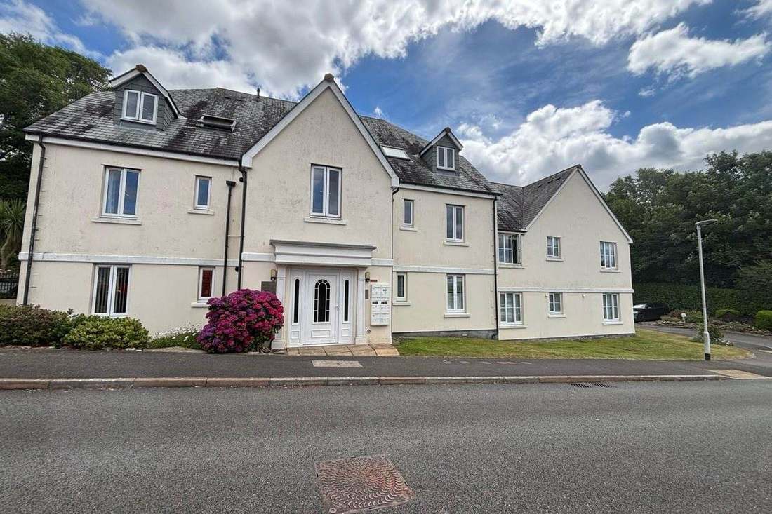
What We Would Put First for a Block in Tewkesbury
Lead Insurance Placement with Flood History
The River Severn at Tewkesbury warning area covers 27.09 per cent of the town, and in 2007 the centre was completely cut off from vehicles. We would put flood history at the front of insurance placement and prepare for claims handling.
InsurancePlan Reserves Without Relying on Defences
The Severn embankment and walls have a stated standard of protection of one year in one, and the Abbey Mill structures serve navigation. For a riverside block we would plan the reserve fund without counting on engineered flood protection.
Reserve fundsAsk Which Article 4 Boundary Applies
The direction covers 7.01 per cent of the town against a conservation area covering 16.22 per cent, and its schedule is unpublished. We would ask Tewkesbury Borough Council before specifying external works to a block in the historic core.
ConsentsAllow for Grade II* Fabric in Major Works
Of 367 listed entries, 42 are Grade II*, and nearly every building lining the three main streets is listed. We would allow for listed building consent and suitable contractor procurement in any Section 20 consultation.
Major works and Section 20Managing a Block in Tewkesbury at a Glance
- Local authority
- Tewkesbury Borough Council
- Authority type
- District, under the county council
- Building control
- Cheltenham and Tewkesbury Building Control, shared with Cheltenham Borough Council
- County
- Gloucestershire
- Fire and rescue service
- Gloucestershire Fire and Rescue Service
- Water and sewerage
- Severn Trent Water
- From our Plymouth office
- About 141 miles in a straight line
- Setting
- Inland
What It Costs to Move a Block in Tewkesbury to Us
Management is a fixed annual fee, quoted for the building and agreed before we start. We take no commission and no third-party incentives, so the fee is the whole of what we earn from the building. Taking a block on carries a one-off start-up fee, set by size:
| Block size | Fee |
|---|---|
| Start-up fee, up to 10 units | £420.00 |
| Start-up fee, up to 25 units | £540.00 |
| Start-up fee, 50 units and above | £660.00 |
Taken from our published Additional Services price list, PBM Form #01-27 rev.6, effective 23 June 2025. All fees quoted are inclusive of VAT. See the full price list and how a handover works.
Five Flood Areas Meet at the Severn and Avon
Tewkesbury sits at the confluence of the Severn and the Avon and is named in five separate Environment Agency areas. The River Severn at Tewkesbury warning area covers 27.09 per cent of the built-up area. The Cheltenham and Tewkesbury tributaries alert covers 26.69 per cent and the River Severn in Gloucestershire alert 18.93 per cent. The Severn Ham warning area covers 2.39 per cent, naming Abbey Mill, Upper and Lower Lode and Shakespeare Court. The River Avon in Worcestershire alert covers 1.11 per cent. The council documents the 2007 benchmark precisely. River levels at the Mythe gauge reached a peak of 5.43 metres on 22 July. The previous record was 5.3 metres in March 1947, and normal summer levels are around half a metre. The flood on the Severn between Upton and Gloucester was assessed as having between a 0.66 and 0.5 per cent probability of occurring in any year. An estimated 810 properties were affected, in a council account written for the borough rather than the town. Properties flooded first from surface water and smaller watercourses including the Carrant and Tirle Brooks, and then from the main rivers, some twice. The centre of the town was completely cut off from vehicles. Separately the Mythe water treatment works flooded on 22 July, leaving over 350,000 people without clean water for up to seventeen days. Recorded flood outlines run 1939, 1947, 1968, 1981, 1985, 1990, 1998, 2000 and 2007. The assets recorded at the town are two structures on the Avon at Abbey Mill and Stanchard Pit that the record states are for navigation purposes. There is also a 5.9 kilometre run of embankment, wall, high ground and raised road on the Severn whose stated standard of protection is one year in one. None of them should be presented as protecting the town. No named flood alleviation scheme for Tewkesbury with a date and a cost is published on any official source. A block here should lead its insurance placement with this flood history and plan reserves without relying on defences.
Tewkesbury South Is 28.5 Per Cent Flats
Across the 50 census output areas covering the built-up area, the town holds 6,472 households with 1,207 in flats, 18.6 per cent. These are made up of 986 in purpose-built blocks, 57 in a converted or shared house, 72 in another converted building and 92 over commercial premises. The internal contrast is stark. Tewkesbury South has 28.5 per cent of its households in flats and Tewkesbury North and Twyning 19.1 per cent. Tewkesbury East, which delivers nearly half the built-up area, has just 67 flatted households, 3.1 per cent. Tewkesbury North and Twyning is also far larger than the town, with only 4.2 per cent of its area inside it. Most flats here are in purpose-built blocks, so reserve fund plans can follow each block's own roof, fabric and services.

Nearly Every Building on the Main Streets Is Listed
One conservation area covering 16.22 per cent of the built-up area, and its history needs both dates. The council's own appraisal records that it was designated by Gloucestershire County Council on 29 December 1969. It was amended by the borough council on 6 October 1987, with an Article 4 direction confirmed on 28 October 1987. The national register carries only the 1987 amendment, so 1969 is the origin and the later date is not the designation. The appraisal was adopted on 23 February 2012, updating a 2005 study with surveys carried out in 2010. It covers most of the historic core together with a substantial area of water meadow between the Severn and the Mill Avon known as The Ham. External works to a block inside the area should be specified against the 2012 appraisal.
367 entries on the National Heritage List fall inside the built-up area, seven Grade I, 42 Grade II* and 317 Grade II. That is a Grade II* share of 11.4 per cent. The council's appraisal says nearly every building lining the three main streets is listed, and although many are Grade II there are a significant number at Grade II*. Three scheduled monuments sit inside the town: the ground around the abbey, the site of Holm Castle and Queen Margaret's Camp. A major works programme for a listed block here should allow time for listed building consent and contractors used to historic fabric.
Severn Vale Clay Keeps Radon at Class 2
Low, and the geology explains it: this is Severn vale alluvium and Lias clay rather than limestone. Class 2 covers 99.4 per cent of the built-up area at 1 to 3 per cent of homes at or above the action level. A single class 3 square accounts for the remaining 0.6 per cent. Radon is a minor item for most blocks here, though ground floor flats on that one square should be checked.
Article 4 Covers 7 Per Cent, the Conservation Area 16
An Article 4 direction covers 7.01 per cent of the built-up area. Its date is recorded differently in two places, and the council's own document should be preferred. The appraisal states it was confirmed on 28 October 1987, while the national register gives 1 June 1988. What it removes and which streets it covers are not published. The council's copy is a five page scan, and the schedule appears nowhere else. The 2012 appraisal lists as outstanding work the extension of the Article 4 boundary to reflect the revised conservation area boundary and amendment of its provisions. That fits the direction covering 7 per cent of the town against a conservation area covering 16 per cent. So a building can sit inside the conservation area and outside the direction. Before external works to a block in the historic core, the council has to be asked which applies.
No Made Neighbourhood Plan Covers the Town
Two adopted documents apply. The first is the Joint Core Strategy for Gloucester, Cheltenham and Tewkesbury, adopted by all three councils in December 2017. The second is the Tewkesbury Borough Plan 2011 to 2031, adopted on 8 June 2022 at a special meeting of the council. A replacement strategic and local plan shared with Cheltenham and Gloucester is in preparation with no dated milestone published. There is no made neighbourhood plan for the town. Ten plans have been made across the borough, at Alderton, Churchdown and Innsworth, Twyning, Winchcombe and Sudeley and elsewhere, but Tewkesbury town is not among them. The council records that no plan is currently at publication consultation or at referendum anywhere in the borough. Tewkesbury is not in a National Landscape at all, and the nearest Cotswolds boundary is 3.03 kilometres away. Consents for alterations to a block are judged against these two plans, with no neighbourhood plan to add.
Service charge or accounts query? Email accounts@
Tewkesbury Questions
How High Did the Severn Get at Tewkesbury in 2007?
River levels at the Mythe gauge peaked at 5.43 metres on 22 July 2007, against a previous record of 5.3 metres in March 1947 and normal summer levels of around half a metre. The council's borough-level account estimates 810 properties were affected, flooding first from surface water and smaller watercourses including the Carrant and Tirle Brooks, then from the main rivers, some twice.
Is Tewkesbury in the Cotswolds National Landscape?
No. The built-up area has zero overlap with any National Landscape, and the nearest Cotswolds boundary is 3.03 kilometres away. Decisions are made under the Joint Core Strategy for Gloucester, Cheltenham and Tewkesbury, adopted in December 2017, and the Tewkesbury Borough Plan 2011 to 2031, adopted on 8 June 2022.
When Was the Tewkesbury Conservation Area Designated?
The council's appraisal records designation by Gloucestershire County Council on 29 December 1969, amended by the borough council on 6 October 1987. The national register carries only the 1987 amendment. The appraisal was adopted on 23 February 2012, and the area covers most of the historic core plus The Ham, the water meadow between the Severn and the Mill Avon.
Nearby Areas
Talk to Us About Your Building in Tewkesbury.
A free, no-obligation proposal, written so it can be circulated to a board.