
Block Management in Cirencester
Roman Corinium covers 6.07 per cent of the town, so groundworks meet a separate consent regime.
In Cirencester, our service covers block, estate and leasehold management for residents' management companies, RTM companies and freeholders. Six scheduled monuments lie inside the town, which matters for any drainage run, underpinning or lift pit. The council's flood assessment puts 253 properties, grouped with Siddington, at significant risk, and the Daglingworth Stream runs in culvert beneath Spital Gate Lane, Hereward Road and the Abbey grounds.
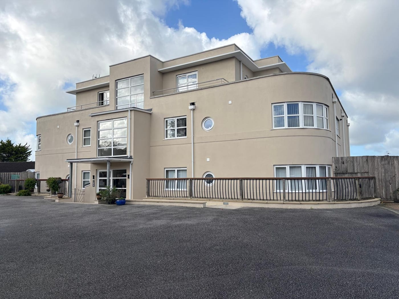
What We Would Put First for a Block in Cirencester
Clear Scheduled Monument Consent Before Groundworks
Six scheduled monuments lie inside Cirencester and the Corinium designation covers 6.07 per cent of the town, a regime with no equivalent of permitted development. For drainage runs, underpinning or a lift pit we would establish the consent position before specifying and tendering the work.
ConsentsCheck Drainage Where the Sewers Surcharge
The council records that the surface water sewer network is prone to surcharging when river levels are high, which affected the Spitalgate and Trafalgar Road area. For a block there we would include gullies and drains in the inspection schedule and set the insurance and reserve position accordingly.
InspectionsRecord the Cirencester Park Lake Route
The flood assessment identifies a breach risk from the 1736 lake at Cirencester Park, with water following Sheep Street, Querns Lane, Trinity Road and Watermoor Road. For a block on that route we would record it in the risk file and raise it at insurance placement.
InsuranceArrange Radon Measurement at Ground Level
Class 3 covers 63.5 per cent of the town at 3 to 5 per cent of homes at or above the action level, and measurement is advised across almost all of Cirencester. We would arrange measurement in ground-floor communal areas and log the result.
ComplianceManaging a Block in Cirencester at a Glance
- Local authority
- Cotswold District Council
- Authority type
- District, under the county council
- Building control
- Cotswold District Council Building Control
- County
- Gloucestershire
- Fire and rescue service
- Gloucestershire Fire and Rescue Service
- Water and sewerage
- Thames Water
- From our Plymouth office
- About 133 miles in a straight line
- Setting
- Inland
What It Costs to Move a Block in Cirencester to Us
Management is a fixed annual fee, quoted for the building and agreed before we start. We take no commission and no third-party incentives, so the fee is the whole of what we earn from the building. Taking a block on carries a one-off start-up fee, set by size:
| Block size | Fee |
|---|---|
| Start-up fee, up to 10 units | £420.00 |
| Start-up fee, up to 25 units | £540.00 |
| Start-up fee, 50 units and above | £660.00 |
Taken from our published Additional Services price list, PBM Form #01-27 rev.6, effective 23 June 2025. All fees quoted are inclusive of VAT. See the full price list and how a handover works.
Six Scheduled Monuments Make Groundworks a Separate Consent Question
Four conservation areas, all designated on the same day, 25 November 2008: Cirencester South, Cirencester Town Centre, Gloucester Street and River Walk, and Cirencester Park. All four have appraisals, though none carries a printed adoption date. They replaced an older and messier arrangement of four separate designations. The appraisal records that the first conservation area in the town was designated in January 1968, less than a year after the Civic Amenities Act introduced the mechanism. The council's own page shows which area a block falls in, and that area's appraisal is the document a specification for external works should follow.
326 entries on the National Heritage List fall inside the built-up area, three Grade I, 27 Grade II* and 296 Grade II. Scheduling is the bigger constraint. Six scheduled monuments lie inside the built-up area, and the Corinium Roman town designation alone covers 6.07 per cent of the entire town. Archaeology of that extent is a live constraint on anything involving groundworks, drainage runs, underpinning or a new lift pit. It is a separate consent regime from listed building consent, with no equivalent of permitted development.
Watermoor and St Michael's Hold Most of the Flats
The town holds 8,266 households with 2,096 in flats, 25.4 per cent. Of these, 1,748 were in purpose-built blocks, 150 in a converted or shared house, 113 in another converted building and 85 over commercial premises. That figure covers the 64 census output areas in the built-up area, as no single ward describes the town and nine wards contribute to it. Two are genuine town wards and hold most of the flats: Watermoor with 44.2 per cent of its households in flats and St Michael's with 40.9 per cent. Two others do not describe the town at all: Siddington and Cerney Rural has just 1.2 per cent of its area in the town and Stratton 0.1 per cent. Abbey ward is misleading, delivering more than a fifth of the town while only 9.2 per cent of the ward lies inside it. Most flats here are in purpose-built blocks, where communal plant and major works planning drive the budget.

A Culverted Stream and a 1736 Lake Shape the Flood Picture
Fluvial on the River Churn, with the Daglingworth Stream and the Gumstool Brook. Two Environment Agency areas cover the town and they are almost coextensive. The Churn catchment alert covers 9.41 per cent of the built-up area. The warning area for the Churn from Baunton to Siddington, which explicitly includes the Daglingworth Stream and the Gumstool Brook in Cirencester only, covers 9.40 per cent. The council's own strategic assessment puts 253 Cirencester properties at significant risk, the highest figure in the district, though it footnotes that this is grouped with Siddington. Three schemes are recorded without costs. The damaged Kingsmeadow culvert was rehabilitated in 2012, and local improvements from the River Churn flood risk management strategy followed in 2013. At Watermoor specifically, a flood wall, kerbs and embankments were built to protect properties from the Daglingworth Stream, also in 2013. Two features matter in particular. The first is culverting: the Daglingworth Stream runs 354 metres in culvert at Spital Gate Lane and Hereward Road and 575 metres under the Abbey grounds. The council records that the surface water sewer network is prone to surcharging when river levels are high, which affected the Spitalgate and Trafalgar Road area. The second is the reservoir. The assessment identifies a risk to the town from breach or failure of the lake at Cirencester Park, built in 1736 and holding 38,326 cubic metres. Flood water would flow south east through the town, affecting the A419 and roughly following Sheep Street, Querns Lane, Trinity Road and Watermoor Road. In the summer of 2007 the Churn flooded parts of the town. For a block on one of these routes, gullies and drains belong on the inspection schedule and the risk belongs in the insurance disclosure.
Moderate Radon on the Dip Slope, Measurement Still Advised
Moderate, as Cirencester sits on the dip slope. Across the sixteen one-kilometre squares over the built-up area, class 3 covers 63.5 per cent of the town at 3 to 5 per cent of homes at or above the action level. Class 2 covers 36.4 per cent at 1 to 3 per cent, with a sliver of lowest-band ground. The published advice across almost the whole town is that radon measurement is advised. No square reaches the higher bands found a few miles west around Stroud and Minchinhampton. For a block, measurement in ground-floor communal areas is the sensible step.

No Article 4 and No Made Neighbourhood Plan Yet
Decided under the Cotswold District Local Plan 2011 to 2031, adopted 3 August 2018, with a new plan for 2026 to 2043 in preparation. There is no made neighbourhood plan. The draft reached its publication consultation stage between 16 April and 29 May 2026 and no referendum has been held. There is no Article 4 direction. The council's own list names eighteen places from Avening and Bibury through to Tetbury and Weston Subedge, but not Cirencester. Only 11.13 per cent of the built-up area lies inside the Cotswolds National Landscape and the town centre falls outside it. Despite sitting in the middle of the Cotswolds, Cirencester is largely excluded from the designation itself. For most blocks, external works are judged against the Local Plan and any conservation area appraisal.
Service charge or accounts query? Email accounts@
Cirencester Questions
Is Cirencester Covered by Any Article 4 Direction?
No. There is no Article 4 direction in Cirencester. Cotswold District Council's own list names eighteen places from Avening and Bibury to Tetbury and Weston Subedge, but not Cirencester. Only 11.13 per cent of the built-up area lies inside the Cotswolds National Landscape, and the town centre falls outside it.
Which Conservation Area Appraisal Applies to Our Block?
Cirencester has four conservation areas, all designated on 25 November 2008: Cirencester South, Cirencester Town Centre, Gloucester Street and River Walk, and Cirencester Park. Each has an appraisal. The council's own page shows which area a block falls in, and we would work from that area's appraisal.
Has the Churn Flooded the Town Before?
Yes. In the summer of 2007 the Churn flooded parts of the town. Recorded works since include rehabilitation of the damaged Kingsmeadow culvert in 2012 and, at Watermoor, a flood wall, kerbs and embankments against the Daglingworth Stream in 2013. The Environment Agency warning area for the Churn from Baunton to Siddington covers 9.40 per cent of the built-up area.
Nearby Areas
Talk to Us About Your Building in Cirencester.
A free, no-obligation proposal, written so it can be circulated to a board.