
Block Management in Salcombe
Every square over the town is radon class 6, beside a high-salinity ria.
For Salcombe blocks we handle the whole management role for RMCs, RTM companies and freeholders, from the service charge budget to Section 20 works. Every kilometre square over the built-up town is radon class 6, the highest band, where measurement is advised. The estuary is a ria with high salinity and little freshwater input, and low-lying parts of the town fall within a tidal warning area with no completed defence scheme.
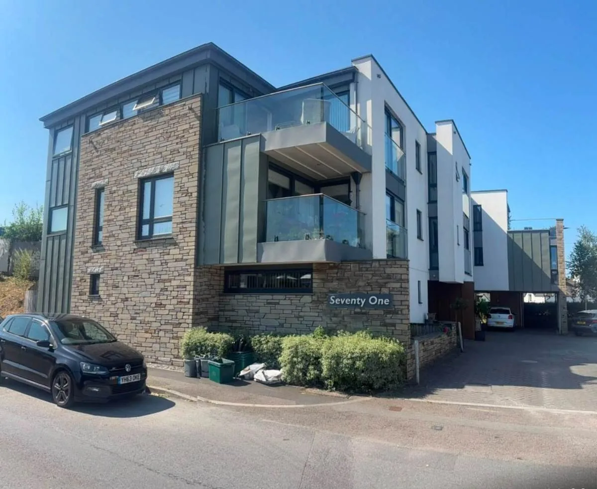
What We Would Put First for a Block in Salcombe
Measure Radon in Every Block
Every square over the built-up town, including Fore Street, Island Street, Bonaventure Road and Batson, is class 6, where the maximum potential is over 30 per cent of homes above the action level. We would recommend radon measurement in the communal areas of every block.
ComplianceInspect Metalwork Exposed to the Ria
The estuary has very little freshwater input and high salinity, and the flood warning water body is the English Channel. For a waterside block we would schedule inspections of railings, balustrades and fixings for corrosion and budget for replacement.
InspectionsPlan for Tidal Flooding Without a Barrier
Flood barriers at Whitestrand are a neighbourhood plan aspiration supported by 53 per cent, not a programme. For blocks in low-lying parts of Salcombe or Lower Batson we would give insurers an accurate flood position and handle claims.
InsuranceCheck Principal Residence Restrictions
Policy SALC H3 ties new open market housing to principal residence by condition or section 106 agreement. Where a block includes such homes, we would check the restriction when handling subletting and other lease consents.
Leasehold managementManaging a Block in Salcombe at a Glance
- Local authority
- South Hams District Council
- Authority type
- District, under the county council
- Building control
- South Hams District Council Building Control
- County
- Devon
- Fire and rescue service
- Devon and Somerset Fire and Rescue Service
- Water and sewerage
- South West Water
- From our Plymouth office
- About 18 miles in a straight line
- Setting
- Coastal
What It Costs to Move a Block in Salcombe to Us
Management is a fixed annual fee, quoted for the building and agreed before we start. We take no commission and no third-party incentives, so the fee is the whole of what we earn from the building. Taking a block on carries a one-off start-up fee, set by size:
| Block size | Fee |
|---|---|
| Start-up fee, up to 10 units | £420.00 |
| Start-up fee, up to 25 units | £540.00 |
| Start-up fee, 50 units and above | £660.00 |
Taken from our published Additional Services price list, PBM Form #01-27 rev.6, effective 23 June 2025. All fees quoted are inclusive of VAT. See the full price list and how a handover works.
Every Square over the Town Is Radon Class 6
Class 6 of 6, the highest band, where the maximum radon potential is greater than 30 per cent of homes above the action level and measurement is advised. Every kilometre square covering the built-up town is class 6, including Fore Street, Island Street, Bonaventure Road and Batson. Every block here should have radon measured in communal areas and ground-floor flats, with results kept on the compliance record.
41 Per Cent of Ward Flats Are Not Purpose-Built
The published ward is Salcombe and Thurlestone, so the figures reach beyond the town itself. Across it 274 of 2,349 households were flats at the 2021 Census, 11.7 per cent, of which 163 were purpose-built. The striking figure is the remainder: 41 per cent of the ward's flats are not purpose-built, being 61 in a converted or shared house, 31 in another converted building and 19 over commercial premises. Converted buildings need clear lease boundaries for repairs, insurance and shared services.

A Ria with Marine Rather Than Estuarine Salinity
Salcombe is genuinely marine rather than estuarine in the usual sense. Its own made neighbourhood plan records that the estuary is a nationally important example of a ria, having very little freshwater input, high salinity levels and a large tidal range. It adds that many truly marine plants and animals are found there which seldom occur intertidally in estuaries elsewhere. The Environment Agency lists the water body for the town's flood warning area as the English Channel and the South Devon coast. North and South Sands sit under the alert area for exposed coastal areas from Plymouth to Start Point. On waterside blocks, railings, balustrades and fixings corrode faster and need regular inspection and a budget for replacement.
Standards classify a high-salinity coastal atmosphere as C5-M, very high marine, in which unprotected steel loses more than 80 micrometres of thickness in its first year against as little as 1.3 inland. Balustrades, railings, fixings and walkway structures are what that costs a Salcombe block, so we survey them on a shorter interval and fund the reserve fund from what the surveys find.
Tidal Flooding with No Completed Defence Scheme
Salcombe's flood risk is tidal rather than fluvial. The warning area for the South Devon coast at the Kingsbridge and Avon estuaries covers low-lying parts of Kingsbridge, Salcombe, Frogmore, Southpool and Lower Batson. The seaward beaches fall under a separate area running from Bigbury Bay to Start Point that names North Sands and South Sands. There is no completed defence scheme. Flood barriers at Whitestrand appear in the neighbourhood plan as a community priority supported by 53 per cent, which is an aspiration and not a programme. The conservation area appraisal records surviving flood boards at Custom House, Clifton Place and Folly Lane, the older answer to the same problem. Blocks in the low-lying parts need an accurate flood position given to insurers at each placement.

Three Grade II Star Buildings in the Salcombe Area
Salcombe parish has two conservation areas, both designated by the county council on 14 September 1973. The Salcombe area was partly extended and partly deleted in 1985 and extended again in July 1989. Its boundary was amended once more when the appraisal was adopted in February 2010. The Batson area was designated the same day and reduced and extended in 1985, and has no published appraisal. The council's appraisal names The Grange, Holy Trinity Church and the Old Porch House of 1660 as grade II star and records that the remainder are grade II. For a block in the Salcombe area the appraisal is the reference for consents; in Batson, with no appraisal, early discussion with the council helps.
Policy SALC H3 Ties New Homes to Principal Residence
Applications are decided under the Plymouth and South West Devon Joint Local Plan 2014 to 2034, adopted by South Hams on 21 March 2019. The Salcombe Neighbourhood Plan carried a referendum on 25 July 2019 by 430 votes to 32, 93.07 per cent in favour on a 33.4 per cent turnout, and was made on 19 September 2019. Its policy SALC H3 is the one to know about. New open market housing other than replacement dwellings will only be supported where a condition or a section 106 agreement ties occupancy to principal residence. New unrestricted market homes will not be supported at any time. The council currently lists the plan as having modifications under examination. Where a block contains homes under that restriction, it bears on subletting and other lease consents.
Service charge or accounts query? Email accounts@
Salcombe Questions
Do the Old Flood Boards Still Matter in Salcombe?
The conservation area appraisal records surviving flood boards at Custom House, Clifton Place and Folly Lane, the older answer to tidal flooding. The Kingsbridge and Avon estuaries warning area covers low-lying parts of Salcombe and Lower Batson, and North Sands and South Sands fall under a separate Bigbury Bay to Start Point area. No defence scheme has been completed.
Is the Salcombe Neighbourhood Plan in Force?
It was made on 19 September 2019 after a referendum on 25 July 2019 carried by 430 votes to 32, 93.07 per cent in favour on a 33.4 per cent turnout. The council currently lists the plan as having modifications under examination. Decisions are taken under the Plymouth and South West Devon Joint Local Plan 2014 to 2034.
Is Batson a Separate Conservation Area?
Yes. Batson was designated by the county council on 14 September 1973, the same day as the Salcombe area, and was reduced and extended in 1985. Unlike the Salcombe area, whose appraisal was adopted in February 2010 with an amended boundary, Batson has no published appraisal.
Nearby Areas
Talk to Us About Your Building in Salcombe.
A free, no-obligation proposal, written so it can be circulated to a board.