
Block Management in Wotton-under-Edge
A building-by-building Article 4 schedule in a town wholly within the Cotswolds National Landscape
Our service in Wotton-under-Edge spans block, estate and leasehold management for residents' management companies, RTM companies and freeholders. The 1993 Article 4 direction works building by building, removing rights for roof alterations, porches and other external changes, so each address has to be checked against the published schedule. Radon measurement is advised in every square over the town, and the town has 190 listed entries.
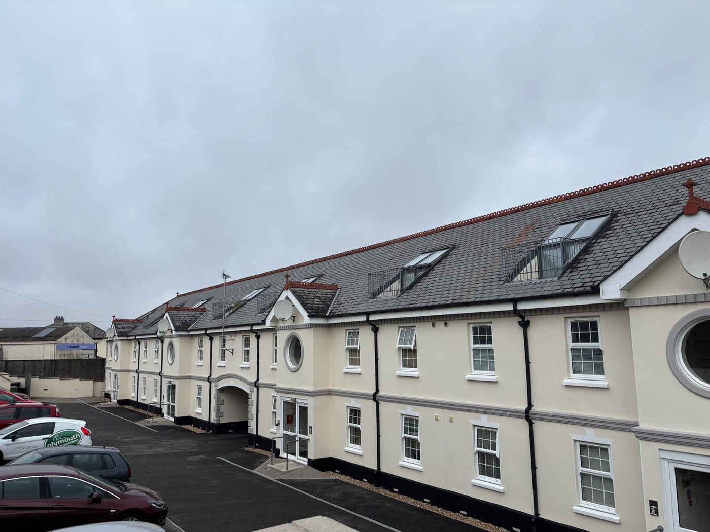
What We Would Put First for a Block in Wotton-under-Edge
Check the Address Against the Schedule
The 1993 direction names buildings on streets including Long Street, Church Street, The Chipping and Haw Street, and removes rights for roof alterations, porches and other external changes. We would check the schedule and obtain any consent before specifying roof works.
Major works and Section 20Measure Radon Throughout
Three squares are class 5, covering about 86 per cent of Wotton, and the other two class 4. Measurement is advised in every square, so we would arrange it in communal areas and keep the results on the compliance record.
ComplianceAssume Conservation Area Control Until Checked
The conservation area covers 15.63 per cent of the built-up area, with a statement adopted in November 1999. For a central block we would confirm status before any external works and budget for consent in the reserve fund.
Reserve fundsReview Flats over Shops and Conversions
Of 359 flats in the town, 54 are over commercial premises and 50 in converted or shared houses. For a mixed-use or converted block we would commission a fire risk assessment and keep its findings on the compliance record.
Fire risk assessmentsManaging a Block in Wotton-under-Edge at a Glance
- Local authority
- Stroud District Council
- Authority type
- District, under the county council
- Building control
- Stroud District Council Building Control
- County
- Gloucestershire
- Fire and rescue service
- Gloucestershire Fire and Rescue Service
- Water and sewerage
- Severn Trent Water
- From our Plymouth office
- About 117 miles in a straight line
- Setting
- Inland
What It Costs to Move a Block in Wotton-under-Edge to Us
Management is a fixed annual fee, quoted for the building and agreed before we start. We take no commission and no third-party incentives, so the fee is the whole of what we earn from the building. Taking a block on carries a one-off start-up fee, set by size:
| Block size | Fee |
|---|---|
| Start-up fee, up to 10 units | £420.00 |
| Start-up fee, up to 25 units | £540.00 |
| Start-up fee, 50 units and above | £660.00 |
Taken from our published Additional Services price list, PBM Form #01-27 rev.6, effective 23 June 2025. All fees quoted are inclusive of VAT. See the full price list and how a handover works.
Article 4 Applies Building by Building, Not by Street
An Article 4 direction issued by the Secretary of State on 2 April 1993 applies here. It removes permitted development rights for the enlargement, improvement or other alteration of a dwellinghouse, for roof enlargements and any other alteration to a roof, for the erection of a porch outside an external door, and for the installation, alteration or replacement of a satellite antenna. Between them those cover most of what an owner would normally want to do to the outside of a building without applying. The direction is property-specific rather than area-wide, and the council publishes the schedule. It names buildings on Bear Street, Bradley Street, The Chipping, Church Street, Coombe Road, Culverhay, Dyers Brook, Gloucester Street, Haw Street, the High Street, Long Street, Ludgate Hill, Manor Lane, Market Street, Old Town, Potters Pond, School Lane, Symn Lane and Valley Road. Because it works building by building, a block's address has to be checked against the schedule before roof or other external works are specified.
Conversions and Flats over Shops Need Fire Checks
The published Wotton-under-Edge ward figure is 373 flats among 2,975 households, 12.5 per cent, but the ward is larger than the town. Only 2,229 of the ward's households, 74.9 per cent, lie inside the built-up area. The town itself has 2,229 households and 359 flats, 16.1 per cent. That is 219 in purpose-built blocks, 50 in a converted or shared house, 36 in another converted building and 54 over commercial premises. For flats over shops and conversions, the fire risk assessment should check separation between the flats and any commercial or shared parts.

Only a Catchment Alert Reaches Wotton-under-Edge
Fluvial on the Little Avon River. The only Environment Agency designation containing the town is the catchment alert for the Little Avon and the Vale of Berkeley, covering 2.65 per cent of the built-up area. No flood warning area reaches Wotton, and the other 105 Environment Agency areas within 25 kilometres are near it rather than over it. The Environment Agency flood map puts 2.54 per cent of the town in Flood Zone 2 and 1.82 per cent in Flood Zone 3, fluvial modelling only. No defence scheme and no street list are published. The Environment Agency warning area named for the Wotton Brook is at Gloucester and unrelated to this town. For most blocks flood is a limited insurance question, though a block near the river should confirm its zone at renewal.
190 Listed Entries in a Complete Historic Core
One conservation area. The council records that it was first designated in August 1972, extended in 1988 and amended slightly in 1999 during its first review. A conservation area statement was adopted in November 1999 as supplementary planning advice. The area covers 15.63 per cent of the built-up area, so a central building here should be assumed to be inside it until checked. For a block inside it, consents for external works should be allowed for in the programme and the reserve fund.
190 entries on the National Heritage List fall inside the built-up area: one Grade I, four Grade II* and 185 Grade II. That count reflects how complete the town's historic core is. Works to a listed block can need listed building consent, which should be in place before a specification is issued.

Every Radon Square over Wotton Is Class 4 or 5
Elevated across the whole town, with no low ground. Of the five one-kilometre squares over the built-up area, three are class 5, covering about 86 per cent of the town by area. There the published maximum radon potential is 10 to 30 per cent of homes at or above the action level. The other two are class 4 at 5 to 10 per cent. Every square over Wotton falls in the band where radon measurement is advised, so every block should have measurement in its communal areas on the compliance record.
Wholly Inside the Cotswolds National Landscape
Applications are decided under the Stroud District Local Plan, adopted 19 November 2015. There is no made neighbourhood plan. The town is wholly inside the Cotswolds National Landscape, which covers 99.99 per cent of the built-up area. For a block, that designation adds weight to design and materials in any planning application for external works.
Service charge or accounts query? Email accounts@
Wotton-under-Edge Questions
How Do We Know If Our Wotton-under-Edge Building Is Covered by Article 4?
The 1993 direction is property-specific, and the council publishes the schedule. It names buildings on streets including Bear Street, Bradley Street, The Chipping, Gloucester Street, the High Street, Long Street, Market Street and Old Town. Because it works building by building, the address has to be checked against the schedule rather than assumed from the street name.
Is Flooding a Risk for Blocks in Wotton-under-Edge?
It is limited. The only Environment Agency designation containing the town is the catchment alert for the Little Avon and the Vale of Berkeley, covering 2.65 per cent of the built-up area. No warning area reaches Wotton, and the flood map puts 1.82 per cent of the town in Flood Zone 3. The Wotton Brook warning area is at Gloucester and unrelated.
What Share of Wotton-under-Edge Homes Are Flats?
359 of the town's 2,229 households are flats, 16.1 per cent. The ward figure of 12.5 per cent is lower because the ward is larger than the town. Of the 359, 219 are in purpose-built blocks, 50 in a converted or shared house, 36 in another converted building and 54 over commercial premises.
Nearby Areas
Talk to Us About Your Building in Wotton-under-Edge.
A free, no-obligation proposal, written so it can be circulated to a board.